TopoQuest Logo
Do you find TopoQuest useful?
Help keep TopoQuest running and adding new maps/features by donating!
Bitcoin:  19c7KJd3qBynnjoSw5npx9KScwjBe4ifkT
Litecoin:  LXs6TkuXGGXo1vDsWCkWVdjQX94eUKd6ui
Home View Maps Find Maps Find Places Resources & Links


Sutherland, Virginia Topographic Map

USGS Map Title: Sutherland, VA
USGS Map MRC: 37077B5
DRG (GeoTIFF) Download: o37077b5.tif


Neighboring USGS Topographic Map Quads:


  Winterpock, VA  
37077C6
 

  Beach, VA  
37077C5
 

  Chester, VA  
37077C4
 

  Church Road, VA  
37077B6
 

  Sutherland, VA  
37077B5
 

  Petersburg, VA  
37077B4
 

  DeWitt, VA  
37077A6
 

  Dinwiddie, VA  
37077A5
 

  Carson, VA  
37077A4


Map MRC Location:

N38°
W78°
N38°
W77°
H8 H7 H6 H5 H4 H3 H2 H1
G8 G7 G6 G5 G4 G3 G2 G1
F8 F7 F6 F5 F4 F3 F2 F1
E8 E7 E6 E5 E4 E3 E2 E1
D8 D7 D6 D5 D4 D3 D2 D1
C8 C7 C6 C5 C4 C3 C2 C1
B8 B7 B6 B5 B4 B3 B2 B1
A8 A7 A6 A5 A4 A3 A2 A1
N37°
W78°
N37°
W77°

Sutherland, VA USGS 1:24K Topographic Map Preview:
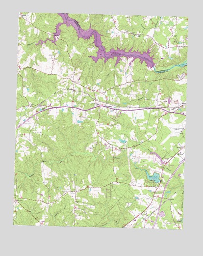
Sutherland, VA USGS Topographic Map
Click on map above to begin viewing in our Map Viewer.

This topographic map contains these locations and features:
Feature Name Type Latitude Longitude GNIS ID View Map
AddisonPopulated PlaceN37.1977°W77.5025°1499041View Map
Andrews CemeteryCemeteryN37.2397°W77.5450°1462471View Map
Beverly AcresPopulated PlaceN37.2363°W77.5094°1760030View Map
Brasfield ReservoirReservoirN37.2202°W77.5280°1489443View Map
BurgessPopulated PlaceN37.1427°W77.5117°1499191View Map
Chesdin ManorPopulated PlaceN37.2232°W77.5428°1690727View Map
Chestnut GardensPopulated PlaceN37.2146°W77.5039°1690728View Map
Clarkes DamDamN37.1756°W77.5437°1489610View Map
Clarkes LakeReservoirN37.1761°W77.5459°1489611View Map
Clay EstatesPopulated PlaceN37.2079°W77.5567°1690729View Map
Dabney CemeteryCemeteryN37.1393°W77.5794°1465567View Map
Dabney EstatesPopulated PlaceN37.1454°W77.5553°1690736View Map
Dinwiddie Ambulance and Rescue SquadBuildingN37.1314°W77.5340°2331827View Map
Dinwiddie County AirportAirportN37.1838°W77.5020°1498772View Map
Dinwiddie Volunteer Ambulance and Rescue SquadBuildingN37.1314°W77.5339°2075472View Map
District 2CivilN37.2176°W77.5278°1927200View Map
Drivers CemeteryCemeteryN37.1457°W77.5869°1465959View Map
Five ForksPopulated PlaceN37.1393°W77.6228°1477329View Map
Fort Lee Recreation AreaParkN37.1529°W77.5233°1466794View Map
George F Brasfield DamDamN37.2202°W77.5280°1489442View Map
Gravelly Run Church (historical)ChurchN37.1360°W77.5997°1690756View Map
Hunters GreenPopulated PlaceN37.2415°W77.5367°1760081View Map
JackPopulated PlaceN37.1965°W77.5092°1468571View Map
Jack Stone QuarryMineN37.2025°W77.5069°2724873View Map
Jones CemeteryCemeteryN37.2385°W77.5105°1468828View Map
Jordon LakeReservoirN37.1555°W77.5227°1489604View Map
Lake Jordon DamDamN37.1536°W77.5179°1489603View Map
LakewoodPopulated PlaceN37.1604°W77.5175°1690776View Map
Leonards Boat RampLocaleN37.2238°W77.5483°1690777View Map
Leonards CampgroundLocaleN37.2243°W77.5475°1690778View Map
LifeEvac IBuildingN37.1827°W77.5030°2331919View Map
Midway Elementary SchoolSchoolN37.1962°W77.6152°1470442View Map
Miry RunStreamN37.2265°W77.5619°1470628View Map
Number Eleven School (historical)SchoolN37.1396°W77.5803°1690793View Map
Oak Grove Baptist ChurchChurchN37.1693°W77.5055°1471717View Map
Oak Hill EstatesPopulated PlaceN37.2371°W77.5330°1760106View Map
Ocran CemeteryCemeteryN37.1940°W77.5544°1690795View Map
Ocran ChurchChurchN37.1946°W77.5544°1471813View Map
Olgers CemeteryCemeteryN37.1979°W77.5661°1471896View Map
Pamplins PondReservoirN37.2346°W77.5057°1472032View Map
Penmar EstatesPopulated PlaceN37.2293°W77.5067°1760110View Map
Picture BranchStreamN37.1518°W77.5019°1472271View Map
Picture DamDamN37.1634°W77.5157°1489606View Map
Picture LakeReservoirN37.1671°W77.5196°1489607View Map
Picture Lake CampgroundLocaleN37.1652°W77.5158°1690800View Map
Pine Grove ChurchChurchN37.1729°W77.5028°1472346View Map
Rocky Branch CemeteryCemeteryN37.1888°W77.5739°1690806View Map
Rocky Branch ChurchChurchN37.1890°W77.5736°1473447View Map
Rocky RunStreamN37.2254°W77.5508°1473483View Map
Sandy RidgePopulated PlaceN37.2377°W77.5003°1760126View Map
Seven Springs MarinaLocaleN37.2271°W77.5289°1760131View Map
Slates PondReservoirN37.1931°W77.6068°1474680View Map
Smith CemeteryCemeteryN37.1768°W77.6233°1474737View Map
Southside Elementary SchoolSchoolN37.1298°W77.5352°1690821View Map
Springfield ChurchChurchN37.2474°W77.6230°1475020View Map
Stafford Brothers DamDamN37.1868°W77.5797°1489628View Map
Stoney CreekStreamN37.2496°W77.5897°1475199View Map
SutherlandPopulated PlaceN37.1960°W77.5597°1500198View Map
Sutherland Elementary SchoolSchoolN37.1935°W77.5020°1690808View Map
Sutherland ManorPopulated PlaceN37.1913°W77.5505°1690825View Map
Sutherland Post OfficePost OfficeN37.1969°W77.5588°1690826View Map
Virginia Motorsports ParkLocaleN37.1690°W77.5293°2520541View Map
Wallace CreekStreamN37.2171°W77.5192°1476258View Map
Wesley ChapelChurchN37.2385°W77.5358°1476456View Map
Whipponock Boat RampLocaleN37.2368°W77.5955°1690835View Map
Whipponock CampgroundLocaleN37.2360°W77.5950°1690836View Map
Whipponock CreekStreamN37.2457°W77.5908°1476567View Map
Wyatt CemeteryCemeteryN37.2393°W77.5414°1474309View Map

Note: Coordinates in the location and feature list above are referenced to NAD83 datum.


Copyright (C) 2008-2025 Ryan Niemi / Sunset Dynamics ... All Rights Reserved