TopoQuest Logo
Do you find TopoQuest useful?
Help keep TopoQuest running and adding new maps/features by donating!
Bitcoin:  19c7KJd3qBynnjoSw5npx9KScwjBe4ifkT
Litecoin:  LXs6TkuXGGXo1vDsWCkWVdjQX94eUKd6ui
Home View Maps Find Maps Find Places Resources & Links


Church Road, Virginia Topographic Map

USGS Map Title: Church Road, VA
USGS Map MRC: 37077B6
DRG (GeoTIFF) Download: o37077b6.tif


Neighboring USGS Topographic Map Quads:


  Mannboro, VA  
37077C7
 

  Winterpock, VA  
37077C6
 

  Beach, VA  
37077C5
 

  Hebron, VA  
37077B7
 

  Church Road, VA  
37077B6
 

  Sutherland, VA  
37077B5
 

  Darvills, VA  
37077A7
 

  DeWitt, VA  
37077A6
 

  Dinwiddie, VA  
37077A5


Map MRC Location:

N38°
W78°
N38°
W77°
H8 H7 H6 H5 H4 H3 H2 H1
G8 G7 G6 G5 G4 G3 G2 G1
F8 F7 F6 F5 F4 F3 F2 F1
E8 E7 E6 E5 E4 E3 E2 E1
D8 D7 D6 D5 D4 D3 D2 D1
C8 C7 C6 C5 C4 C3 C2 C1
B8 B7 B6 B5 B4 B3 B2 B1
A8 A7 A6 A5 A4 A3 A2 A1
N37°
W78°
N37°
W77°

Church Road, VA USGS 1:24K Topographic Map Preview:
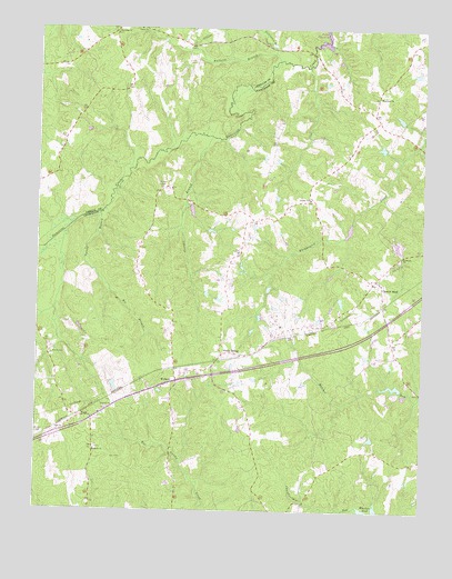
Church Road, VA USGS Topographic Map
Click on map above to begin viewing in our Map Viewer.

This topographic map contains these locations and features:
Feature Name Type Latitude Longitude GNIS ID View Map
Central Baptist ChurchChurchN37.1840°W77.6380°1690725View Map
Church RoadLocaleN37.1829°W77.6383°1464917View Map
Church Road Post OfficePost OfficeN37.1855°W77.6402°2766446View Map
Corinth CemeteryCemeteryN37.1518°W77.7269°1690732View Map
Corinth ChurchChurchN37.1515°W77.7269°1465254View Map
District 1CivilN37.1481°W77.7343°1927179View Map
Eades DamDamN37.2052°W77.7014°1489608View Map
Eades PondReservoirN37.2029°W77.6999°1489609View Map
Fellowbed BranchStreamN37.2440°W77.6742°1466520View Map
FordPopulated PlaceN37.1493°W77.7356°1466754View Map
Ford Post OfficePost OfficeN37.1477°W77.7310°2767214View Map
Ford Volunteer Fire Department Station 2BuildingN37.1708°W77.6723°2075468View Map
Georges BranchStreamN37.2221°W77.6942°1467041View Map
Jones DamDamN37.1802°W77.6514°1489619View Map
Jones Store (historical)LocaleN37.2285°W77.7358°1497792View Map
Kit BranchStreamN37.1821°W77.7261°1469057View Map
MarmonaPopulated PlaceN37.2279°W77.6411°1690785View Map
Marmora ChurchChurchN37.2327°W77.6397°1470101View Map
Mispah CemeteryCemeteryN37.2093°W77.7089°1470630View Map
Mount Poole CemeteryCemeteryN37.1410°W77.7300°1690791View Map
Mount Poole ChurchChurchN37.1407°W77.7306°1471054View Map
Mount Zion Baptist ChurchChurchN37.1457°W77.7425°1474389View Map
NamozinePopulated PlaceN37.2496°W77.7250°1690039View Map
Namozine BridgeBridgeN37.2438°W77.6617°1690792View Map
Namozine ChurchChurchN37.2490°W77.7258°1471314View Map
Norris CemeteryCemeteryN37.1657°W77.7403°1471569View Map
Poole Christian ChurchChurchN37.1677°W77.6894°1690801View Map
Poole SidingLocaleN37.1651°W77.6900°1472605View Map
Pucketts BranchStreamN37.2418°W77.6728°1472843View Map
Saint Peters ChurchChurchN37.1910°W77.6322°1473900View Map
Stokes DamDamN37.1568°W77.6314°1489620View Map
Trinity CemeteryCemeteryN37.2054°W77.6608°1690828View Map
Trinity ChurchChurchN37.2060°W77.6619°1475865View Map
Tylers BranchStreamN37.2024°W77.7300°1476016View Map
Union ChurchChurchN37.2499°W77.7178°1476046View Map
WalkersPopulated PlaceN37.1582°W77.7061°1493753View Map
Watkins FarmLocaleN37.2256°W77.6256°2676181View Map
Whites CemeteryCemeteryN37.1440°W77.7486°1476662View Map
Wilkersons Store (historical)LocaleN37.2265°W77.6397°1690839View Map

Note: Coordinates in the location and feature list above are referenced to NAD83 datum.


Copyright (C) 2008-2024 Ryan Niemi / Sunset Dynamics ... All Rights Reserved