TopoQuest Logo
Do you find TopoQuest useful?
Help keep TopoQuest running and adding new maps/features by donating!
Bitcoin:  19c7KJd3qBynnjoSw5npx9KScwjBe4ifkT
Litecoin:  LXs6TkuXGGXo1vDsWCkWVdjQX94eUKd6ui
Home View Maps Find Maps Find Places Resources & Links


Stony Creek, Virginia Topographic Map

USGS Map Title: Stony Creek, VA
USGS Map MRC: 36077H4
DRG (GeoTIFF) Download: o36077h4.tif


Neighboring USGS Topographic Map Quads:


  Dinwiddie, VA  
37077A5
 

  Carson, VA  
37077A4
 

  Templeton, VA  
37077A3
 

  Cherry Hill, VA  
36077H5
 

  Stony Creek, VA  
36077H4
 

  Sussex, VA  
36077H3
 

  Purdy, VA  
36077G5
 

  Jarratt, VA  
36077G4
 

  Yale, VA  
36077G3


Map MRC Location:

N37°
W78°
N37°
W77°
H8 H7 H6 H5 H4 H3 H2 H1
G8 G7 G6 G5 G4 G3 G2 G1
F8 F7 F6 F5 F4 F3 F2 F1
E8 E7 E6 E5 E4 E3 E2 E1
D8 D7 D6 D5 D4 D3 D2 D1
C8 C7 C6 C5 C4 C3 C2 C1
B8 B7 B6 B5 B4 B3 B2 B1
A8 A7 A6 A5 A4 A3 A2 A1
N36°
W78°
N36°
W77°

Stony Creek, VA USGS 1:24K Topographic Map Preview:
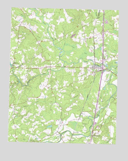
Stony Creek, VA USGS Topographic Map
Click on map above to begin viewing in our Map Viewer.

This topographic map contains these locations and features:
Feature Name Type Latitude Longitude GNIS ID View Map
Black BranchStreamN36.9721°W77.4519°1463469View Map
Bolling SwampStreamN36.9968°W77.4022°1463646View Map
Flat SwampStreamN36.8818°W77.4108°1466666View Map
Fort NottowayPopulated PlaceN36.8857°W77.4239°1499441View Map
Galley SwampSwampN36.9585°W77.4122°1466963View Map
Green Church BridgeBridgeN36.8824°W77.4386°1467461View Map
Halifax School (historical)SchoolN36.9977°W77.4089°1690758View Map
High Hill BranchStreamN36.8829°W77.4047°1468007View Map
HuskePopulated PlaceN36.8976°W77.4186°1477432View Map
Huske School (historical)SchoolN36.8976°W77.4405°1690215View Map
Interchange 31CrossingN36.9438°W77.3925°1690219View Map
Interchange 33CrossingN36.9790°W77.3928°1690220View Map
Island SwampStreamN36.9190°W77.3805°1468541View Map
Jones SchoolSchoolN36.9446°W77.4047°1468861View Map
Lewis DamDamN36.8901°W77.4497°1490954View Map
Lewis PondReservoirN36.8902°W77.4521°1490955View Map
Little Bethel ChurchChurchN36.9488°W77.4950°1469473View Map
Little Bethel School (historical)SchoolN36.9679°W77.4905°1690779View Map
Morgans DamDamN36.9735°W77.4297°1490972View Map
Morgans PondReservoirN36.9752°W77.4276°1490973View Map
Mortar BranchStreamN36.9863°W77.4625°1470769View Map
Peagram CemeteryCemeteryN36.9726°W77.4911°1690798View Map
Peaquarter SwampSwampN36.9526°W77.4491°1472157View Map
Rack CreekStreamN36.8754°W77.4564°1472927View Map
Rocky BranchStreamN36.9288°W77.4919°1473441View Map
Saint Johns ChurchChurchN36.9735°W77.4086°1473762View Map
Saint Johns School (historical)SchoolN36.9732°W77.4094°1690249View Map
Sappony CemeteryCemeteryN36.9454°W77.4522°1690250View Map
Sappony ChurchChurchN36.9451°W77.4522°1474054View Map
Sappony CreekStreamN36.9504°W77.4358°1474057View Map
Snake BranchStreamN36.9624°W77.4386°1474795View Map
Southwest SwampStreamN36.9440°W77.3839°1474920View Map
Spiers DamDamN36.9307°W77.4875°1490964View Map
Spiers PondReservoirN36.9307°W77.4875°1502134View Map
Stony CreekStreamN36.9474°W77.3805°1475207View Map
Stony CreekPopulated PlaceN36.9479°W77.4008°1500170View Map
Stony Creek DistrictCivilN36.9261°W77.4501°1927527View Map
Stony Creek High SchoolSchoolN36.9463°W77.3939°1690255View Map
Stony Creek Post OfficePost OfficeN36.9478°W77.4009°2519654View Map
Stony Creek Rescue SquadBuildingN36.9373°W77.3943°2331846View Map
Stony Creek Rescue SquadBuildingN36.9476°W77.4011°2085901View Map
Stony Creek Volunteer Fire DepartmentBuildingN36.9474°W77.4000°2331723View Map
Town of Stony CreekCivilN36.9480°W77.4001°2391429View Map
Winfields MillPopulated PlaceN36.9479°W77.4955°1477887View Map
Winfields MillpondReservoirN36.9451°W77.4986°1476858View Map

Note: Coordinates in the location and feature list above are referenced to NAD83 datum.


Copyright (C) 2008-2025 Ryan Niemi / Sunset Dynamics ... All Rights Reserved