TopoQuest Logo
Do you find TopoQuest useful?
Help keep TopoQuest running and adding new maps/features by donating!
Bitcoin:  19c7KJd3qBynnjoSw5npx9KScwjBe4ifkT
Litecoin:  LXs6TkuXGGXo1vDsWCkWVdjQX94eUKd6ui
Home View Maps Find Maps Find Places Resources & Links


Dixie, Alabama Topographic Map

USGS Map Title: Dixie, AL
USGS Map MRC: 31086B6
DRG (GeoTIFF) Download: o31086b6.tif


Neighboring USGS Topographic Map Quads:


  Brooklyn, AL  
31086C7
 

  Loango, AL  
31086C6
 

  River Falls, AL  
31086C5
 

  Damascus, AL  
31086B7
 

  Dixie, AL  
31086B6
 

  Carolina, AL  
31086B5
 

  Parker Springs, AL  
31086A7
 

  Bradley, AL  
31086A6
 

  Wing, AL  
31086A5


Map MRC Location:

N32°
W87°
N32°
W86°
H8 H7 H6 H5 H4 H3 H2 H1
G8 G7 G6 G5 G4 G3 G2 G1
F8 F7 F6 F5 F4 F3 F2 F1
E8 E7 E6 E5 E4 E3 E2 E1
D8 D7 D6 D5 D4 D3 D2 D1
C8 C7 C6 C5 C4 C3 C2 C1
B8 B7 B6 B5 B4 B3 B2 B1
A8 A7 A6 A5 A4 A3 A2 A1
N31°
W87°
N31°
W86°

Dixie, AL USGS 1:24K Topographic Map Preview:
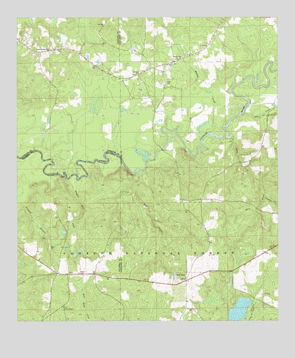
Dixie, AL USGS Topographic Map
Click on map above to begin viewing in our Map Viewer.

This topographic map contains these locations and features:
Feature Name Type Latitude Longitude GNIS ID View Map
Blue CreekStreamN31.1868°W86.6916°159207View Map
Brooklyn Zion School (historical)SchoolN31.2477°W86.7083°161626View Map
Conecuh River Missionary Baptist ChurchChurchN31.2093°W86.6300°159441View Map
DixiePopulated PlaceN31.1446°W86.7194°161658View Map
Dixie Lookout TowerTowerN31.1302°W86.7280°164316View Map
Dixie Methodist ChurchChurchN31.1449°W86.7238°161660View Map
Dixie Volunteer Fire DepartmentBuildingN31.1426°W86.7053°2691256View Map
Dixon Forestry CenterLocaleN31.1510°W86.6983°164510View Map
Douglas Mill CreekStreamN31.1835°W86.7261°159512View Map
Eden CreekStreamN31.2013°W86.6466°159039View Map
Feagin CemeteryCemeteryN31.2235°W86.6780°164052View Map
First Zion ChurchChurchN31.2468°W86.7083°159598View Map
Floral School (historical)SchoolN31.1910°W86.6391°162922View Map
Florala ChurchChurchN31.1913°W86.6380°161634View Map
GeorgiavillePopulated PlaceN31.2368°W86.7305°162923View Map
Georgiaville School (historical)SchoolN31.2379°W86.7250°161627View Map
Mason (historical)LocaleN31.1571°W86.7488°161701View Map
Mason CemeteryCemeteryN31.1554°W86.7344°160052View Map
Mill CreekStreamN31.1360°W86.7413°163085View Map
Mobley CreekStreamN31.2030°W86.6566°160119View Map
Mobley Creek Baptist ChurchChurchN31.2332°W86.6716°160120View Map
Mount Olive ChurchChurchN31.1396°W86.6736°163420View Map
RomePopulated PlaceN31.1418°W86.6688°160530View Map
Rome PondReservoirN31.1443°W86.6744°160531View Map
Second Brooklyn Zion ChurchChurchN31.2368°W86.7344°160577View Map
Smith CemeteryCemeteryN31.2202°W86.6894°160627View Map
Snowhill ChurchChurchN31.2271°W86.6916°160638View Map
Teel CreekStreamN31.2107°W86.6411°160730View Map
Welfare ChurchChurchN31.2313°W86.6758°160818View Map

Note: Coordinates in the location and feature list above are referenced to NAD83 datum.


Copyright (C) 2008-2025 Ryan Niemi / Sunset Dynamics ... All Rights Reserved