TopoQuest Logo
Do you find TopoQuest useful?
Help keep TopoQuest running and adding new maps/features by donating!
Bitcoin:  19c7KJd3qBynnjoSw5npx9KScwjBe4ifkT
Litecoin:  LXs6TkuXGGXo1vDsWCkWVdjQX94eUKd6ui
Home View Maps Find Maps Find Places Resources & Links


Liberty Island, California Topographic Map

USGS Map Title: Liberty Island, CA
USGS Map MRC: 38121C6
DRG (GeoTIFF) Download: o38121c6.tif


Neighboring USGS Topographic Map Quads:


  Dixon, CA  
38121D7
 

  Saxon, CA  
38121D6
 

  Clarksburg, CA  
38121D5
 

  Dozier, CA  
38121C7
 

  Liberty Island, CA  
38121C6
 

  Courtland, CA  
38121C5
 

  Birds Landing, CA  
38121B7
 

  Rio Vista, CA  
38121B6
 

  Isleton, CA  
38121B5


Map MRC Location:

N39°
W122°
N39°
W121°
H8 H7 H6 H5 H4 H3 H2 H1
G8 G7 G6 G5 G4 G3 G2 G1
F8 F7 F6 F5 F4 F3 F2 F1
E8 E7 E6 E5 E4 E3 E2 E1
D8 D7 D6 D5 D4 D3 D2 D1
C8 C7 C6 C5 C4 C3 C2 C1
B8 B7 B6 B5 B4 B3 B2 B1
A8 A7 A6 A5 A4 A3 A2 A1
N38°
W122°
N38°
W121°

Liberty Island, CA USGS 1:24K Topographic Map Preview:
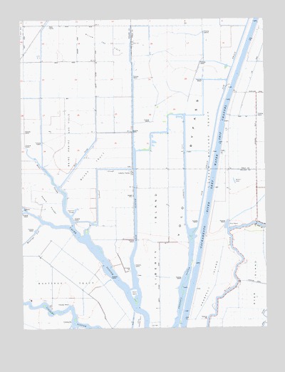
Liberty Island, CA USGS Topographic Map
Click on map above to begin viewing in our Map Viewer.

This topographic map contains these locations and features:
Feature Name Type Latitude Longitude GNIS ID View Map
Chicory WharfLocaleN38.2694°W121.6400°254548View Map
DaisiePopulated PlaceN38.3146°W121.6438°254550View Map
DC Stewart LandingLocaleN38.2535°W121.6550°254553View Map
Duck SloughStreamN38.2896°W121.6450°222689View Map
Duck SloughGutN38.3177°W121.7213°233802View Map
Egbert CutCanalN38.2974°W121.6344°1666067View Map
Five PointsPopulated PlaceN38.2907°W121.6444°1658544View Map
French IslandIslandN38.2641°W121.6938°223913View Map
GreenPopulated PlaceN38.3457°W121.6397°254545View Map
Haas SloughStreamN38.2913°W121.7247°224999View Map
Hastings TractCivilN38.2719°W121.7291°225004View Map
Kidder LandingLocaleN38.2763°W121.6372°254547View Map
Lents LandingLocaleN38.2674°W121.6400°254549View Map
Liberty CutCanalN38.3155°W121.6672°227058View Map
Liberty FarmsLocaleN38.3130°W121.6944°227060View Map
Liberty IslandIslandN38.2869°W121.6786°227063View Map
Little Hastings TractCivilN38.2505°W121.6922°227268View Map
Little Holland TractCivilN38.3241°W121.6555°227273View Map
Little Medora Lake (historical)LakeN38.3063°W121.6327°1666069View Map
Lookout SloughGutN38.3124°W121.7122°227647View Map
LundPopulated PlaceN38.3305°W121.6438°254546View Map
Maine Prarie Gas FieldOilfieldN38.3271°W121.7269°277332View Map
Medora LakeLakeN38.3092°W121.6420°228478View Map
Millar Gas FieldOilfieldN38.3646°W121.7083°277333View Map
Moore TractCivilN38.3166°W121.7147°229027View Map
Peters PocketFlatN38.3005°W121.7372°230566View Map
Prospect IslandIslandN38.2680°W121.6544°231071View Map
Sacramento River Deep Water Ship ChannelChannelN38.3102°W121.6527°253894View Map
Shag SloughGutN38.2941°W121.6925°232850View Map
Sycamore SloughLakeN38.2969°W121.7243°235929View Map
Ulatis CreekStreamN38.2971°W121.7486°255174View Map
WA Stewart LandingLocaleN38.2819°W121.6413°254552View Map
WoodwardPopulated PlaceN38.3110°W121.6441°254551View Map
Wright CutCanalN38.2516°W121.6947°238198View Map

Note: Coordinates in the location and feature list above are referenced to NAD83 datum.


Copyright (C) 2008-2025 Ryan Niemi / Sunset Dynamics ... All Rights Reserved