TopoQuest Logo
Do you find TopoQuest useful?
Help keep TopoQuest running and adding new maps/features by donating!
Bitcoin:  19c7KJd3qBynnjoSw5npx9KScwjBe4ifkT
Litecoin:  LXs6TkuXGGXo1vDsWCkWVdjQX94eUKd6ui
Home View Maps Find Maps Find Places Resources & Links


Dodge, Oklahoma Topographic Map

USGS Map Title: Dodge, OK
USGS Map MRC: 36094E6
DRG (GeoTIFF) Download: o36094e6.tif


Neighboring USGS Topographic Map Quads:


  Afton NE, OK  
36094F7
 

  Cayuga, OK  
36094F6
 

  Tiff City, MO  
36094F5
 

  Grove, OK  
36094E7
 

  Dodge, OK  
36094E6
 

  South West City, MO  
36094E5
 

  Jay, OK  
36094D7
 

  Sycamore, OK  
36094D6
 

  Colcord NE, AR  
36094D5


Map MRC Location:

N37°
W95°
N37°
W94°
H8 H7 H6 H5 H4 H3 H2 H1
G8 G7 G6 G5 G4 G3 G2 G1
F8 F7 F6 F5 F4 F3 F2 F1
E8 E7 E6 E5 E4 E3 E2 E1
D8 D7 D6 D5 D4 D3 D2 D1
C8 C7 C6 C5 C4 C3 C2 C1
B8 B7 B6 B5 B4 B3 B2 B1
A8 A7 A6 A5 A4 A3 A2 A1
N36°
W95°
N36°
W94°

Dodge, OK USGS 1:24K Topographic Map Preview:
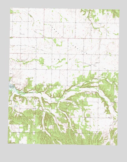
Dodge, OK USGS Topographic Map
Click on map above to begin viewing in our Map Viewer.

This topographic map contains these locations and features:
Feature Name Type Latitude Longitude GNIS ID View Map
ButlerCivilN36.5409°W94.7196°2631082View Map
Butler CemeteryCemeteryN36.5431°W94.7282°1090746View Map
Butler Census Designated PlaceCensusN36.5387°W94.7407°2584376View Map
Butler ChurchChurchN36.5329°W94.7191°1090747View Map
Butler Volunteer Fire DepartmentBuildingN36.5327°W94.6978°2657514View Map
Carr ChurchChurchN36.6120°W94.6480°1090992View Map
Cave Springs BranchStreamN36.5502°W94.6777°729857View Map
CayugaCivilN36.6184°W94.6537°2631084View Map
Cowskin Rural Fire District Station 2BuildingN36.5982°W94.6620°2657388View Map
DodgeCivilN36.5789°W94.6385°2631097View Map
DodgePopulated PlaceN36.5737°W94.6561°1100357View Map
Dodge Census Designated PlaceCensusN36.5789°W94.6385°2408676View Map
Dodge ChurchChurchN36.5756°W94.6477°1092114View Map
Fields CemeteryCemeteryN36.5651°W94.6467°1092805View Map
Grove High SchoolSchoolN36.5995°W94.7490°1793687View Map
Grove Municipal AirportAirportN36.5998°W94.7369°1102488View Map
Honey CreekStreamN36.5521°W94.7434°50278View Map
Olympus CemeteryCemeteryN36.5767°W94.7372°1096267View Map
Peters Prairie ChurchChurchN36.5256°W94.6566°1096576View Map
Pollan CemeteryCemeteryN36.6226°W94.6628°1096809View Map
Polson CemeteryCemeteryN36.5256°W94.6360°1096812View Map
Scraper CemeteryCemeteryN36.5396°W94.7172°1097888View Map
Sloan CemeteryCemeteryN36.5541°W94.6726°1098124View Map
Snail CreekStreamN36.5479°W94.7438°1098145View Map
Snell CemeteryCemeteryN36.5384°W94.6947°1098165View Map
Township 6CivilN36.5779°W94.6919°1824557View Map
White WaterCivilN36.5036°W94.7393°2631201View Map
White Water Census Designated PlaceCensusN36.5017°W94.7289°2584397View Map

Note: Coordinates in the location and feature list above are referenced to NAD83 datum.


Copyright (C) 2008-2024 Ryan Niemi / Sunset Dynamics ... All Rights Reserved