TopoQuest Logo
Do you find TopoQuest useful?
Help keep TopoQuest running and adding new maps/features by donating!
Bitcoin:  19c7KJd3qBynnjoSw5npx9KScwjBe4ifkT
Litecoin:  LXs6TkuXGGXo1vDsWCkWVdjQX94eUKd6ui
Home View Maps Find Maps Find Places Resources & Links


Tiff City, Missouri Topographic Map

USGS Map Title: Tiff City, MO
USGS Map MRC: 36094F5
DRG (GeoTIFF) Download: o36094f5.tif


Neighboring USGS Topographic Map Quads:


  Wyandotte, OK  
36094G6
 

  Seneca, MO  
36094G5
 

  Neosho West, MO  
36094G4
 

  Cayuga, OK  
36094F6
 

  Tiff City, MO  
36094F5
 

  Anderson, MO  
36094F4
 

  Dodge, OK  
36094E6
 

  South West City, MO  
36094E5
 

  Noel, MO  
36094E4


Map MRC Location:

N37°
W95°
N37°
W94°
H8 H7 H6 H5 H4 H3 H2 H1
G8 G7 G6 G5 G4 G3 G2 G1
F8 F7 F6 F5 F4 F3 F2 F1
E8 E7 E6 E5 E4 E3 E2 E1
D8 D7 D6 D5 D4 D3 D2 D1
C8 C7 C6 C5 C4 C3 C2 C1
B8 B7 B6 B5 B4 B3 B2 B1
A8 A7 A6 A5 A4 A3 A2 A1
N36°
W95°
N36°
W94°

Tiff City, MO USGS 1:24K Topographic Map Preview:
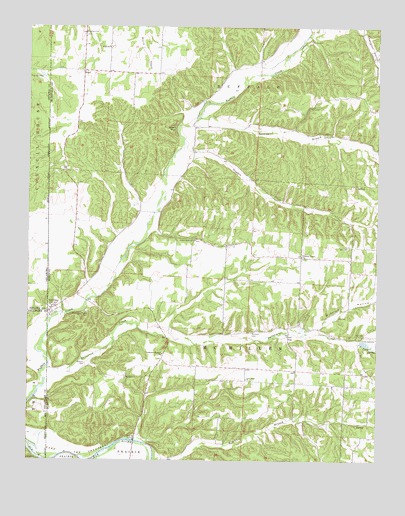
Tiff City, MO USGS Topographic Map
Click on map above to begin viewing in our Map Viewer.

This topographic map contains these locations and features:
Feature Name Type Latitude Longitude GNIS ID View Map
Beeman HollowValleyN36.7237°W94.5655°713881View Map
Blackfoot BranchStreamN36.6251°W94.5774°714324View Map
Cedar Point ChurchChurchN36.6884°W94.5663°715614View Map
CoyPopulated PlaceN36.6612°W94.5322°716435View Map
Enterprise (historical)Populated PlaceN36.6723°W94.6086°739377View Map
HartPopulated PlaceN36.7373°W94.6058°719168View Map
Hart School (historical)SchoolN36.7442°W94.5969°719176View Map
Keenon CemeteryCemeteryN36.6528°W94.6052°720488View Map
Kinslow HollowValleyN36.6631°W94.5216°720639View Map
Lone Dove School (historical)SchoolN36.6784°W94.5688°746449View Map
Lone Star ChurchChurchN36.6487°W94.5472°721466View Map
Lone Star School (historical)SchoolN36.6484°W94.5455°746452View Map
Love School (historical)SchoolN36.7187°W94.5130°746451View Map
Mannings Chapel CemeteryCemeteryN36.6681°W94.6041°721805View Map
Mitchell CemeteryCemeteryN36.6623°W94.5452°722483View Map
Morrison ChurchChurchN36.6492°W94.5905°722656View Map
Morrison School (historical)SchoolN36.6490°W94.5908°746450View Map
North Fork Patterson CreekStreamN36.6595°W94.5080°723465View Map
Owens BluffCliffN36.7209°W94.5730°723904View Map
Patterson CreekStreamN36.6484°W94.6186°724089View Map
Patterson Heights ChurchChurchN36.6559°W94.5774°724090View Map
Pleasant Grove ChurchChurchN36.6840°W94.5277°724487View Map
Price CemeteryCemeteryN36.7462°W94.5247°724921View Map
Rinehart CemeteryCemeteryN36.7478°W94.6049°725313View Map
South Fork Patterson CreekStreamN36.6595°W94.5080°726750View Map
Springfield PlainAreaN36.7498°W94.6249°758114View Map
Stogdon CreekStreamN36.7140°W94.5727°727122View Map
Sugar ForkStreamN36.7484°W94.5241°727245View Map
Tiff CityPopulated PlaceN36.6684°W94.6172°727650View Map
Tiff City Fire DepartmentBuildingN36.6672°W94.6181°2621231View Map
Tiff City Post OfficePost OfficeN36.6685°W94.6173°2783085View Map
Tiff City School (historical)SchoolN36.6693°W94.6160°745885View Map
Tiff City Volunteer Fire DepartmentBuildingN36.6675°W94.6181°2657501View Map
Township of Buffalo HartCivilN36.7413°W94.5865°766941View Map
Township of Buffalo MayCivilN36.7340°W94.5038°766942View Map
Township of McMillen CoyCivilN36.6463°W94.5296°766949View Map
Township of McMillen TiffCivilN36.6671°W94.5895°766950View Map

Note: Coordinates in the location and feature list above are referenced to NAD83 datum.


Copyright (C) 2008-2024 Ryan Niemi / Sunset Dynamics ... All Rights Reserved