TopoQuest Logo
Do you find TopoQuest useful?
Help keep TopoQuest running and adding new maps/features by donating!
Bitcoin:  19c7KJd3qBynnjoSw5npx9KScwjBe4ifkT
Litecoin:  LXs6TkuXGGXo1vDsWCkWVdjQX94eUKd6ui
Home View Maps Find Maps Find Places Resources & Links


South West City, Missouri Topographic Map

USGS Map Title: South West City, MO
USGS Map MRC: 36094E5
DRG (GeoTIFF) Download: o36094e5.tif


Neighboring USGS Topographic Map Quads:


  Cayuga, OK  
36094F6
 

  Tiff City, MO  
36094F5
 

  Anderson, MO  
36094F4
 

  Dodge, OK  
36094E6
 

  South West City, MO  
36094E5
 

  Noel, MO  
36094E4
 

  Sycamore, OK  
36094D6
 

  Colcord NE, AR  
36094D5
 

  Gravette, AR  
36094D4


Map MRC Location:

N37°
W95°
N37°
W94°
H8 H7 H6 H5 H4 H3 H2 H1
G8 G7 G6 G5 G4 G3 G2 G1
F8 F7 F6 F5 F4 F3 F2 F1
E8 E7 E6 E5 E4 E3 E2 E1
D8 D7 D6 D5 D4 D3 D2 D1
C8 C7 C6 C5 C4 C3 C2 C1
B8 B7 B6 B5 B4 B3 B2 B1
A8 A7 A6 A5 A4 A3 A2 A1
N36°
W95°
N36°
W94°

South West City, MO USGS 1:24K Topographic Map Preview:
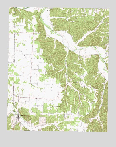
South West City, MO USGS Topographic Map
Click on map above to begin viewing in our Map Viewer.

This topographic map contains these locations and features:
Feature Name Type Latitude Longitude GNIS ID View Map
Church of ChristChurchN36.5498°W94.5383°715832View Map
CowskinBuildingN36.6204°W94.5949°745847View Map
Cowskin PrairieAreaN36.5645°W94.5955°716418View Map
Fairview CemeteryCemeteryN36.5884°W94.6174°717750View Map
Fisher Lake DamDamN36.6184°W94.6069°763260View Map
Greenwood ChurchChurchN36.6020°W94.5944°718841View Map
Honey Creek Post OfficePost OfficeN36.5126°W94.6113°765614View Map
Honey Lake ChurchChurchN36.6051°W94.5033°719768View Map
Honey Lake HollowValleyN36.5890°W94.5413°719769View Map
Horner HollowValleyN36.6103°W94.5099°719835View Map
Kingdom ChurchChurchN36.5254°W94.5624°720618View Map
KLTK-AM (Southwest City)TowerN36.5079°W94.6097°759203View Map
Langley CemeteryCemeteryN36.6248°W94.5733°720808View Map
Liberty ChurchChurchN36.5167°W94.5455°720966View Map
Manning CemeteryCemeteryN36.5959°W94.5769°721803View Map
Noel Primary SchoolSchoolN36.5444°W94.5235°2709483View Map
PackPopulated PlaceN36.5067°W94.5330°740064View Map
Pine HollowValleyN36.5740°W94.5066°724384View Map
Round Grove School (historical)SchoolN36.5556°W94.5974°746456View Map
SaratogaPopulated PlaceN36.5415°W94.5566°729959View Map
Saratoga CemeteryCemeteryN36.5506°W94.5833°726060View Map
Saratoga CreekStreamN36.5840°W94.5502°1853974View Map
Saratoga HollowValleyN36.5837°W94.5499°726061View Map
Shanghai HollowValleyN36.5801°W94.5047°726264View Map
South West CityPopulated PlaceN36.5126°W94.6113°758447View Map
South West City CemeteryCemeteryN36.5270°W94.6155°726797View Map
South West City Post OfficePost OfficeN36.5138°W94.6112°2782671View Map
South West City Volunteer Fire DepartmentBuildingN36.5342°W94.6132°2621538View Map
Southwest City Elementary SchoolSchoolN36.5167°W94.6162°2709482View Map
Southwest City Structure E-1 DamDamN36.5084°W94.6169°763399View Map
Stone CemeteryCemeteryN36.5781°W94.5141°727126View Map
Town of Southwest CityCivilN36.5207°W94.6100°2397669View Map
Township of Elk River WestCivilN36.5467°W94.5127°766946View Map
Township of PrairieCivilN36.5584°W94.5873°766955View Map
White River HillsAreaN36.6248°W94.6249°754097View Map
Williams-Hays CemeteryCemeteryN36.6009°W94.6138°728905View Map

Note: Coordinates in the location and feature list above are referenced to NAD83 datum.


Copyright (C) 2008-2024 Ryan Niemi / Sunset Dynamics ... All Rights Reserved