TopoQuest Logo
Do you find TopoQuest useful?
Help keep TopoQuest running and adding new maps/features by donating!
Bitcoin:  19c7KJd3qBynnjoSw5npx9KScwjBe4ifkT
Litecoin:  LXs6TkuXGGXo1vDsWCkWVdjQX94eUKd6ui
Home View Maps Find Maps Find Places Resources & Links


Dorton, Tennessee Topographic Map

USGS Map Title: Dorton, TN
USGS Map MRC: 35084H8
DRG (GeoTIFF) Download: o35084h8.tif


Neighboring USGS Topographic Map Quads:


  Isoline, TN  
36085A1
 

  Fox Creek, TN  
36084A8
 

  Hebbertsburg, TN  
36084A7
 

  Crossville, TN  
35085H1
 

  Dorton, TN  
35084H8
 

  Ozone, TN  
35084H7
 

  Vandever, TN  
35085G1
 

  Grassy Cove, TN  
35084G8
 

  Roddy, TN  
35084G7


Map MRC Location:

N36°
W85°
N36°
W84°
H8 H7 H6 H5 H4 H3 H2 H1
G8 G7 G6 G5 G4 G3 G2 G1
F8 F7 F6 F5 F4 F3 F2 F1
E8 E7 E6 E5 E4 E3 E2 E1
D8 D7 D6 D5 D4 D3 D2 D1
C8 C7 C6 C5 C4 C3 C2 C1
B8 B7 B6 B5 B4 B3 B2 B1
A8 A7 A6 A5 A4 A3 A2 A1
N35°
W85°
N35°
W84°

Dorton, TN USGS 1:24K Topographic Map Preview:
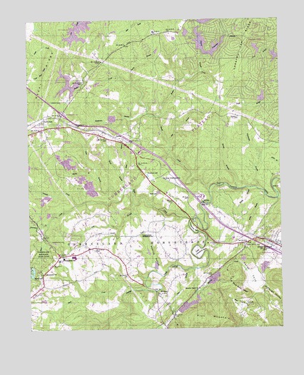
Dorton, TN USGS Topographic Map
Click on map above to begin viewing in our Map Viewer.

This topographic map contains these locations and features:
Feature Name Type Latitude Longitude GNIS ID View Map
Bagwell BranchStreamN35.9795°W84.9125°1276087View Map
Baker BranchStreamN35.9281°W84.8755°1304921View Map
Baker BranchStreamN35.9362°W84.9530°1276140View Map
Baker Chapel CemeteryCemeteryN35.9509°W84.9499°1304925View Map
Baker Chapel Methodist Church (historical)ChurchN35.9506°W84.9494°1318239View Map
Bakers Chapel School (historical)SchoolN35.9506°W84.9491°1318238View Map
Barnes BranchStreamN35.9315°W84.8955°1276342View Map
Bat Town CoveValleyN35.8868°W84.8998°1276447View Map
Battown CemeteryCemeteryN35.8865°W84.8977°1318245View Map
Big BranchStreamN35.9509°W84.9297°1277241View Map
BowlingPopulated PlaceN35.9445°W84.9458°1302834View Map
Brown CreekStreamN35.9609°W84.9369°1278571View Map
Brown Creek LakeReservoirN35.9912°W84.9133°1305447View Map
Buck CreekStreamN35.8781°W84.9613°1278810View Map
Buck CreekStreamN35.8906°W84.9486°1305489View Map
Buck Creek Ranch AirportAirportN35.8831°W84.9705°2675566View Map
Byrd CreekStreamN35.9192°W84.9197°1305582View Map
Byrd Lake DamDamN35.9006°W84.9988°1307167View Map
Canterbury LakeReservoirN35.9992°W84.9126°1302280View Map
Canterbury Lake DamDamN35.9984°W84.9133°1302281View Map
Center BridgeBridgeN35.9276°W84.8763°1280120View Map
Cherry BranchPopulated PlaceN35.9884°W84.9500°1302841View Map
Cherry BranchStreamN35.9748°W84.9483°1280333View Map
Chestnut HillPopulated PlaceN35.9620°W84.9097°1646855View Map
Chestnut Hill Baptist ChurchChurchN35.9662°W84.9158°1318241View Map
Chestnut Hill SchoolSchoolN35.9626°W84.9088°1280394View Map
Chestnut Oak RidgeRidgeN35.9917°W84.8911°1269449View Map
City of Crab OrchardCivilN35.9065°W84.8841°2404144View Map
Clear BranchStreamN35.8990°W84.9177°1280648View Map
Cline CemeteryCemeteryN35.9109°W84.8761°1318247View Map
Coon Hollow BranchStreamN35.8990°W84.9997°1281176View Map
Cox BranchStreamN35.8798°W84.9288°1281479View Map
Crab OrchardPopulated PlaceN35.9092°W84.8780°1281520View Map
Crab Orchard Church of ChristChurchN35.9087°W84.8791°1314197View Map
Crab Orchard Church of GodChurchN35.9101°W84.8769°1314198View Map
Crab Orchard Post OfficePost OfficeN35.9091°W84.8772°1649059View Map
Crab Orchard QuarryMineN35.9930°W84.9702°2633248View Map
Cry CemeteryCemeteryN35.9614°W84.9941°1318237View Map
Cumberland CountyCivilN35.9504°W84.9984°1639736View Map
Cumberland County Fire Department Station 3BuildingN35.9031°W84.9859°2654943View Map
Cumberland County Fire Department Station 4 - 1BuildingN35.9787°W84.9657°2654950View Map
Cumberland County Fire Department Station 6BuildingN35.9094°W84.8778°2654761View Map
Cumberland Homestead ChurchChurchN35.9134°W84.9436°1306227View Map
Cumberland HomesteadsPopulated PlaceN35.9084°W84.9452°1281836View Map
Daddys CreekPopulated PlaceN35.9265°W84.9283°1302854View Map
Davis MineMineN35.9447°W84.9836°2633249View Map
Dayton SpurPopulated PlaceN35.9601°W84.9922°1314939View Map
DortonPopulated PlaceN35.9528°W84.9561°1306389View Map
Dorton SchoolSchoolN35.9567°W84.9669°1282661View Map
FairviewPopulated PlaceN35.9940°W84.9272°1302860View Map
Flat MountainSummitN35.8781°W84.9105°1284410View Map
Fox Creek LakeReservoirN35.9958°W84.9743°1284775View Map
Goodstock Cemetery Number TwoCemeteryN35.8790°W84.9472°1318231View Map
Hale LakeReservoirN35.9301°W84.9354°1286522View Map
Haley CoveValleyN35.9016°W84.8959°1286537View Map
Haley Grove CemeteryCemeteryN35.9087°W84.8930°1286540View Map
Haley Grove church (historical)ChurchN35.9090°W84.8924°1302877View Map
Haleys GrovePopulated PlaceN35.9098°W84.8916°1311130View Map
Haleys Grove School (historical)SchoolN35.9092°W84.8919°1318246View Map
Hedgecoth (historical)Populated PlaceN35.8820°W84.9375°1302876View Map
Hedgecoth CemeteryCemeteryN35.9265°W84.9511°1318233View Map
Hidden Hollow EstatesPopulated PlaceN35.9876°W84.9194°1302871View Map
Highland EstatesPopulated PlaceN35.9265°W84.9527°1302873View Map
Highland Homesite AdditionPopulated PlaceN35.9520°W84.9888°1302872View Map
Highland ViewPopulated PlaceN35.9117°W84.9777°1302874View Map
HomesteadPopulated PlaceN35.9051°W84.9819°1646857View Map
Homestead CemeteryCemeteryN35.9103°W84.9827°1288188View Map
Homestead ChurchChurchN35.8976°W84.9922°1288189View Map
Homestead Elementary SchoolSchoolN35.9037°W84.9830°1648379View Map
Homestead High School (historical)SchoolN35.9028°W84.9850°1318232View Map
Homestead School (historical)SchoolN35.9128°W84.9536°1302875View Map
Horseshoe BendBendN35.9156°W84.9197°1288432View Map
Hyder RidgeRidgeN35.9787°W84.9908°1288888View Map
Interchange 322CrossingN35.9626°W84.9827°1302885View Map
Interchange 329CrossingN35.9051°W84.8766°1302886View Map
Keating HollowValleyN35.8982°W84.9370°1289922View Map
Kemmers Old Stand (historical)LocaleN35.9292°W84.9311°1302891View Map
Kirkstone LakeReservoirN35.9683°W84.8836°1302252View Map
Kirkstone Lake DamDamN35.9667°W84.8833°1302253View Map
Lake SherwoodReservoirN35.9834°W84.8833°1302264View Map
Larry Turner LakeReservoirN35.9744°W84.9794°1302258View Map
Larry Turner Lake DamDamN35.9751°W84.9733°1302259View Map
Lead BranchStreamN35.9281°W84.9538°1290861View Map
Little Horseshoe BendBendN35.9045°W84.9177°1291532View Map
Long BranchStreamN35.9256°W84.9475°1291879View Map
McClough HollowValleyN35.8913°W84.8842°1269787View Map
McGinnis FordCrossingN35.9331°W84.9066°1315486View Map
Meadow CreekStreamN35.8992°W84.9180°1293493View Map
Meadow Creek ChurchChurchN35.8912°W84.9158°1318244View Map
Meadows Creek ChurchChurchN35.8912°W84.9155°1293516View Map
MeridianPopulated PlaceN35.8901°W84.9316°1315494View Map
Meridian School (historical)SchoolN35.8848°W84.9336°1302912View Map
Mountain View EstatesPopulated PlaceN35.9140°W84.9272°1302911View Map
Muddy BranchStreamN35.9353°W84.9647°1295026View Map
North CreekStreamN35.9312°W84.9102°1295852View Map
Onemile CreekStreamN35.9253°W84.9755°1296436View Map
Otter Creek JunctionPopulated PlaceN35.9356°W84.9319°1315661View Map
Pine Grove EstatesPopulated PlaceN35.9967°W84.9611°1302936View Map
Pinethicket BranchStreamN35.9309°W84.8841°1297599View Map
Polebridge BranchStreamN35.9862°W84.9102°1298034View Map
Rowells OrchardsLocaleN35.9269°W84.9319°2678195View Map
Saint George LakeReservoirN35.9867°W84.9092°1302268View Map
Saint George Lake DamDamN35.9851°W84.9100°1302269View Map
Sand Rock RidgeRidgeN35.8895°W84.8952°1300678View Map
Sanderson BranchStreamN35.9623°W84.9408°1300710View Map
Sherwood DamDamN35.9834°W84.8833°1302265View Map
Spring BranchStreamN35.9317°W84.8894°1271050View Map
Spring LakeReservoirN35.9948°W84.9208°1302276View Map
Spring Lake DamDamN35.9967°W84.9200°1302277View Map
Stansbury CemeteryCemeteryN35.9701°W84.9013°1318243View Map
Threemile CreekStreamN35.9181°W84.9902°1272588View Map
Turner Brothers QuarryMineN35.9414°W84.9797°2633251View Map
Turner CemeteryCemeteryN35.9670°W84.9836°1273069View Map
Ward BranchStreamN35.9320°W84.9519°1273773View Map
Warner Cemetery Number OneCemeteryN35.9212°W84.9763°1318234View Map
Warner Cemetery Number TwoCemeteryN35.9181°W84.9783°1318235View Map
Wildwood LakeReservoirN35.9371°W84.9407°1274568View Map
Willis BranchStreamN35.9287°W84.8819°1274736View Map

Note: Coordinates in the location and feature list above are referenced to NAD83 datum.


Copyright (C) 2008-2025 Ryan Niemi / Sunset Dynamics ... All Rights Reserved