TopoQuest Logo
Do you find TopoQuest useful?
Help keep TopoQuest running and adding new maps/features by donating!
Bitcoin:  19c7KJd3qBynnjoSw5npx9KScwjBe4ifkT
Litecoin:  LXs6TkuXGGXo1vDsWCkWVdjQX94eUKd6ui
Home View Maps Find Maps Find Places Resources & Links


Dover, Tennessee Topographic Map

USGS Map Title: Dover, TN
USGS Map MRC: 36087D7
DRG (GeoTIFF) Download: o36087d7.tif


Neighboring USGS Topographic Map Quads:


  Tharpe, TN  
36087E8
 

  Bumpus Mills, TN  
36087E7
 

  Indian Mound, TN  
36087E6
 

  Standing Rock, TN  
36087D8
 

  Dover, TN  
36087D7
 

  Cumberland City, TN  
36087D6
 

  McKinnon, TN  
36087C8
 

  Stewart, TN  
36087C7
 

  Erin, TN  
36087C6


Map MRC Location:

N37°
W88°
N37°
W87°
H8 H7 H6 H5 H4 H3 H2 H1
G8 G7 G6 G5 G4 G3 G2 G1
F8 F7 F6 F5 F4 F3 F2 F1
E8 E7 E6 E5 E4 E3 E2 E1
D8 D7 D6 D5 D4 D3 D2 D1
C8 C7 C6 C5 C4 C3 C2 C1
B8 B7 B6 B5 B4 B3 B2 B1
A8 A7 A6 A5 A4 A3 A2 A1
N36°
W88°
N36°
W87°

Dover, TN USGS 1:24K Topographic Map Preview:
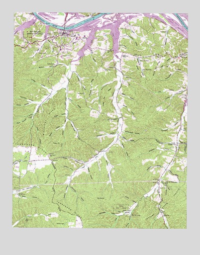
Dover, TN USGS Topographic Map
Click on map above to begin viewing in our Map Viewer.

This topographic map contains these locations and features:
Feature Name Type Latitude Longitude GNIS ID View Map
Asbury ChurchChurchN36.3981°W87.8697°1275922View Map
Bannister Landing (historical)LocaleN36.4959°W87.8239°1642921View Map
Barkley Wildlife Management AreaParkN36.4978°W87.8481°1304959View Map
Barn HollowValleyN36.4810°W87.7998°1276330View Map
Barn HollowValleyN36.4848°W87.8227°1304960View Map
Bear SpringPopulated PlaceN36.4753°W87.7547°1305021View Map
Bear Spring Furnace (historical)LocaleN36.4798°W87.7528°1308779View Map
Bear Springs School (historical)SchoolN36.4776°W87.7534°1325370View Map
Blackgum HollowValleyN36.4079°W87.8304°1277606View Map
Bluegrass RidgeRidgeN36.4378°W87.8500°1277820View Map
Boyett SpringSpringN36.4685°W87.8017°1278130View Map
Brigham CemeteryCemeteryN36.4628°W87.7939°1305418View Map
Bufford HollowValleyN36.4707°W87.8429°1278924View Map
Bufford SpringSpringN36.4698°W87.8453°1305512View Map
Byrd CemeteryCemeteryN36.4128°W87.8239°1279249View Map
Caney HollowValleyN36.4616°W87.8004°1279585View Map
CarlislePopulated PlaceN36.4248°W87.7570°1279676View Map
Carlisle CemeteryCemeteryN36.4220°W87.7603°1308808View Map
Carlisle Furnace (historical)LocaleN36.4231°W87.7584°1308809View Map
Carlisle School (historical)SchoolN36.4267°W87.7570°1325371View Map
Carlisle SpringSpringN36.4223°W87.7578°1649753View Map
Chambers PondSwampN36.3770°W87.8380°1280221View Map
City of DoverCivilN36.4819°W87.8436°2403506View Map
Cold SpringSpringN36.4392°W87.8614°1280893View Map
Commissioner District 6CivilN36.4556°W87.8178°2464574View Map
Cook HollowValleyN36.3994°W87.8565°1281125View Map
Cook HollowValleyN36.4329°W87.8382°1281126View Map
Coon HollowValleyN36.4327°W87.7529°1306091View Map
Corinth ChurchChurchN36.4145°W87.8467°1306117View Map
Crook Field HollowValleyN36.4379°W87.8357°1281658View Map
Cross CreekStreamN36.3995°W87.7709°1281697View Map
Donaway School (historical)SchoolN36.4534°W87.8242°1308828View Map
DoverPopulated PlaceN36.4878°W87.8384°1282753View Map
Dover Access PointParkN36.4903°W87.8431°1642935View Map
Dover Division (historical)CensusN36.4728°W87.8647°1648963View Map
Dover Elementary SchoolSchoolN36.4870°W87.8311°1308829View Map
Dover Fire DepartmentBuildingN36.4844°W87.8434°2653647View Map
Dover Lookout TowerTowerN36.4178°W87.8475°1647766View Map
Dover Police DepartmentBuildingN36.4844°W87.8433°2765853View Map
Dover Post OfficePost OfficeN36.4881°W87.8385°1649759View Map
Dry BranchStreamN36.4951°W87.7934°1282869View Map
Dunaway HollowValleyN36.4666°W87.8317°1283136View Map
Dunaway RidgeRidgeN36.4577°W87.8196°1283137View Map
Dyers CreekStreamN36.4917°W87.8397°1306403View Map
East Fork Lick CreekStreamN36.4562°W87.8372°1283351View Map
Erin HollowValleyN36.4843°W87.8521°1283842View Map
Evans Landing (historical)LocaleN36.4987°W87.8117°1308841View Map
Fairground PondLakeN36.4745°W87.8408°1283978View Map
Fairview ChurchChurchN36.4534°W87.8234°1306436View Map
Felldown HollowValleyN36.4106°W87.7660°1284190View Map
Fitzhughs LandingLocaleN36.4989°W87.8606°1315055View Map
Fort Donelson (historical)LocaleN36.4931°W87.8550°1308844View Map
Fort Donelson National BattlefieldParkN36.4873°W87.8609°1284664View Map
Fort Donelson National CemeteryCemeteryN36.4875°W87.8492°1308845View Map
Fort Donelson United Methodist ChurchChurchN36.4870°W87.8431°1325373View Map
Furrs Landing (historical)LocaleN36.4995°W87.8589°1642938View Map
Gatin HollowValleyN36.4090°W87.7645°1285243View Map
Glasgow CemeteryCemeteryN36.4906°W87.7972°1285489View Map
Grave Yard Bank MineMineN36.4737°W87.7522°1308853View Map
Grave Yard Ore BankMineN36.4731°W87.7539°1308854View Map
Guinea Jim HollowValleyN36.4030°W87.7679°1286380View Map
Guinea Jim SpringSpringN36.4007°W87.7657°1286381View Map
Gum SpringSpringN36.4892°W87.7656°1286420View Map
Hart CemeteryCemeteryN36.4200°W87.8061°1287042View Map
Heddy HollowValleyN36.4543°W87.7998°1287321View Map
Helwick HollowValleyN36.4012°W87.8345°1287357View Map
Helwick HollowValleyN36.4110°W87.8216°1287358View Map
Hickman CreekStreamN36.4967°W87.8578°1287557View Map
Hickman Creek Recreation AreaParkN36.4937°W87.8686°1642940View Map
Hildreth HollowValleyN36.4246°W87.7556°1287773View Map
Hogan HollowValleyN36.4410°W87.8367°1287991View Map
Hotel Ore BankMineN36.4814°W87.7550°1308873View Map
Hurricane HollowValleyN36.3993°W87.8344°1288829View Map
Hurricane HollowValleyN36.4476°W87.8573°1288830View Map
Indian CreekStreamN36.4928°W87.8503°1288951View Map
Jack Lot HollowValleyN36.4386°W87.7991°1289158View Map
Lick CreekStreamN36.4901°W87.8164°1291209View Map
Lick Creek Church (historical)ChurchN36.4478°W87.8514°1308889View Map
Lick Creek Recreation AreaParkN36.4889°W87.8147°1642945View Map
Lindsey HollowValleyN36.4545°W87.8469°1291327View Map
Lock D (historical)DamN36.4951°W87.8531°1308891View Map
Long CreekStreamN36.4923°W87.8020°1291931View Map
Louis HollowValleyN36.3848°W87.7896°1292106View Map
Lower Long Creek ChurchChurchN36.4756°W87.7878°1292222View Map
Lower Long Creek SchoolSchoolN36.4756°W87.7967°1306712View Map
Lower Mint SpringSpringN36.4723°W87.7834°1292225View Map
McCarty HollowValleyN36.4189°W87.8093°1293131View Map
McCrowey HollowValleyN36.3825°W87.7994°1293216View Map
McGiffin HollowValleyN36.3898°W87.7869°1293314View Map
Mintspring HollowValleyN36.4736°W87.7846°1294072View Map
Moldingroom HollowValleyN36.4251°W87.7587°1294149View Map
Moore CemeteryCemeteryN36.4773°W87.7661°1294278View Map
Moore HollowValleyN36.4451°W87.7997°1294298View Map
Moore LandingLocaleN36.4973°W87.8559°1308910View Map
Negro HollowValleyN36.4739°W87.7616°1295342View Map
New CemeteryCemeteryN36.4878°W87.8459°1295458View Map
Newground HollowValleyN36.3922°W87.7830°1308923View Map
North Cross CreekStreamN36.3995°W87.7709°1308925View Map
Old Sykes SpringSpringN36.3831°W87.7895°1296378View Map
Orchard HollowValleyN36.4497°W87.8363°1296474View Map
Orchard HollowValleyN36.4605°W87.7967°1308931View Map
Parker CemeteryCemeteryN36.4178°W87.8481°1296818View Map
Parker HollowValleyN36.4127°W87.8221°1296833View Map
Parker HollowValleyN36.4339°W87.8378°1296834View Map
Pea RidgeRidgeN36.4703°W87.7622°1297035View Map
Peapatch HollowValleyN36.4858°W87.7994°1297069View Map
Plum Nursery HollowValleyN36.4416°W87.8601°1297975View Map
Potatopatch Hollow MineMineN36.4653°W87.7572°1308943View Map
Pulley FieldFlatN36.4376°W87.8361°1308944View Map
Pulley HillSummitN36.4248°W87.8461°1298663View Map
Randolph Furnace (historical)LocaleN36.4523°W87.8359°1308945View Map
Rattlesnake HollowValleyN36.4925°W87.7638°1298946View Map
Rattlesnake HollowValleyN36.4981°W87.8192°1298948View Map
Rock HollowValleyN36.4349°W87.8608°1299769View Map
Round Pond RidgeRidgeN36.4670°W87.7733°1300178View Map
Scarborough HollowValleyN36.4317°W87.7968°1300865View Map
Settle CemeteryCemeteryN36.3948°W87.8703°1301089View Map
Settle CemeteryCemeteryN36.4523°W87.8492°1301090View Map
Settle HollowValleyN36.3949°W87.8727°1301091View Map
Sexton CemeteryCemeteryN36.4059°W87.8336°1301129View Map
Sexton SpringSpringN36.4773°W87.8564°1301135View Map
Shaw HollowValleyN36.4287°W87.7979°1269939View Map
Shingles LandingLocaleN36.4967°W87.7539°1314279View Map
Shoulder HollowValleyN36.4294°W87.8011°1270225View Map
Sidney C Lewis Highway BridgeBridgeN36.4912°W87.8386°1642962View Map
Skunk Hollow MinesMineN36.4801°W87.7547°1308973View Map
Skunk Hollow Ore BanksMineN36.4806°W87.7547°1308974View Map
Smith HollowValleyN36.4795°W87.8213°1270689View Map
Spring HollowValleyN36.3834°W87.7901°1271124View Map
Spring HollowValleyN36.4475°W87.8624°1271125View Map
Stalls Landing (historical)LocaleN36.4970°W87.8209°1642964View Map
Stewart County EMSBuildingN36.4871°W87.8315°2697465View Map
Stewart County High SchoolSchoolN36.4853°W87.8300°1308981View Map
Stewart County Sheriff's OfficeBuildingN36.4890°W87.8394°2765742View Map
Stewart County Volunteer Fire Service Station 13 Spring StreetBuildingN36.4863°W87.8307°2654238View Map
Stewart State ForestForestN36.3864°W87.7564°1271375View Map
The MoundSummitN36.3903°W87.8153°1272413View Map
Thompson CemeteryCemeteryN36.3984°W87.7689°1272531View Map
Thompson HollowValleyN36.4381°W87.7547°1272552View Map
Turkey Pen RidgeRidgeN36.4526°W87.8089°1273029View Map
Upper Long Creek School (historical)SchoolN36.4226°W87.8067°1309002View Map
Upper Mint SpringSpringN36.4670°W87.7811°1273303View Map
Vinegar HillSummitN36.4692°W87.7875°1273467View Map
Walters Landing (historical)LocaleN36.4989°W87.7597°1309012View Map
Watson HollowValleyN36.4262°W87.7995°1273931View Map
Well HollowValleyN36.4543°W87.7589°1274092View Map
West Fork Lick CreekStreamN36.4564°W87.8375°1274180View Map
Whitedirt HollowValleyN36.4199°W87.7580°1274407View Map
Winters CemeteryCemeteryN36.3862°W87.7911°1274889View Map

Note: Coordinates in the location and feature list above are referenced to NAD83 datum.


Copyright (C) 2008-2024 Ryan Niemi / Sunset Dynamics ... All Rights Reserved