TopoQuest Logo
Do you find TopoQuest useful?
Help keep TopoQuest running and adding new maps/features by donating!
Bitcoin:  19c7KJd3qBynnjoSw5npx9KScwjBe4ifkT
Litecoin:  LXs6TkuXGGXo1vDsWCkWVdjQX94eUKd6ui
Home View Maps Find Maps Find Places Resources & Links


Doverel, Georgia Topographic Map

USGS Map Title: Doverel, GA
USGS Map MRC: 31084F5
DRG (GeoTIFF) Download: o31084f5.tif


Neighboring USGS Topographic Map Quads:


  Brooksville, GA  
31084G6
 

  Shellman, GA  
31084G5
 

  Dawson, GA  
31084G4
 

  Martins Crossroads, GA  
31084F6
 

  Doverel, GA  
31084F5
 

  Chickasawhatchee, GA  
31084F4
 

  Edison, GA  
31084E6
 

  Morgan, GA  
31084E5
 

  Holt, GA  
31084E4


Map MRC Location:

N32°
W85°
N32°
W84°
H8 H7 H6 H5 H4 H3 H2 H1
G8 G7 G6 G5 G4 G3 G2 G1
F8 F7 F6 F5 F4 F3 F2 F1
E8 E7 E6 E5 E4 E3 E2 E1
D8 D7 D6 D5 D4 D3 D2 D1
C8 C7 C6 C5 C4 C3 C2 C1
B8 B7 B6 B5 B4 B3 B2 B1
A8 A7 A6 A5 A4 A3 A2 A1
N31°
W85°
N31°
W84°

Doverel, GA USGS 1:24K Topographic Map Preview:
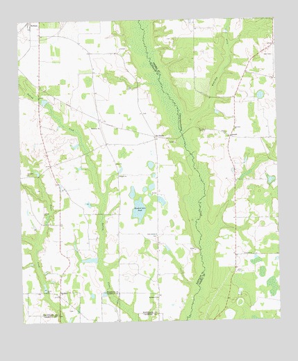
Doverel, GA USGS Topographic Map
Click on map above to begin viewing in our Map Viewer.

This topographic map contains these locations and features:
Feature Name Type Latitude Longitude GNIS ID View Map
Aycock MillPopulated PlaceN31.6374°W84.6130°354421View Map
Bentley LakeReservoirN31.7168°W84.6125°342078View Map
Bentley Lake DamDamN31.7168°W84.6116°342077View Map
Bethelem Freewill Baptist Church CemeteryCemeteryN31.6357°W84.5592°2585282View Map
Bethlehem ChurchChurchN31.6377°W84.6063°354663View Map
Bethlehem ChurchChurchN31.6352°W84.5594°311230View Map
Bones Mill (historical)LocaleN31.6663°W84.6124°344723View Map
Bynum LakeReservoirN31.6968°W84.5949°342076View Map
Bynum Lake DamDamN31.6968°W84.5949°342075View Map
Cherry Hill ChurchChurchN31.6524°W84.5124°312619View Map
Cherry Hill SchoolSchoolN31.6524°W84.5119°344631View Map
Collier CemeteryCemeteryN31.6457°W84.5205°312842View Map
Dover CemeteryCemeteryN31.7046°W84.5377°344647View Map
Dover CemeteryCemeteryN31.7032°W84.5246°344648View Map
Dover ChurchChurchN31.7029°W84.5244°355539View Map
DoverelPopulated PlaceN31.7016°W84.5221°355540View Map
Enterprise ChurchChurchN31.7054°W84.5852°313965View Map
Five PointsPopulated PlaceN31.7016°W84.5580°326282View Map
Friendship ChurchChurchN31.6863°W84.6210°355923View Map
Friendship ChurchChurchN31.7046°W84.5366°355924View Map
Hundred Acre PondLakeN31.6715°W84.5674°315821View Map
Millirons Mill (historical)LocaleN31.6860°W84.6160°344746View Map
Oak Grove ChurchChurchN31.7043°W84.5202°319776View Map
Prospect ChurchChurchN31.6854°W84.5763°321162View Map
Rice LakeReservoirN31.6502°W84.5866°337476View Map
Rice Lake DamDamN31.6502°W84.5866°337475View Map
Rice Lake Dam NorthDamN31.6752°W84.5899°342073View Map
Rice Lake NorthReservoirN31.6752°W84.5899°342074View Map
Rocky Bottom ChurchChurchN31.6607°W84.5588°321783View Map
Salem Baptist ChurchChurchN31.6907°W84.5780°322349View Map
Sweet Home Church (historical)ChurchN31.7221°W84.6146°344774View Map
Terrell School (historical)SchoolN31.6452°W84.5724°344775View Map
Walk-Ikey CreekStreamN31.7027°W84.5452°324760View Map
Wall LakeReservoirN31.7242°W84.5716°337478View Map
Wall Lake DamDamN31.7235°W84.5699°337477View Map

Note: Coordinates in the location and feature list above are referenced to NAD83 datum.


Copyright (C) 2008-2024 Ryan Niemi / Sunset Dynamics ... All Rights Reserved