TopoQuest Logo
Do you find TopoQuest useful?
Help keep TopoQuest running and adding new maps/features by donating!
Bitcoin:  19c7KJd3qBynnjoSw5npx9KScwjBe4ifkT
Litecoin:  LXs6TkuXGGXo1vDsWCkWVdjQX94eUKd6ui
Home View Maps Find Maps Find Places Resources & Links


Edison, Georgia Topographic Map

USGS Map Title: Edison, GA
USGS Map MRC: 31084E6
DRG (GeoTIFF) Download: o31084e6.tif


Neighboring USGS Topographic Map Quads:


  Carnegie, GA  
31084F7
 

  Martins Crossroads, GA  
31084F6
 

  Doverel, GA  
31084F5
 

  Bluffton, GA  
31084E7
 

  Edison, GA  
31084E6
 

  Morgan, GA  
31084E5
 

  Bancroft, GA  
31084D7
 

  Arlington, GA  
31084D6
 

  Leary, GA  
31084D5


Map MRC Location:

N32°
W85°
N32°
W84°
H8 H7 H6 H5 H4 H3 H2 H1
G8 G7 G6 G5 G4 G3 G2 G1
F8 F7 F6 F5 F4 F3 F2 F1
E8 E7 E6 E5 E4 E3 E2 E1
D8 D7 D6 D5 D4 D3 D2 D1
C8 C7 C6 C5 C4 C3 C2 C1
B8 B7 B6 B5 B4 B3 B2 B1
A8 A7 A6 A5 A4 A3 A2 A1
N31°
W85°
N31°
W84°

Edison, GA USGS 1:24K Topographic Map Preview:
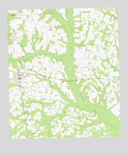
Edison, GA USGS Topographic Map
Click on map above to begin viewing in our Map Viewer.

This topographic map contains these locations and features:
Feature Name Type Latitude Longitude GNIS ID View Map
Bay BranchStreamN31.5321°W84.6763°310877View Map
Bear BranchStreamN31.5791°W84.7244°310921View Map
Boggy CreekStreamN31.5046°W84.6260°311613View Map
Calhoun County High SchoolSchoolN31.5632°W84.7277°335055View Map
Carter CreekStreamN31.6013°W84.6774°312378View Map
City of EdisonCivilN31.5608°W84.7374°2403544View Map
Davis CreekStreamN31.5257°W84.7124°313350View Map
DickeyPopulated PlaceN31.5571°W84.6602°355493View Map
Dickey CemeteryCemeteryN31.5535°W84.6630°335059View Map
Dickey Presbyterian ChurchChurchN31.5538°W84.6627°335060View Map
EdisonPopulated PlaceN31.5582°W84.7383°355643View Map
Edison Baptist ChurchChurchN31.5585°W84.7396°335061View Map
Edison DivisionCivilN31.5667°W84.7491°1936243View Map
Edison Police DepartmentBuildingN31.5575°W84.7380°2733492View Map
Edison Volunteer Fire DepartmentBuildingN31.5573°W84.7377°2603905View Map
Faith Holiness ChurchChurchN31.5130°W84.7313°335063View Map
Hood BranchStreamN31.5171°W84.6458°315620View Map
Kemps Store (historical)LocaleN31.6168°W84.6471°335066View Map
Lake MydaReservoirN31.5963°W84.7426°319180View Map
Lake Myda DamDamN31.5935°W84.7380°338345View Map
Little Pachitla CreekStreamN31.5607°W84.6785°317140View Map
Manry School (historical)SchoolN31.6102°W84.7088°335069View Map
Morgan DivisionCivilN31.5337°W84.6261°1936418View Map
Neals CreekStreamN31.5313°W84.6638°319225View Map
New Hope ChurchChurchN31.5182°W84.6710°319374View Map
Pachitla CemeteryCemeteryN31.5360°W84.6416°320147View Map
Parkins BranchStreamN31.5899°W84.6738°320237View Map
Pine Island ChurchChurchN31.6043°W84.6996°320614View Map
Regan CemeteryCemeteryN31.6096°W84.6671°321492View Map
Saint Marks ChurchChurchN31.5663°W84.6549°335083View Map
Saint Stevens CemeteryCemeteryN31.5691°W84.7232°322315View Map
Salem Baptist ChurchChurchN31.5618°W84.7130°322347View Map
Salem CemeteryCemeteryN31.5618°W84.7124°335088View Map
Taylor LakeReservoirN31.5279°W84.6366°338344View Map
Taylor Lake DamDamN31.5268°W84.6349°338343View Map
Tennelle ChapelChurchN31.5046°W84.7233°324001View Map
Tennelle CreekStreamN31.5163°W84.7046°324002View Map
TurmanPopulated PlaceN31.5016°W84.7294°326563View Map
West Calhoun Division (historical)CensusN31.5132°W84.7316°1936636View Map

Note: Coordinates in the location and feature list above are referenced to NAD83 datum.


Copyright (C) 2008-2024 Ryan Niemi / Sunset Dynamics ... All Rights Reserved