TopoQuest Logo
Do you find TopoQuest useful?
Help keep TopoQuest running and adding new maps/features by donating!
Bitcoin:  19c7KJd3qBynnjoSw5npx9KScwjBe4ifkT
Litecoin:  LXs6TkuXGGXo1vDsWCkWVdjQX94eUKd6ui
Home View Maps Find Maps Find Places Resources & Links


Pinewood Lake, Colorado Topographic Map

USGS Map Title: Pinewood Lake, CO
USGS Map MRC: 40105C3
DRG (GeoTIFF) Download: o40105c3.tif


Neighboring USGS Topographic Map Quads:


  Glen Haven, CO  
40105D4
 

  Drake, CO  
40105D3
 

  Masonville, CO  
40105D2
 

  Panorama Peak, CO  
40105C4
 

  Pinewood Lake, CO  
40105C3
 

  Carter Lake Reservoir, CO  
40105C2
 

  Raymond, CO  
40105B4
 

  Lyons, CO  
40105B3
 

  Hygiene, CO  
40105B2


Map MRC Location:

N41°
W106°
N41°
W105°
H8 H7 H6 H5 H4 H3 H2 H1
G8 G7 G6 G5 G4 G3 G2 G1
F8 F7 F6 F5 F4 F3 F2 F1
E8 E7 E6 E5 E4 E3 E2 E1
D8 D7 D6 D5 D4 D3 D2 D1
C8 C7 C6 C5 C4 C3 C2 C1
B8 B7 B6 B5 B4 B3 B2 B1
A8 A7 A6 A5 A4 A3 A2 A1
N40°
W106°
N40°
W105°

Pinewood Lake, CO USGS 1:24K Topographic Map Preview:
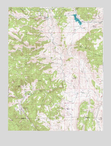
Pinewood Lake, CO USGS Topographic Map
Click on map above to begin viewing in our Map Viewer.

This topographic map contains these locations and features:
Feature Name Type Latitude Longitude GNIS ID View Map
Bald MountainSummitN40.3558°W105.2639°178021View Map
Bald Mountain Gate HouseLocaleN40.3597°W105.2558°178022View Map
Bald Mountain TunnelTunnelN40.3597°W105.2686°178023View Map
Beartrap GulchValleyN40.3486°W105.3220°178018View Map
Beech HillSummitN40.2750°W105.2792°178033View Map
Blue MountainSummitN40.3353°W105.2811°178013View Map
Burnett GulchValleyN40.2891°W105.3231°178000View Map
Button RockPillarN40.2605°W105.3708°178036View Map
Chickenhouse GulchValleyN40.3425°W105.3205°178017View Map
Cojade MineMineN40.3555°W105.2978°1683592View Map
Colard RanchLocaleN40.2717°W105.2950°177997View Map
Colorado Rose Red QuarryMineN40.2839°W105.3475°1683594View Map
Crescent LakeLakeN40.2869°W105.3466°178003View Map
Devils GulchValleyN40.3340°W105.3512°177973View Map
Diamond K QuarryMineN40.2561°W105.2717°1683586View Map
Drummer FlatFlatN40.3017°W105.3244°178008View Map
Dry HollowValleyN40.2918°W105.2678°178009View Map
Elk RidgeRidgeN40.3169°W105.3603°202514View Map
Emhaw GulchValleyN40.3651°W105.3476°178031View Map
Gray MountainSummitN40.3036°W105.2853°178010View Map
Hell CanyonValleyN40.3428°W105.3206°177964View Map
Howard GulchValleyN40.3223°W105.3049°178011View Map
Howe QuarryMineN40.2561°W105.2717°1683587View Map
Indian MountainSummitN40.2622°W105.2508°202518View Map
Jacobson and Lyons QuarryMineN40.2561°W105.2717°1683588View Map
Kirts QuarryMineN40.2561°W105.2717°1683589View Map
Linger RanchLocaleN40.3519°W105.2867°178015View Map
Little Elk ParkFlatN40.2750°W105.3589°178002View Map
Maure HollowValleyN40.2879°W105.3517°178005View Map
Mill GulchValleyN40.3687°W105.2874°178026View Map
Moose MountainSummitN40.2950°W105.3633°178006View Map
Muggins GulchValleyN40.2838°W105.3743°178004View Map
NolandPopulated PlaceN40.2592°W105.2544°178034View Map
North Fork Little Thompson RiverStreamN40.3022°W105.3017°177963View Map
Ohline MineMineN40.2561°W105.2717°1683590View Map
Pincher ParkFlatN40.3289°W105.3283°178012View Map
Pinewood LakeReservoirN40.3627°W105.2844°178025View Map
Pinewood RanchLocaleN40.3542°W105.2744°178020View Map
Pinewood SchoolSchoolN40.3600°W105.2786°178024View Map
Pinewood SpringsPopulated PlaceN40.2733°W105.3567°178001View Map
Pinewood Springs Fire Protection DistrictBuildingN40.2774°W105.3600°2667163View Map
Pole Hill CanalCanalN40.3694°W105.3333°178030View Map
Pole Hill Gate HouseLocaleN40.3661°W105.3317°178029View Map
Pole Hill Power PlantLocaleN40.3653°W105.3253°178028View Map
Rabbit GulchValleyN40.3658°W105.3680°177646View Map
Rattlesnake DamDamN40.3667°W105.2989°200674View Map
Rattlesnake ParkFlatN40.3528°W105.2880°178016View Map
Rattlesnake Park MineMineN40.3561°W105.2978°1683593View Map
Rattlesnake TunnelTunnelN40.3661°W105.3050°178027View Map
Redstone QuarryMineN40.2561°W105.2717°1683591View Map
Round MountainSummitN40.3008°W105.3353°178007View Map
Rowell GulchValleyN40.2872°W105.2840°177998View Map
Rowell HillSummitN40.2614°W105.3358°178035View Map
Skinner GulchValleyN40.3728°W105.2879°177677View Map
South Side DamDamN40.3683°W105.3605°200330View Map
South Side ReservoirReservoirN40.3683°W105.3605°200331View Map
Spruce GulchValleyN40.3177°W105.3047°178019View Map
Stevens RanchLocaleN40.3342°W105.2744°178014View Map
X Bar 7 RanchLocaleN40.2878°W105.2842°177999View Map

Note: Coordinates in the location and feature list above are referenced to NAD83 datum.


Copyright (C) 2008-2024 Ryan Niemi / Sunset Dynamics ... All Rights Reserved