TopoQuest Logo
Do you find TopoQuest useful?
Help keep TopoQuest running and adding new maps/features by donating!
Bitcoin:  19c7KJd3qBynnjoSw5npx9KScwjBe4ifkT
Litecoin:  LXs6TkuXGGXo1vDsWCkWVdjQX94eUKd6ui
Home View Maps Find Maps Find Places Resources & Links


Drakesboro, Kentucky Topographic Map

USGS Map Title: Drakesboro, KY
USGS Map MRC: 37087B1
DRG (GeoTIFF) Download: o37087b1.tif


Neighboring USGS Topographic Map Quads:


  Central City West, KY  
37087C2
 

  Central City East, KY  
37087C1
 

  Paradise, KY  
37086C8
 

  Greenville, KY  
37087B2
 

  Drakesboro, KY  
37087B1
 

  Rochester, KY  
37086B8
 

  Kirkmansville, KY  
37087A2
 

  Rosewood, KY  
37087A1
 

  Dunmor, KY  
37086A8


Map MRC Location:

N38°
W88°
N38°
W87°
H8 H7 H6 H5 H4 H3 H2 H1
G8 G7 G6 G5 G4 G3 G2 G1
F8 F7 F6 F5 F4 F3 F2 F1
E8 E7 E6 E5 E4 E3 E2 E1
D8 D7 D6 D5 D4 D3 D2 D1
C8 C7 C6 C5 C4 C3 C2 C1
B8 B7 B6 B5 B4 B3 B2 B1
A8 A7 A6 A5 A4 A3 A2 A1
N37°
W88°
N37°
W87°

Drakesboro, KY USGS 1:24K Topographic Map Preview:
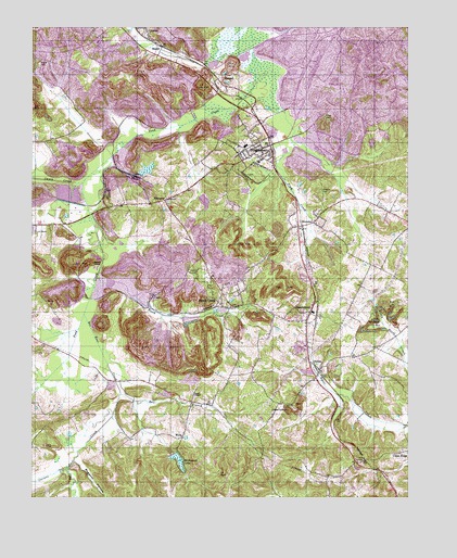
Drakesboro, KY USGS Topographic Map
Click on map above to begin viewing in our Map Viewer.

This topographic map contains these locations and features:
Feature Name Type Latitude Longitude GNIS ID View Map
Bat East CreekStreamN37.1737°W87.1078°486462View Map
Beech CreekPopulated PlaceN37.1770°W87.0631°486696View Map
Beech CreekStreamN37.1834°W87.1031°486697View Map
BeechmontPopulated PlaceN37.1745°W87.0325°486750View Map
Beechmont Census Designated PlaceCensusN37.1714°W87.0365°2629573View Map
Beechmont Volunteer Fire DepartmentBuildingN37.1718°W87.0352°2636965View Map
BeltonPopulated PlaceN37.1600°W87.0283°507312View Map
BevierPopulated PlaceN37.2445°W87.0819°507504View Map
Boggess HollowValleyN37.1351°W87.1098°487615View Map
BrowderPopulated PlaceN37.1973°W87.0364°487977View Map
Browder CemeteryCemeteryN37.2067°W87.0292°487979View Map
Caney CreekStreamN37.2095°W87.1072°488838View Map
Carters CreekStreamN37.1331°W87.1131°489022View Map
Carters Creek (historical)Populated PlaceN37.1315°W87.1183°2742991View Map
City of DrakesboroCivilN37.2176°W87.0493°2403507View Map
DrakesboroPopulated PlaceN37.2175°W87.0489°491099View Map
Drakesboro DivisionCivilN37.2183°W87.0195°1936980View Map
Drakesboro Fire DepartmentBuildingN37.2171°W87.0498°2636951View Map
EbenezerPopulated PlaceN37.2039°W87.0808°491532View Map
Elk Valley (historical)Populated PlaceN37.2320°W87.0566°2743009View Map
Ennis CemeteryCemeteryN37.2264°W87.0278°491785View Map
Hazel Creek ChurchChurchN37.1484°W87.0450°493951View Map
Kirkwood LakeReservoirN37.1353°W87.0767°495807View Map
Leighs (historical)Populated PlaceN37.1539°W87.0812°2743020View Map
Liberty Hill (historical)Populated PlaceN37.2323°W87.1142°2743021View Map
NonnellPopulated PlaceN37.2373°W87.0594°508717View Map
Peanut (historical)Populated PlaceN37.2251°W87.0502°2743027View Map
Plum CreekStreamN37.2289°W87.0428°500964View Map
Stony PointCliffN37.1875°W87.1047°504513View Map
Sunrise (historical)Populated PlaceN37.2361°W87.0642°2743038View Map
Union RidgePopulated PlaceN37.1370°W87.0019°509261View Map
WellsPopulated PlaceN37.1414°W87.0747°509336View Map
Wilcox CemeteryCemeteryN37.2398°W87.1222°506720View Map
WKYA-FM (Central City)TowerN37.1362°W87.0956°517686View Map

Note: Coordinates in the location and feature list above are referenced to NAD83 datum.


Copyright (C) 2008-2025 Ryan Niemi / Sunset Dynamics ... All Rights Reserved