TopoQuest Logo
Do you find TopoQuest useful?
Help keep TopoQuest running and adding new maps/features by donating!
Bitcoin:  19c7KJd3qBynnjoSw5npx9KScwjBe4ifkT
Litecoin:  LXs6TkuXGGXo1vDsWCkWVdjQX94eUKd6ui
Home View Maps Find Maps Find Places Resources & Links


Draughn, North Carolina Topographic Map

USGS Map Title: Draughn, NC
USGS Map MRC: 36077A5
DRG (GeoTIFF) Download: o36077a5.tif


Neighboring USGS Topographic Map Quads:


  Enfield, NC  
36077B6
 

  Dawson Crossroads, NC  
36077B5
 

  Scotland Neck, NC  
36077B4
 

  Whitakers, NC  
36077A6
 

  Draughn, NC  
36077A5
 

  Hobgood, NC  
36077A4
 

  Hartsease, NC  
35077H6
 

  Tarboro, NC  
35077H5
 

  Speed, NC  
35077H4


Map MRC Location:

N37°
W78°
N37°
W77°
H8 H7 H6 H5 H4 H3 H2 H1
G8 G7 G6 G5 G4 G3 G2 G1
F8 F7 F6 F5 F4 F3 F2 F1
E8 E7 E6 E5 E4 E3 E2 E1
D8 D7 D6 D5 D4 D3 D2 D1
C8 C7 C6 C5 C4 C3 C2 C1
B8 B7 B6 B5 B4 B3 B2 B1
A8 A7 A6 A5 A4 A3 A2 A1
N36°
W78°
N36°
W77°

Draughn, NC USGS 1:24K Topographic Map Preview:
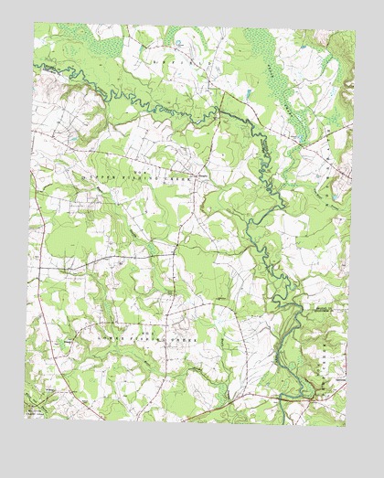
Draughn, NC USGS Topographic Map
Click on map above to begin viewing in our Map Viewer.

This topographic map contains these locations and features:
Feature Name Type Latitude Longitude GNIS ID View Map
Beech SwampSwampN36.1247°W77.5380°1019057View Map
Bellamy CemeteryCemeteryN36.0971°W77.5530°980951View Map
Bethlehem ChurchChurchN36.0396°W77.5511°981227View Map
Bulluck CemeteryCemeteryN36.0051°W77.6022°982241View Map
Cow Haul SwampStreamN36.0763°W77.5255°983640View Map
DraughnPopulated PlaceN36.0779°W77.5603°1006182View Map
Ebenezer CemeteryCemeteryN36.0250°W77.6065°2779130View Map
Ebenezer ChurchChurchN36.0249°W77.6066°984608View Map
Hoerner Waldorf PondReservoirN36.1045°W77.5408°1000079View Map
Hoerners Waldorf Pond DamDamN36.1052°W77.5414°1000078View Map
King CemeteryCemeteryN36.0765°W77.6030°987977View Map
Moore SwampStreamN36.0115°W77.5458°990183View Map
Mount Moriah ChurchChurchN36.0090°W77.6128°990445View Map
Price CemeteryCemeteryN36.0404°W77.5687°992806View Map
Township 5-Lower Fishing CreekCivilN36.0017°W77.5686°1026662View Map

Note: Coordinates in the location and feature list above are referenced to NAD83 datum.


Copyright (C) 2008-2025 Ryan Niemi / Sunset Dynamics ... All Rights Reserved