TopoQuest Logo
Do you find TopoQuest useful?
Help keep TopoQuest running and adding new maps/features by donating!
Bitcoin:  19c7KJd3qBynnjoSw5npx9KScwjBe4ifkT
Litecoin:  LXs6TkuXGGXo1vDsWCkWVdjQX94eUKd6ui
Home View Maps Find Maps Find Places Resources & Links


Whitakers, North Carolina Topographic Map

USGS Map Title: Whitakers, NC
USGS Map MRC: 36077A6
DRG (GeoTIFF) Download: o36077a6.tif


Neighboring USGS Topographic Map Quads:


  Ringwood, NC  
36077B7
 

  Enfield, NC  
36077B6
 

  Dawson Crossroads, NC  
36077B5
 

  Drake, NC  
36077A7
 

  Whitakers, NC  
36077A6
 

  Draughn, NC  
36077A5
 

  Rocky Mount, NC  
35077H7
 

  Hartsease, NC  
35077H6
 

  Tarboro, NC  
35077H5


Map MRC Location:

N37°
W78°
N37°
W77°
H8 H7 H6 H5 H4 H3 H2 H1
G8 G7 G6 G5 G4 G3 G2 G1
F8 F7 F6 F5 F4 F3 F2 F1
E8 E7 E6 E5 E4 E3 E2 E1
D8 D7 D6 D5 D4 D3 D2 D1
C8 C7 C6 C5 C4 C3 C2 C1
B8 B7 B6 B5 B4 B3 B2 B1
A8 A7 A6 A5 A4 A3 A2 A1
N36°
W78°
N36°
W77°

Whitakers, NC USGS 1:24K Topographic Map Preview:
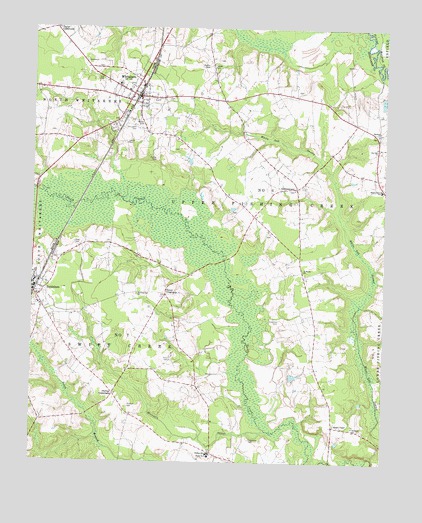
Whitakers, NC USGS Topographic Map
Click on map above to begin viewing in our Map Viewer.

This topographic map contains these locations and features:
Feature Name Type Latitude Longitude GNIS ID View Map
Battle CemeteryCemeteryN36.1146°W77.6886°980628View Map
BattleboroPopulated PlaceN36.0490°W77.7491°980632View Map
Bethany ChurchChurchN36.0949°W77.6269°981090View Map
Bethany ChurchCemeteryN36.0946°W77.6274°2779125View Map
Carlyle CemeteryCemeteryN36.0921°W77.7165°982651View Map
Cherry CrossroadsPopulated PlaceN36.0485°W77.7022°1006159View Map
Gammons PondReservoirN36.0452°W77.6280°999972View Map
Gammons Pond DamDamN36.0452°W77.6280°999971View Map
GethsemanePopulated PlaceN36.0793°W77.6561°1006215View Map
Gethsemane CemeteryCemeteryN36.0788°W77.6565°2779127View Map
Hunter CemeteryCemeteryN36.0874°W77.7063°987249View Map
Hutchins CemeteryCemeteryN36.0410°W77.6617°987295View Map
Jerusalem CemeteryCemeteryN36.0971°W77.7141°987581View Map
Lane SwampStreamN36.0813°W77.7433°988132View Map
Lawrence CemeteryCemeteryN36.0069°W77.6713°988222View Map
Moccasin CreekStreamN36.0085°W77.6639°990115View Map
Morning Star CemeteryCemeteryN36.0478°W77.7133°2779128View Map
Morning Star ChurchChurchN36.0488°W77.7125°990254View Map
Phillips CemeteryCemeteryN36.0160°W77.7150°992142View Map
Phillips CrossroadsPopulated PlaceN36.0196°W77.7205°1006328View Map
Phillips SchoolSchoolN36.0027°W77.6861°992151View Map
Pope CemeteryCemeteryN36.0631°W77.7346°992672View Map
Price CemeteryCemeteryN36.0295°W77.7001°992805View Map
Red HillLocaleN36.0829°W77.6278°1006545View Map
Red Hill CemeteryCemeteryN36.0905°W77.6262°2779126View Map
Red Hill ChurchChurchN36.0907°W77.6269°993121View Map
Saint Marks ChurchChurchN36.0557°W77.6533°994021View Map
Speight ChapelChurchN36.0113°W77.6416°995283View Map
Speight Chapel CemeteryCemeteryN36.0110°W77.6416°2779132View Map
Taylor CrossroadsPopulated PlaceN36.1249°W77.7422°1006387View Map
Temple CemeteryCemeteryN36.1131°W77.6857°995916View Map
Thompson Farms AirportAirportN36.0275°W77.6582°2679280View Map
Town of WhitakersCivilN36.1057°W77.7131°2406874View Map
Township 6-Upper Fishing CreekCivilN36.0792°W77.6386°1026663View Map
Tyler CemeteryCemeteryN36.1104°W77.7255°996395View Map
Watson CemeteryCemeteryN36.0978°W77.7107°996867View Map
WhitakersPopulated PlaceN36.1054°W77.7128°997124View Map
Whitakers Fire DepartmentBuildingN36.1052°W77.7135°2639834View Map
Whitakers Police DepartmentBuildingN36.1076°W77.7119°2130974View Map
Whitakers Post OfficePost OfficeN36.1058°W77.7130°2773831View Map
Whitakers School (historical)SchoolN36.0979°W77.7200°1951244View Map
Williams CemeteryCemeteryN36.0108°W77.6346°2779131View Map
Williams ChurchChurchN36.0107°W77.6350°997378View Map
Willow Grove SchoolSchoolN36.0788°W77.6255°997418View Map

Note: Coordinates in the location and feature list above are referenced to NAD83 datum.


Copyright (C) 2008-2025 Ryan Niemi / Sunset Dynamics ... All Rights Reserved