TopoQuest Logo
Do you find TopoQuest useful?
Help keep TopoQuest running and adding new maps/features by donating!
Bitcoin:  19c7KJd3qBynnjoSw5npx9KScwjBe4ifkT
Litecoin:  LXs6TkuXGGXo1vDsWCkWVdjQX94eUKd6ui
Home View Maps Find Maps Find Places Resources & Links


Dry Fork, Utah Topographic Map

USGS Map Title: Dry Fork, UT
USGS Map MRC: 40109E6
DRG (GeoTIFF) Download: o40109e6.tif


Neighboring USGS Topographic Map Quads:


  Marsh Peak, UT  
40109F7
 

  Taylor Mountain, UT  
40109F6
 

  Dyer Mountain, UT  
40109F5
 

  Lake Mountain, UT  
40109E7
 

  Dry Fork, UT  
40109E6
 

  Steinaker Reservoir, UT  
40109E5
 

  Lapoint, UT  
40109D7
 

  Vernal NW, UT  
40109D6
 

  Vernal NE, UT  
40109D5


Map MRC Location:

N41°
W110°
N41°
W109°
H8 H7 H6 H5 H4 H3 H2 H1
G8 G7 G6 G5 G4 G3 G2 G1
F8 F7 F6 F5 F4 F3 F2 F1
E8 E7 E6 E5 E4 E3 E2 E1
D8 D7 D6 D5 D4 D3 D2 D1
C8 C7 C6 C5 C4 C3 C2 C1
B8 B7 B6 B5 B4 B3 B2 B1
A8 A7 A6 A5 A4 A3 A2 A1
N40°
W110°
N40°
W109°

Dry Fork, UT USGS 1:24K Topographic Map Preview:
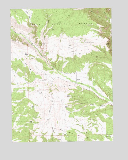
Dry Fork, UT USGS Topographic Map
Click on map above to begin viewing in our Map Viewer.

This topographic map contains these locations and features:
Feature Name Type Latitude Longitude GNIS ID View Map
Alma Taylor HollowValleyN40.5836°W109.7118°1438171View Map
Beck SpringSpringN40.5904°W109.6790°1438549View Map
Black CanyonValleyN40.6119°W109.6274°1438836View Map
Box SpringSpringN40.5479°W109.7126°1439082View Map
Burch SpringSpringN40.5188°W109.7253°1439333View Map
Castle CoveBasinN40.5547°W109.6999°1439510View Map
Charleys ParkFlatN40.6241°W109.7288°1439644View Map
Charleys Park SpringSpringN40.6211°W109.7244°1450110View Map
Chicken SpringSpringN40.5336°W109.7223°1439680View Map
Chivers SpringSpringN40.5317°W109.6848°1439701View Map
Chokecherry SpringSpringN40.5783°W109.7218°1439721View Map
Dry ForkPopulated PlaceN40.5575°W109.6693°1440612View Map
Dry Fork CemeteryCemeteryN40.5594°W109.6554°1448355View Map
Dry Fork Picnic SiteLocaleN40.5819°W109.7149°1448356View Map
East End SpringSpringN40.5911°W109.6328°1440781View Map
Hawthorn SpringSpringN40.5430°W109.6823°1441637View Map
June SpringSpringN40.5824°W109.6666°1442255View Map
Lind SpringSpringN40.5786°W109.6459°1442628View Map
Little MountainSummitN40.5383°W109.6985°1442748View Map
Little Mountain OverlookLocaleN40.5383°W109.6990°1448608View Map
Middle SpringSpringN40.5844°W109.6726°1443379View Map
Mud SpringSpringN40.6062°W109.6998°1443705View Map
Pine RidgeRidgeN40.5711°W109.7290°1444404View Map
Pine Ridge Picnic SiteLocaleN40.5708°W109.7213°1448835View Map
Shindy DrawValleyN40.5366°W109.6265°1445527View Map
Shindy Hollow Picnic SiteParkN40.5277°W109.6749°1448998View Map
Shindy SpringSpringN40.5277°W109.6777°1445528View Map
Willow SpringsSpringN40.5821°W109.7333°1447448View Map

Note: Coordinates in the location and feature list above are referenced to NAD83 datum.


Copyright (C) 2008-2025 Ryan Niemi / Sunset Dynamics ... All Rights Reserved