TopoQuest Logo
Do you find TopoQuest useful?
Help keep TopoQuest running and adding new maps/features by donating!
Bitcoin:  19c7KJd3qBynnjoSw5npx9KScwjBe4ifkT
Litecoin:  LXs6TkuXGGXo1vDsWCkWVdjQX94eUKd6ui
Home View Maps Find Maps Find Places Resources & Links


Lorella, Oregon Topographic Map

USGS Map Title: Lorella, OR
USGS Map MRC: 42121B3
DRG (GeoTIFF) Download: o42121b3.tif


Neighboring USGS Topographic Map Quads:


  Yonna, OR  
42121C4
 

  Yainax Butte, OR  
42121C3
 

  Dry Prairie, OR  
42121C2
 

  Bonanza, OR  
42121B4
 

  Lorella, OR  
42121B3
 

  Goodlow Mountain, OR  
42121B2
 

  Malin, OR  
42121A4
 

  Bryant Mountain, OR  
42121A3
 

  Langell Valley, OR  
42121A2


Map MRC Location:

N43°
W122°
N43°
W121°
H8 H7 H6 H5 H4 H3 H2 H1
G8 G7 G6 G5 G4 G3 G2 G1
F8 F7 F6 F5 F4 F3 F2 F1
E8 E7 E6 E5 E4 E3 E2 E1
D8 D7 D6 D5 D4 D3 D2 D1
C8 C7 C6 C5 C4 C3 C2 C1
B8 B7 B6 B5 B4 B3 B2 B1
A8 A7 A6 A5 A4 A3 A2 A1
N42°
W122°
N42°
W121°

Lorella, OR USGS 1:24K Topographic Map Preview:
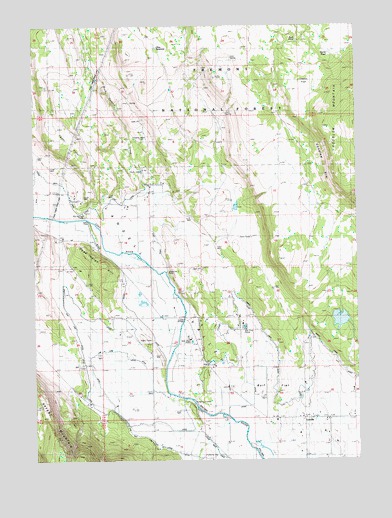
Lorella, OR USGS Topographic Map
Click on map above to begin viewing in our Map Viewer.

This topographic map contains these locations and features:
Feature Name Type Latitude Longitude GNIS ID View Map
Big Springs PumpLocaleN42.1952°W121.3583°1117681View Map
Capon FlatFlatN42.2307°W121.2714°1118597View Map
Cedar PointRidgeN42.2124°W121.3597°1118762View Map
Dead Indian HillSummitN42.1840°W121.3575°1136206View Map
East CanalCanalN42.1999°W121.3275°1133076View Map
High Line DitchCanalN42.1302°W121.3319°1121806View Map
Irwins PumpLocaleN42.1935°W121.3572°1122289View Map
Jones Number 2 PumpLocaleN42.1796°W121.3275°1163724View Map
Keller BridgeBridgeN42.1652°W121.3200°1122656View Map
LorellaPopulated PlaceN42.1371°W121.2725°1123481View Map
Lorella DrainCanalN42.1374°W121.2583°1157069View Map
Lorella LateralCanalN42.1304°W121.2628°1157070View Map
Lorella Post Office (historical)Post OfficeN42.1371°W121.2725°1165563View Map
Low Line DitchCanalN42.1565°W121.3444°1123544View Map
Mahoney ReservoirReservoirN42.2262°W121.3436°1161674View Map
Mallory SpringSpringN42.2249°W121.3011°1167053View Map
McCartie RanchLocaleN42.2063°W121.3269°1123901View Map
North CanalCanalN42.1513°W121.2828°1124726View Map
Olive ReservoirReservoirN42.2438°W121.3303°1133291View Map
Randall DamDamN42.1644°W121.2550°1133653View Map
Randall ReservoirReservoirN42.1649°W121.2544°1133654View Map
Rock PondLakeN42.2449°W121.2756°1133292View Map
Rocky Canyon CreekStreamN42.1849°W121.3378°1126233View Map
Stump PondLakeN42.2422°W121.2606°1133293View Map
Williams ReservoirReservoirN42.2014°W121.2670°1157071View Map
Wolf FlatFlatN42.1443°W121.2928°1133075View Map

Note: Coordinates in the location and feature list above are referenced to NAD83 datum.


Copyright (C) 2008-2025 Ryan Niemi / Sunset Dynamics ... All Rights Reserved