TopoQuest Logo
Do you find TopoQuest useful?
Help keep TopoQuest running and adding new maps/features by donating!
Bitcoin:  19c7KJd3qBynnjoSw5npx9KScwjBe4ifkT
Litecoin:  LXs6TkuXGGXo1vDsWCkWVdjQX94eUKd6ui
Home View Maps Find Maps Find Places Resources & Links


Goodlow Mountain, Oregon Topographic Map

USGS Map Title: Goodlow Mountain, OR
USGS Map MRC: 42121B2
DRG (GeoTIFF) Download: o42121b2.tif


Neighboring USGS Topographic Map Quads:


  Yainax Butte, OR  
42121C3
 

  Dry Prairie, OR  
42121C2
 

  Horsefly Mountain, OR  
42121C1
 

  Lorella, OR  
42121B3
 

  Goodlow Mountain, OR  
42121B2
 

  Gerber Reservoir, OR  
42121B1
 

  Bryant Mountain, OR  
42121A3
 

  Langell Valley, OR  
42121A2
 

  Brady Butte, OR  
42121A1


Map MRC Location:

N43°
W122°
N43°
W121°
H8 H7 H6 H5 H4 H3 H2 H1
G8 G7 G6 G5 G4 G3 G2 G1
F8 F7 F6 F5 F4 F3 F2 F1
E8 E7 E6 E5 E4 E3 E2 E1
D8 D7 D6 D5 D4 D3 D2 D1
C8 C7 C6 C5 C4 C3 C2 C1
B8 B7 B6 B5 B4 B3 B2 B1
A8 A7 A6 A5 A4 A3 A2 A1
N42°
W122°
N42°
W121°

Goodlow Mountain, OR USGS 1:24K Topographic Map Preview:
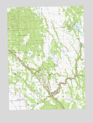
Goodlow Mountain, OR USGS Topographic Map
Click on map above to begin viewing in our Map Viewer.

This topographic map contains these locations and features:
Feature Name Type Latitude Longitude GNIS ID View Map
Ben Hall CreekStreamN42.2218°W121.1508°1117509View Map
Ben Hall SpringSpringN42.2242°W121.1509°1133280View Map
Bieler RanchLocaleN42.2052°W121.1919°1117575View Map
Big Adobe DamDamN42.1388°W121.1572°1131427View Map
Big Adobe ReservoirReservoirN42.1382°W121.1589°1117577View Map
Campbell SpringSpringN42.1363°W121.2362°1118549View Map
Cys BranchStreamN42.1290°W121.2486°1119650View Map
DeVaul LakeLakeN42.1936°W121.1592°1119729View Map
Dobe CreekStreamN42.1360°W121.1942°1133108View Map
Dry Prairie DamDamN42.2325°W121.1753°1133509View Map
Gary ReservoirReservoirN42.2480°W121.2009°1133279View Map
Gerber DamDamN42.2010°W121.1333°1121103View Map
Gerber Reservoir North Recreation SiteLocaleN42.2192°W121.1347°1638508View Map
Gerber Reservoir South Recreation SiteLocaleN42.2041°W121.1300°1133099View Map
Gillette SpringSpringN42.1534°W121.1558°1133270View Map
Glover RanchLocaleN42.1590°W121.2100°1121172View Map
Goodlow MountainSummitN42.2199°W121.2436°1121227View Map
Goodlow Mountain Research Natural AreaParkN42.2165°W121.2011°1167408View Map
Goodlow PondSwampN42.1727°W121.1925°1133271View Map
Goodlow RimCliffN42.1752°W121.2197°1121228View Map
Harbison SpringSpringN42.1750°W121.1995°1121587View Map
HaynesvillePopulated PlaceN42.1365°W121.2325°1159093View Map
Haynesville CemeteryCemeteryN42.1379°W121.2125°1157068View Map
Hope ReservoirReservoirN42.1815°W121.2386°1133277View Map
House SpringSpringN42.1450°W121.2040°1159091View Map
Johnson RanchLocaleN42.1582°W121.2086°1122489View Map
Kent ReservoirReservoirN42.1475°W121.2049°1133103View Map
Lewis SpringSpringN42.1679°W121.1744°1133267View Map
Linsay SpringSpringN42.1495°W121.2019°1133102View Map
Lockey FlatLakeN42.2056°W121.1488°1133100View Map
Meadow SpringSpringN42.1415°W121.1997°1133105View Map
Miller Creek CampLocaleN42.1842°W121.1297°2548253View Map
Miller Creek SpringSpringN42.1710°W121.1283°1133275View Map
Miller Diversion DamDamN42.1351°W121.1884°1133276View Map
Nail SpringSpringN42.1316°W121.2203°1159092View Map
Nobel PondLakeN42.1911°W121.1991°1133268View Map
Noble CreekStreamN42.1527°W121.2039°1133101View Map
Noble RanchLocaleN42.1899°W121.1908°1124701View Map
Noble ReservoirReservoirN42.1857°W121.1914°1124702View Map
Noble Reservoir Number OneReservoirN42.1465°W121.1952°1133104View Map
North Gerber Campground Boat RampLocaleN42.2181°W121.1333°2700264View Map
Pankey BasinBasinN42.1602°W121.1758°1125150View Map
Pankey LakeLakeN42.1941°W121.2148°1125151View Map
Pankey RanchLocaleN42.1646°W121.1800°1167409View Map
Pankey ReservoirReservoirN42.1670°W121.1813°1133266View Map
Pankey SpringsSpringN42.1673°W121.1797°1159090View Map
Potholes CampLocaleN42.2148°W121.1490°2548689View Map
R N A SpringSpringN42.2141°W121.1880°1133278View Map
Randall Dam Number 3DamN42.1521°W121.2419°1131554View Map
Randall Reservoir Number 3ReservoirN42.1531°W121.2420°1131555View Map
Rock CanyonValleyN42.1402°W121.1844°1133107View Map
Schnipps ValleyValleyN42.1640°W121.1405°1126648View Map
Schnipps Valley SpringSpringN42.1642°W121.1282°1133274View Map
Stan H SpringSpringN42.2285°W121.1415°1157067View Map
Stan H Springs CampLocaleN42.2299°W121.1395°2548752View Map
Stewart SpringSpringN42.1683°W121.2415°1127603View Map
Tillie SpringSpringN42.1523°W121.1324°1133273View Map
Wilkerson Horse Camp SpringSpringN42.2385°W121.2040°1129092View Map

Note: Coordinates in the location and feature list above are referenced to NAD83 datum.


Copyright (C) 2008-2025 Ryan Niemi / Sunset Dynamics ... All Rights Reserved