TopoQuest Logo
Do you find TopoQuest useful?
Help keep TopoQuest running and adding new maps/features by donating!
Bitcoin:  19c7KJd3qBynnjoSw5npx9KScwjBe4ifkT
Litecoin:  LXs6TkuXGGXo1vDsWCkWVdjQX94eUKd6ui
Home View Maps Find Maps Find Places Resources & Links


Duck Creek, Oregon Topographic Map

USGS Map Title: Duck Creek, OR
USGS Map MRC: 45116A8
DRG (GeoTIFF) Download: o45116a8.tif


Neighboring USGS Topographic Map Quads:


  Lick Creek, OR  
45117B1
 

  Gumboot Butte, OR  
45116B8
 

  Puderbaugh Ridge, OR  
45116B7
 

  Deadman Point, OR  
45117A1
 

  Duck Creek, OR  
45116A8
 

  Homestead, OR  
45116A7
 

  Halfway, OR  
44117H1
 

  McLain Gulch, OR  
44116H8
 

  Oxbow, OR  
44116H7


Map MRC Location:

N46°
W117°
N46°
W116°
H8 H7 H6 H5 H4 H3 H2 H1
G8 G7 G6 G5 G4 G3 G2 G1
F8 F7 F6 F5 F4 F3 F2 F1
E8 E7 E6 E5 E4 E3 E2 E1
D8 D7 D6 D5 D4 D3 D2 D1
C8 C7 C6 C5 C4 C3 C2 C1
B8 B7 B6 B5 B4 B3 B2 B1
A8 A7 A6 A5 A4 A3 A2 A1
N45°
W117°
N45°
W116°

Duck Creek, OR USGS 1:24K Topographic Map Preview:
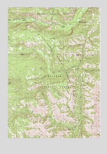
Duck Creek, OR USGS Topographic Map
Click on map above to begin viewing in our Map Viewer.

This topographic map contains these locations and features:
Feature Name Type Latitude Longitude GNIS ID View Map
Cold SpringsSpringN45.0947°W116.9404°1156678View Map
Cold Springs Guard StationLocaleN45.0960°W116.9402°1139972View Map
Corral CreekStreamN45.0179°W116.9963°1140139View Map
Coverdale Guard StationLocaleN45.1079°W116.9238°1140269View Map
Coverdale Recreation SiteLocaleN45.1082°W116.9232°1156874View Map
Coverdale SpringSpringN45.1132°W116.9315°1153103View Map
Deer CreekStreamN45.0682°W116.9165°1140832View Map
Doe CreekStreamN45.0888°W116.8977°1141110View Map
Driveway CreekStreamN45.0474°W116.9040°1141253View Map
Duck CreekStreamN45.0682°W116.9065°1141371View Map
Duck Lake Recreation SiteLocaleN45.0946°W116.9974°1159225View Map
Duke CreekStreamN45.0607°W116.9052°1141389View Map
Dutchman CreekStreamN45.0624°W116.9429°1141438View Map
Elk CreekStreamN45.0196°W116.9410°1141764View Map
Evergreen Recreation SiteLocaleN45.1124°W116.9954°1152819View Map
Grave CreekStreamN45.0754°W116.9479°1142980View Map
Hidden Recreation SiteLocaleN45.1138°W116.9802°1152818View Map
Jolly CreekStreamN45.0246°W116.9032°1144369View Map
Lake Fork CreekStreamN45.0082°W116.9085°1144778View Map
Lake Fork Recreation SiteLocaleN45.0082°W116.9121°1156679View Map
Line CreekStreamN45.0615°W116.9049°1145045View Map
Lonesome CreekStreamN45.0768°W116.8993°1145378View Map
North CreekStreamN45.0668°W116.9443°1146894View Map
Packsaddle CreekStreamN45.0521°W116.9916°1147338View Map
Rock SpringSpringN45.1118°W116.8858°1133845View Map
Sheep CreekStreamN45.0424°W116.9752°1149325View Map
Skookum CreekStreamN45.1090°W116.9399°1149610View Map
Steep CreekStreamN45.0538°W116.9049°1150393View Map
Trap CreekStreamN45.0415°W116.9046°1151388View Map
Wet CreekStreamN45.0457°W116.9038°1152163View Map

Note: Coordinates in the location and feature list above are referenced to NAD83 datum.


Copyright (C) 2008-2025 Ryan Niemi / Sunset Dynamics ... All Rights Reserved