TopoQuest Logo
Do you find TopoQuest useful?
Help keep TopoQuest running and adding new maps/features by donating!
Bitcoin:  19c7KJd3qBynnjoSw5npx9KScwjBe4ifkT
Litecoin:  LXs6TkuXGGXo1vDsWCkWVdjQX94eUKd6ui
Home View Maps Find Maps Find Places Resources & Links


McLain Gulch, Oregon Topographic Map

USGS Map Title: McLain Gulch, OR
USGS Map MRC: 44116H8
DRG (GeoTIFF) Download: o44116h8.tif


Neighboring USGS Topographic Map Quads:


  Deadman Point, OR  
45117A1
 

  Duck Creek, OR  
45116A8
 

  Homestead, OR  
45116A7
 

  Halfway, OR  
44117H1
 

  McLain Gulch, OR  
44116H8
 

  Oxbow, OR  
44116H7
 

  Posy Valley, OR  
44117G1
 

  Brownlee Dam, OR  
44116G8
 

  Cuddy Mountain, ID  
44116G7


Map MRC Location:

N45°
W117°
N45°
W116°
H8 H7 H6 H5 H4 H3 H2 H1
G8 G7 G6 G5 G4 G3 G2 G1
F8 F7 F6 F5 F4 F3 F2 F1
E8 E7 E6 E5 E4 E3 E2 E1
D8 D7 D6 D5 D4 D3 D2 D1
C8 C7 C6 C5 C4 C3 C2 C1
B8 B7 B6 B5 B4 B3 B2 B1
A8 A7 A6 A5 A4 A3 A2 A1
N44°
W117°
N44°
W116°

McLain Gulch, OR USGS 1:24K Topographic Map Preview:
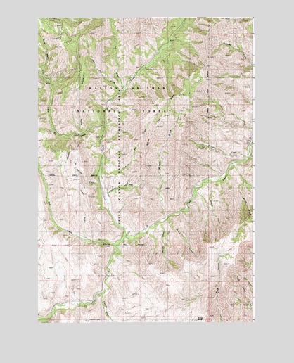
McLain Gulch, OR USGS Topographic Map
Click on map above to begin viewing in our Map Viewer.

This topographic map contains these locations and features:
Feature Name Type Latitude Longitude GNIS ID View Map
Benham CreekStreamN44.9332°W116.8954°1153054View Map
Bobcat CreekStreamN44.9179°W116.9252°1119653View Map
Fall CreekStreamN44.9704°W116.9510°1141976View Map
Fish CreekStreamN44.9082°W116.9543°1142149View Map
Fourmile CreekStreamN44.8863°W116.9629°1142370View Map
Grays GulchValleyN44.9093°W116.9718°1134827View Map
Gregg SpringSpringN44.9317°W116.9477°1134825View Map
Grouse FlatFlatN44.9754°W116.9718°1134824View Map
Holt CreekStreamN44.9338°W116.9032°1143681View Map
Little Elk CreekStreamN44.9549°W116.9632°1145159View Map
Little Fall CreekStreamN44.9688°W116.9532°1142390View Map
McCarty CreekStreamN44.9429°W116.8810°1145925View Map
McGee SpringSpringN44.8765°W116.9080°1134828View Map
McLain GulchValleyN44.9185°W116.9260°1146015View Map
Muncey CreekStreamN44.9160°W116.9304°1146371View Map
No Business CreekStreamN44.9338°W116.9641°1134826View Map
North Pine CreekStreamN44.9099°W116.9499°1147046View Map
North Pine Recreation SiteLocaleN44.9957°W116.9399°1156693View Map
North Pine Rest AreaLocaleN44.9796°W116.9407°1156472View Map
Pine CreekPopulated PlaceN44.9488°W116.8785°2053984View Map
Plummer GulchValleyN44.9277°W116.9618°1147809View Map
Sheep CreekStreamN44.9402°W116.8899°1149324View Map
Turnbull CreekStreamN44.9360°W116.9649°1153075View Map

Note: Coordinates in the location and feature list above are referenced to NAD83 datum.


Copyright (C) 2008-2025 Ryan Niemi / Sunset Dynamics ... All Rights Reserved