TopoQuest Logo
Do you find TopoQuest useful?
Help keep TopoQuest running and adding new maps/features by donating!
Bitcoin:  19c7KJd3qBynnjoSw5npx9KScwjBe4ifkT
Litecoin:  LXs6TkuXGGXo1vDsWCkWVdjQX94eUKd6ui
Home View Maps Find Maps Find Places Resources & Links


Halfway, Oregon Topographic Map

USGS Map Title: Halfway, OR
USGS Map MRC: 44117H1
DRG (GeoTIFF) Download: o44117h1.tif


Neighboring USGS Topographic Map Quads:


  Cornucopia, OR  
45117A2
 

  Deadman Point, OR  
45117A1
 

  Duck Creek, OR  
45116A8
 

  Jimtown, OR  
44117H2
 

  Halfway, OR  
44117H1
 

  McLain Gulch, OR  
44116H8
 

  Richland, OR  
44117G2
 

  Posy Valley, OR  
44117G1
 

  Brownlee Dam, OR  
44116G8


Map MRC Location:

N45°
W118°
N45°
W117°
H8 H7 H6 H5 H4 H3 H2 H1
G8 G7 G6 G5 G4 G3 G2 G1
F8 F7 F6 F5 F4 F3 F2 F1
E8 E7 E6 E5 E4 E3 E2 E1
D8 D7 D6 D5 D4 D3 D2 D1
C8 C7 C6 C5 C4 C3 C2 C1
B8 B7 B6 B5 B4 B3 B2 B1
A8 A7 A6 A5 A4 A3 A2 A1
N44°
W118°
N44°
W117°

Halfway, OR USGS 1:24K Topographic Map Preview:
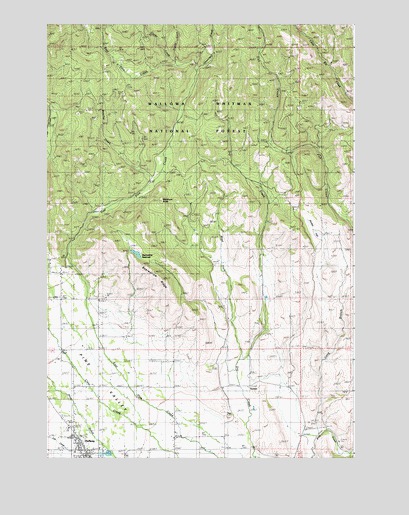
Halfway, OR USGS Topographic Map
Click on map above to begin viewing in our Map Viewer.

This topographic map contains these locations and features:
Feature Name Type Latitude Longitude GNIS ID View Map
Baker County Fairgrounds and Rodeo GroundsLocaleN44.8754°W117.1032°2700428View Map
Baker County Library Halfway Branch LibraryBuildingN44.8754°W117.1087°2700366View Map
Bearwallow GulchValleyN44.9124°W117.0913°1153066View Map
Bearwallow ReservoirReservoirN44.9338°W117.0889°1137789View Map
Bearwallow RidgeRidgeN44.9263°W117.0796°1137791View Map
Beecher CreekStreamN44.9529°W117.0846°1137881View Map
City of HalfwayCivilN44.8780°W117.1096°2410686View Map
Clarks CreekStreamN44.9879°W117.0727°1139765View Map
HalfwayPopulated PlaceN44.8807°W117.1146°1143208View Map
Halfway City HallBuildingN44.8770°W117.1080°2700427View Map
Halfway DivisionCivilN44.9589°W117.0579°1938022View Map
Halfway Elementary School (historical)SchoolN44.8811°W117.1147°2364469View Map
Halfway Oxbow Ambulance ServiceBuildingN44.8794°W117.1135°2553812View Map
Halfway Post OfficePost OfficeN44.8771°W117.1096°1165359View Map
Halfway Public Works Department OfficeBuildingN44.8770°W117.1080°2700426View Map
Halfway Sewage Treatment LagoonsLocaleN44.8763°W117.1002°2697079View Map
Heritage SquareParkN44.8769°W117.1078°2070877View Map
Hooker FlatFlatN44.9409°W117.0169°1153706View Map
Long BranchStreamN44.8821°W117.0141°1145382View Map
Mehlhorn ButteSummitN44.9488°W117.0802°1146081View Map
Mehlhorn MillBuildingN44.9471°W117.1052°1146082View Map
Okanogan CreekStreamN44.9874°W117.0663°1147175View Map
Oliver HomesteadLocaleN44.9277°W117.0385°1167215View Map
Pine Eagle ElementarySchoolN44.8828°W117.1164°2559296View Map
Pine Eagle High SchoolSchoolN44.8828°W117.1165°2364430View Map
Pine Haven CemeteryCemeteryN44.8763°W117.1052°1153055View Map
Pine Valley Community MuseumBuildingN44.8771°W117.1081°2700315View Map
Pine Valley Rural Fire Protection DistrictBuildingN44.8772°W117.1101°2576492View Map
R K Moseley DamDamN44.9325°W117.0858°1155645View Map
SunsetPopulated PlaceN44.8952°W117.0438°1150672View Map
Sunset Post Office (historical)Post OfficeN44.8952°W117.0438°1166010View Map
Trinity CreekStreamN44.9888°W117.0741°1151418View Map
Union High School (historical)SchoolN44.8785°W117.1116°1151650View Map
West Fork Dry CreekStreamN44.9015°W117.0482°1152070View Map

Note: Coordinates in the location and feature list above are referenced to NAD83 datum.


Copyright (C) 2008-2024 Ryan Niemi / Sunset Dynamics ... All Rights Reserved