TopoQuest Logo
Do you find TopoQuest useful?
Help keep TopoQuest running and adding new maps/features by donating!
Bitcoin:  19c7KJd3qBynnjoSw5npx9KScwjBe4ifkT
Litecoin:  LXs6TkuXGGXo1vDsWCkWVdjQX94eUKd6ui
Home View Maps Find Maps Find Places Resources & Links


Dugger, Indiana Topographic Map

USGS Map Title: Dugger, IN
USGS Map MRC: 39087A3
DRG (GeoTIFF) Download: o39087a3.tif


Neighboring USGS Topographic Map Quads:


  Shelburn, IN  
39087B4
 

  Hymera, IN  
39087B3
 

  Jasonville, IN  
39087B2
 

  Sullivan, IN  
39087A4
 

  Dugger, IN  
39087A3
 

  Linton, IN  
39087A2
 

  Carlisle, IN  
38087H4
 

  Bucktown, IN  
38087H3
 

  Sandborn, IN  
38087H2


Map MRC Location:

N40°
W88°
N40°
W87°
H8 H7 H6 H5 H4 H3 H2 H1
G8 G7 G6 G5 G4 G3 G2 G1
F8 F7 F6 F5 F4 F3 F2 F1
E8 E7 E6 E5 E4 E3 E2 E1
D8 D7 D6 D5 D4 D3 D2 D1
C8 C7 C6 C5 C4 C3 C2 C1
B8 B7 B6 B5 B4 B3 B2 B1
A8 A7 A6 A5 A4 A3 A2 A1
N39°
W88°
N39°
W87°

Dugger, IN USGS 1:24K Topographic Map Preview:
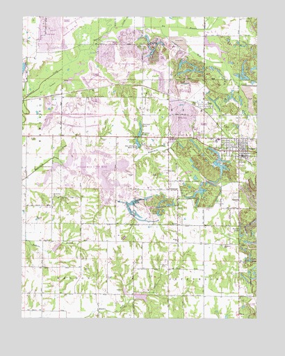
Dugger, IN USGS Topographic Map
Click on map above to begin viewing in our Map Viewer.

This topographic map contains these locations and features:
Feature Name Type Latitude Longitude GNIS ID View Map
Berea ChurchChurchN39.0762°W87.3436°430837View Map
Big BranchStreamN39.1209°W87.3228°431017View Map
Booker CemeteryCemeteryN39.0117°W87.3220°431334View Map
Brodie CemeteryCemeteryN39.0742°W87.3678°431558View Map
Busseron Dam Number B-2DamN39.0267°W87.3584°448540View Map
Caledonia (historical)Populated PlaceN39.0989°W87.3350°452893View Map
CassPopulated PlaceN39.0870°W87.2786°432215View Map
Clayton Cemeteries (historical)CemeteryN39.0509°W87.3095°452894View Map
Deckard CemeteryCemeteryN39.0603°W87.3175°433401View Map
DuggerPopulated PlaceN39.0700°W87.2614°447635View Map
Dugger - Cass Volunteer Fire DepartmentBuildingN39.0670°W87.2588°2625523View Map
Dugger CemeteryCemeteryN39.0611°W87.2586°433758View Map
Dugger Elementary SchoolSchoolN39.0742°W87.2700°447096View Map
Dugger Police DepartmentBuildingN39.0679°W87.2595°2758135View Map
Farnsworth (historical)Populated PlaceN39.0992°W87.3236°452895View Map
GambillPopulated PlaceN39.0489°W87.2597°434932View Map
Hickory ChurchChurchN39.0459°W87.2922°436097View Map
Houck CemeteryCemeteryN39.0739°W87.3328°436512View Map
JerichoPopulated PlaceN39.0614°W87.2975°436992View Map
Kettle CreekStreamN39.1209°W87.3270°437275View Map
Long ChapelChurchN39.1131°W87.3120°438257View Map
Morrison CreekStreamN39.0906°W87.3742°439458View Map
Mount Calvary ChurchChurchN39.0506°W87.3578°439530View Map
Mud CreekStreamN39.1209°W87.3025°439805View Map
Narrow LakeReservoirN39.0342°W87.2584°452467View Map
New Harmony Mine PondReservoirN39.0723°W87.3135°440056View Map
Pirtle CemeteryCemeteryN39.0220°W87.3008°441189View Map
Reservoir NorthReservoirN39.0800°W87.3120°440316View Map
Reservoir SouthReservoirN39.0768°W87.3124°443871View Map
ScotchtownPopulated PlaceN39.0750°W87.2978°443133View Map
ShilohPopulated PlaceN39.0389°W87.2925°443380View Map
Shiloh ChurchChurchN39.0325°W87.2928°443395View Map
Smith CemeteryCemeteryN39.0175°W87.3078°443667View Map
Spencer CemeteryCemeteryN39.0414°W87.3668°443936View Map
StringtownPopulated PlaceN39.0534°W87.2975°444270View Map
Sullivan County ParkParkN39.1025°W87.3742°452897View Map
T LakeLakeN39.0249°W87.2539°446876View Map
Town of DuggerCivilN39.0704°W87.2590°2396690View Map
Township of CassCivilN39.0868°W87.2934°453168View Map
Union High SchoolSchoolN39.0742°W87.2708°447097View Map
Walters CemeteryCemeteryN39.0203°W87.3417°445447View Map
Woodward CemeteryCemeteryN39.0303°W87.2678°446323View Map

Note: Coordinates in the location and feature list above are referenced to NAD83 datum.


Copyright (C) 2008-2024 Ryan Niemi / Sunset Dynamics ... All Rights Reserved