TopoQuest Logo
Do you find TopoQuest useful?
Help keep TopoQuest running and adding new maps/features by donating!
Bitcoin:  19c7KJd3qBynnjoSw5npx9KScwjBe4ifkT
Litecoin:  LXs6TkuXGGXo1vDsWCkWVdjQX94eUKd6ui
Home View Maps Find Maps Find Places Resources & Links


Linton, Indiana Topographic Map

USGS Map Title: Linton, IN
USGS Map MRC: 39087A2
DRG (GeoTIFF) Download: o39087a2.tif


Neighboring USGS Topographic Map Quads:


  Hymera, IN  
39087B3
 

  Jasonville, IN  
39087B2
 

  Coal City, IN  
39087B1
 

  Dugger, IN  
39087A3
 

  Linton, IN  
39087A2
 

  Switz City, IN  
39087A1
 

  Bucktown, IN  
38087H3
 

  Sandborn, IN  
38087H2
 

  Lyons, IN  
38087H1


Map MRC Location:

N40°
W88°
N40°
W87°
H8 H7 H6 H5 H4 H3 H2 H1
G8 G7 G6 G5 G4 G3 G2 G1
F8 F7 F6 F5 F4 F3 F2 F1
E8 E7 E6 E5 E4 E3 E2 E1
D8 D7 D6 D5 D4 D3 D2 D1
C8 C7 C6 C5 C4 C3 C2 C1
B8 B7 B6 B5 B4 B3 B2 B1
A8 A7 A6 A5 A4 A3 A2 A1
N39°
W88°
N39°
W87°

Linton, IN USGS 1:24K Topographic Map Preview:
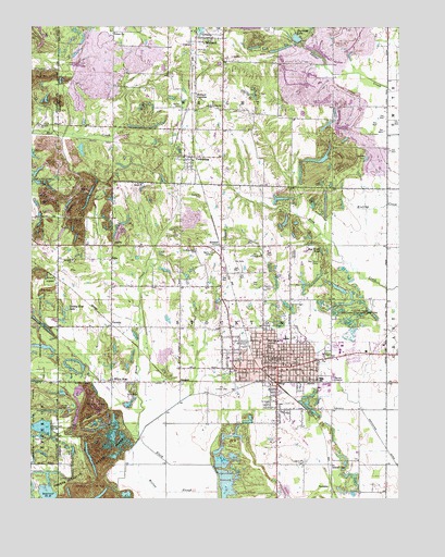
Linton, IN USGS Topographic Map
Click on map above to begin viewing in our Map Viewer.

This topographic map contains these locations and features:
Feature Name Type Latitude Longitude GNIS ID View Map
AntiochPopulated PlaceN39.0987°W87.2375°446729View Map
Antioch ChurchChurchN39.0989°W87.2472°430209View Map
Bethel CemeteryCemeteryN39.1039°W87.1995°430891View Map
Boy Scout PondLakeN39.0660°W87.1517°431419View Map
City of LintonCivilN39.0357°W87.1587°2395726View Map
Clayton CemeteryCemeteryN39.0559°W87.1681°432599View Map
County Line LakeReservoirN39.0500°W87.2378°433041View Map
EllisPopulated PlaceN39.0637°W87.2228°434104View Map
Ellis ChurchChurchN39.0678°W87.2217°434108View Map
Embury ChurchChurchN39.1237°W87.2220°434152View Map
Fairview CemeteryCemeteryN39.0650°W87.1606°434317View Map
Frye CemeteryCemeteryN39.1245°W87.1708°434885View Map
German CemeteryCemeteryN39.0509°W87.1617°435039View Map
Greene County General HospitalHospitalN39.0408°W87.1303°2660442View Map
Hale CemeteryCemeteryN39.0159°W87.2453°435599View Map
Harmons LakeReservoirN39.1220°W87.1603°435745View Map
Historical Marker USA Center of PopulationParkN39.0487°W87.1381°436247View Map
HoosierPopulated PlaceN39.0667°W87.1858°436413View Map
Humphrey ParkParkN39.0392°W87.1492°436606View Map
Island CityPopulated PlaceN39.0092°W87.1478°436848View Map
Island City CemeteryCemeteryN39.0098°W87.1567°436849View Map
LintonPopulated PlaceN39.0348°W87.1658°437969View Map
Linton Fire DepartmentBuildingN39.0352°W87.1685°2625821View Map
Linton Police DepartmentBuildingN39.0352°W87.1680°2758126View Map
Linton-Stockton High SchoolSchoolN39.0425°W87.1639°446969View Map
Linton-Stockton Junior High SchoolSchoolN39.0417°W87.1639°446968View Map
MidlandPopulated PlaceN39.1220°W87.1917°439120View Map
Midland JunctionPopulated PlaceN39.1073°W87.1945°439121View Map
Morris ChapelChurchN39.0242°W87.2375°439448View Map
Old Linton CemeteryCemeteryN39.0281°W87.1850°440577View Map
Olive Branch ChurchChurchN39.0653°W87.1942°440641View Map
Reservoir Number Twenty-nineReservoirN39.0015°W87.2446°441908View Map
Reservoir Number Twenty-sixReservoirN39.0189°W87.2463°441907View Map
Richards CemeteryCemeteryN39.0800°W87.1925°441950View Map
Salem ChurchChurchN39.0837°W87.2139°442907View Map
Samaria ChurchChurchN39.0631°W87.2364°442948View Map
SponslerPopulated PlaceN39.0037°W87.1417°446873View Map
Summersville ChurchChurchN39.1042°W87.1900°444389View Map
SummitPopulated PlaceN39.0312°W87.1995°444390View Map
Sunflower PondReservoirN39.0702°W87.2402°452494View Map
Terhune CemeteryCemeteryN39.0903°W87.1364°444645View Map
Township of StocktonCivilN39.0389°W87.1853°453876View Map
VicksburgPopulated PlaceN39.0906°W87.1981°445273View Map
VictoriaPopulated PlaceN39.0464°W87.2228°445276View Map
WBTO-AM (Linton)TowerN39.0659°W87.1886°448462View Map
White RosePopulated PlaceN39.0312°W87.2228°445963View Map
Willow SloughStreamN39.0020°W87.1867°446110View Map
WQTY-FM (Linton)TowerN39.0659°W87.1886°448948View Map
Wright Township Volunteer Fire DepartmentBuildingN39.1232°W87.1842°2626252View Map

Note: Coordinates in the location and feature list above are referenced to NAD83 datum.


Copyright (C) 2008-2025 Ryan Niemi / Sunset Dynamics ... All Rights Reserved