TopoQuest Logo
Do you find TopoQuest useful?
Help keep TopoQuest running and adding new maps/features by donating!
Bitcoin:  19c7KJd3qBynnjoSw5npx9KScwjBe4ifkT
Litecoin:  LXs6TkuXGGXo1vDsWCkWVdjQX94eUKd6ui
Home View Maps Find Maps Find Places Resources & Links


Dunkleberg Creek, Montana Topographic Map

USGS Map Title: Dunkleberg Creek, MT
USGS Map MRC: 46113E1
DRG (GeoTIFF) Download: o46113e1.tif


Neighboring USGS Topographic Map Quads:


  Drummond, MT  
46113F2
 

  Limestone Ridge, MT  
46113F1
 

  Bailey Mountain, MT  
46112F8
 

  Hall, MT  
46113E2
 

  Dunkleberg Creek, MT  
46113E1
 

  Griffin Creek, MT  
46112E8
 

  Maxville, MT  
46113D2
 

  Pikes Peak, MT  
46113D1
 

  Rock Creek Lake, MT  
46112D8


Map MRC Location:

N47°
W114°
N47°
W113°
H8 H7 H6 H5 H4 H3 H2 H1
G8 G7 G6 G5 G4 G3 G2 G1
F8 F7 F6 F5 F4 F3 F2 F1
E8 E7 E6 E5 E4 E3 E2 E1
D8 D7 D6 D5 D4 D3 D2 D1
C8 C7 C6 C5 C4 C3 C2 C1
B8 B7 B6 B5 B4 B3 B2 B1
A8 A7 A6 A5 A4 A3 A2 A1
N46°
W114°
N46°
W113°

Dunkleberg Creek, MT USGS 1:24K Topographic Map Preview:
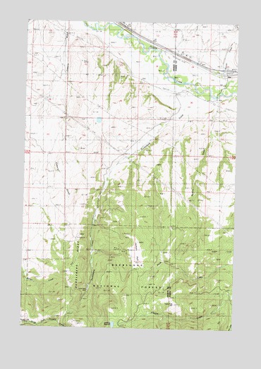
Dunkleberg Creek, MT USGS Topographic Map
Click on map above to begin viewing in our Map Viewer.

This topographic map contains these locations and features:
Feature Name Type Latitude Longitude GNIS ID View Map
09N12W04BABB01 WellWellN46.5705°W113.1170°816869View Map
10N11W19ACAC01 WellWellN46.6099°W113.0251°817101View Map
10N11W19BBBA01 WellWellN46.6144°W113.0362°817129View Map
10N11W20CACA01 WellWellN46.6055°W113.0098°817080View Map
10N11W20CADA01 WellWellN46.6049°W113.0078°817076View Map
Bert CreekStreamN46.6241°W113.0748°779732View Map
Coberly GulchValleyN46.6224°W113.1020°781465View Map
Douglas Creek CabinLocaleN46.5016°W113.1214°782513View Map
Dunkleberg CreekStreamN46.6016°W113.0414°782703View Map
Dunkleberg Post Office (historical)Post OfficeN46.5485°W113.1064°1781815View Map
Dunkleberg RidgeRidgeN46.5310°W113.0923°782704View Map
Forest Rose MineMineN46.5155°W113.0873°783604View Map
Goldberg East DamDamN46.5016°W113.0709°795460View Map
Goldberg ReservoirReservoirN46.5014°W113.0714°784072View Map
Goldberg West DamDamN46.5016°W113.0726°795979View Map
Haskell (historical)Populated PlaceN46.6130°W113.0442°784609View Map
Hoover CreekStreamN46.5988°W113.0073°784993View Map
Interchange 162CrossingN46.6060°W113.0070°1803443View Map
Jackson ParkParkN46.5308°W113.0570°785399View Map
Jackson Park MineMineN46.5305°W113.0573°803033View Map
JensLocaleN46.6041°W113.0062°1803388View Map
JensPopulated PlaceN46.6041°W113.0062°785459View Map
Jens Post Office (historical)Post OfficeN46.6041°W113.0062°1803387View Map
Jens School (historical)SchoolN46.6041°W113.0062°1803389View Map
Lone Tree HillSummitN46.5097°W113.0356°786495View Map
Perkins CreekStreamN46.5955°W113.0159°788654View Map
Randalls (historical)LocaleN46.6041°W113.0037°1803371View Map
SE Section 14 MineMineN46.5305°W113.0689°803127View Map
SE Section 15 MineMineN46.5310°W113.0792°803124View Map
SW Section 14 MineMineN46.5277°W113.0703°803125View Map

Note: Coordinates in the location and feature list above are referenced to NAD83 datum.


Copyright (C) 2008-2024 Ryan Niemi / Sunset Dynamics ... All Rights Reserved