TopoQuest Logo
Do you find TopoQuest useful?
Help keep TopoQuest running and adding new maps/features by donating!
Bitcoin:  19c7KJd3qBynnjoSw5npx9KScwjBe4ifkT
Litecoin:  LXs6TkuXGGXo1vDsWCkWVdjQX94eUKd6ui
Home View Maps Find Maps Find Places Resources & Links


Griffin Creek, Montana Topographic Map

USGS Map Title: Griffin Creek, MT
USGS Map MRC: 46112E8
DRG (GeoTIFF) Download: o46112e8.tif


Neighboring USGS Topographic Map Quads:


  Limestone Ridge, MT  
46113F1
 

  Bailey Mountain, MT  
46112F8
 

  Windy Rock, MT  
46112F7
 

  Dunkleberg Creek, MT  
46113E1
 

  Griffin Creek, MT  
46112E8
 

  Garrison, MT  
46112E7
 

  Pikes Peak, MT  
46113D1
 

  Rock Creek Lake, MT  
46112D8
 

  Conleys Lake, MT  
46112D7


Map MRC Location:

N47°
W113°
N47°
W112°
H8 H7 H6 H5 H4 H3 H2 H1
G8 G7 G6 G5 G4 G3 G2 G1
F8 F7 F6 F5 F4 F3 F2 F1
E8 E7 E6 E5 E4 E3 E2 E1
D8 D7 D6 D5 D4 D3 D2 D1
C8 C7 C6 C5 C4 C3 C2 C1
B8 B7 B6 B5 B4 B3 B2 B1
A8 A7 A6 A5 A4 A3 A2 A1
N46°
W113°
N46°
W112°

Griffin Creek, MT USGS 1:24K Topographic Map Preview:
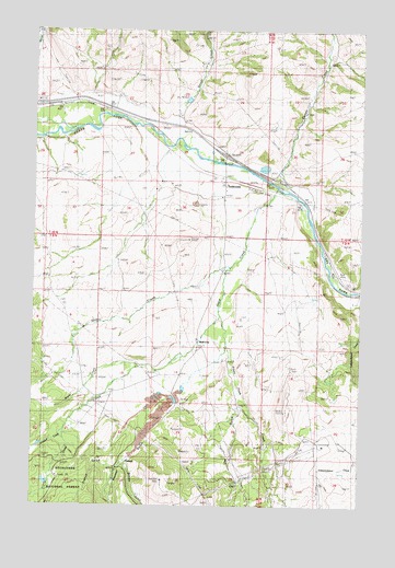
Griffin Creek, MT USGS Topographic Map
Click on map above to begin viewing in our Map Viewer.

This topographic map contains these locations and features:
Feature Name Type Latitude Longitude GNIS ID View Map
09N10W05CBA_01 WellWellN46.5558°W112.8856°816804View Map
09N10W08ABDB01 WellWellN46.5541°W112.8775°816790View Map
09N10W08ABDB02 WellWellN46.5538°W112.8784°816789View Map
09N10W08ABDB03 WellWellN46.5544°W112.8773°816793View Map
09N11W01BCAC01 WellWellN46.5663°W112.9289°816852View Map
09N11W01CABB01 WellWellN46.5627°W112.9281°816837View Map
09N11W11DCDA01 WellWellN46.5435°W112.9392°816740View Map
09N11W13BAAC01 WellWellN46.5402°W112.9256°816723View Map
09N11W15DAAC01 WellWellN46.5330°W112.9676°816698View Map
09N11W16ADCC01 WellWellN46.5352°W112.9814°816709View Map
09N11W16DDCD01 WellWellN46.5274°W112.9792°816675View Map
09N11W21ACCC01 WellWellN46.5208°W112.9853°816634View Map
10N10W19DCCC01 WellWellN46.6002°W112.9012°817051View Map
10N10W30CCD_01 WellWellN46.5860°W112.9128°816939View Map
10N10W31ADCA01 WellWellN46.5791°W112.8942°816906View Map
10N10W31BABA02 WellWellN46.5847°W112.9050°816925View Map
10N11W20DAAD01 WellWellN46.6063°W112.9970°817083View Map
10N11W21CDBC01 WellWellN46.6027°W112.9906°817062View Map
10N11W22BCDD01 WellWellN46.6080°W112.9701°817092View Map
10N11W22BDCD01 SpringSpringN46.6083°W112.9684°817093View Map
10N11W23CADC01 WellWellN46.6038°W112.9462°817070View Map
10N11W25CBAC01 WellWellN46.5908°W112.9298°816974View Map
10N11W25CCDD01 WellWellN46.5863°W112.9289°816943View Map
10N11W35BBBC01 WellWellN46.5835°W112.9537°816920View Map
10N11W36ACDD01 WellWellN46.5777°W112.9187°816899View Map
10N11W36BABB01 WellWellN46.5847°W112.9275°816926View Map
10N11W36BBAA01 WellWellN46.5847°W112.9289°816927View Map
10N11W36BCAD01 WellWellN46.5802°W112.9281°816909View Map
Anderson DamDamN46.6216°W112.9909°796510View Map
Big Bend (historical)LocaleN46.5560°W112.8806°1803432View Map
Blum CreekStreamN46.5360°W112.9603°780175View Map
Carten CreekStreamN46.5891°W112.9231°780978View Map
Crevice CreekStreamN46.5216°W112.9876°781891View Map
Dixie (historical)LocaleN46.5122°W112.9662°1803412View Map
Dry GulchValleyN46.5277°W112.9225°782633View Map
DuttonPopulated PlaceN46.6030°W112.9473°794145View Map
French GulchValleyN46.5097°W112.9684°783739View Map
Gold CreekStreamN46.5835°W112.9084°784045View Map
Gold CreekLocaleN46.5866°W112.9287°1803398View Map
Gold Creek AirportAirportN46.5170°W112.9768°2650685View Map
Gold Creek Elementary SchoolSchoolN46.5805°W112.9281°1803320View Map
Gold Creek Post OfficePost OfficeN46.5851°W112.9285°1803397View Map
GoldcreekPopulated PlaceN46.5866°W112.9287°784073View Map
Gough CreekStreamN46.5985°W112.9495°784135View Map
Grant MineMineN46.5263°W112.9773°803438View Map
Griffin CreekStreamN46.5630°W112.9262°784333View Map
Interchange 166CrossingN46.5924°W112.9284°1803448View Map
LingenpolterPopulated PlaceN46.5327°W112.9676°794139View Map
Lloyd (historical)LocaleN46.5555°W112.8753°1803383View Map
Pikes Peak (historical)LocaleN46.5027°W112.9092°1803374View Map
Pikes Peak CreekStreamN46.5494°W112.9298°788856View Map
Pikes Peak Post Office (historical)Post OfficeN46.5027°W112.9092°1803375View Map
PioneerPopulated PlaceN46.5124°W112.9662°788930View Map
Pioneer GulchValleyN46.5272°W112.9481°788933View Map
Pioneer Post Office (historical)Post OfficeN46.5124°W112.9662°1803400View Map
Pioneer School (historical)SchoolN46.5124°W112.9662°1803399View Map
Placer MineMineN46.5552°W112.9145°794141View Map
Placer MinesMineN46.5180°W112.9314°794140View Map
Saint Mary MissionChurchN46.5813°W112.9295°1803293View Map
Sin-pul-stu-weh GulchValleyN46.5110°W112.9651°791382View Map
Wall CityPopulated PlaceN46.5438°W112.9387°792768View Map
Yamhill (historical)LocaleN46.5005°W112.9509°1803356View Map

Note: Coordinates in the location and feature list above are referenced to NAD83 datum.


Copyright (C) 2008-2025 Ryan Niemi / Sunset Dynamics ... All Rights Reserved