TopoQuest Logo
Do you find TopoQuest useful?
Help keep TopoQuest running and adding new maps/features by donating!
Bitcoin:  19c7KJd3qBynnjoSw5npx9KScwjBe4ifkT
Litecoin:  LXs6TkuXGGXo1vDsWCkWVdjQX94eUKd6ui
Home View Maps Find Maps Find Places Resources & Links


Dunn, Louisiana Topographic Map

USGS Map Title: Dunn, LA
USGS Map MRC: 32091D5
DRG (GeoTIFF) Download: o32091d5.tif


Neighboring USGS Topographic Map Quads:


  Whitney Island South, LA  
32091E6
 

  Congo Creek, LA  
32091E5
 

  Epps, LA  
32091E4
 

  Bee Bayou, LA  
32091D6
 

  Dunn, LA  
32091D5
 

  Delhi, LA  
32091D4
 

  Baskinton, LA  
32091C6
 

  Lamar, LA  
32091C5
 

  Indian Lake, LA  
32091C4


Map MRC Location:

N33°
W92°
N33°
W91°
H8 H7 H6 H5 H4 H3 H2 H1
G8 G7 G6 G5 G4 G3 G2 G1
F8 F7 F6 F5 F4 F3 F2 F1
E8 E7 E6 E5 E4 E3 E2 E1
D8 D7 D6 D5 D4 D3 D2 D1
C8 C7 C6 C5 C4 C3 C2 C1
B8 B7 B6 B5 B4 B3 B2 B1
A8 A7 A6 A5 A4 A3 A2 A1
N32°
W92°
N32°
W91°

Dunn, LA USGS 1:24K Topographic Map Preview:
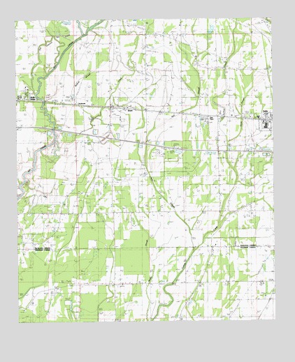
Dunn, LA USGS Topographic Map
Click on map above to begin viewing in our Map Viewer.

This topographic map contains these locations and features:
Feature Name Type Latitude Longitude GNIS ID View Map
Ash SloughLakeN32.4223°W91.5501°532230View Map
Congo CreekStreamN32.4940°W91.5643°534080View Map
Delhi Refining CompanyLocaleN32.4582°W91.5323°558762View Map
DunnPopulated PlaceN32.4643°W91.5785°543156View Map
Dunn Post OfficePost OfficeN32.4632°W91.5790°1630726View Map
Fellowship ChurchChurchN32.4235°W91.5123°534924View Map
Glade SloughStreamN32.4490°W91.5218°535244View Map
Good Hope ChurchChurchN32.4718°W91.5012°535272View Map
Green Grove ChurchChurchN32.4796°W91.5260°535386View Map
Harmony Baptist ChurchChurchN32.3921°W91.5518°554663View Map
Interchange 148CrossingN32.4513°W91.5815°541502View Map
KKRP-FM (Delhi)TowerN32.4626°W91.5537°1633052View Map
Little CreekStreamN32.4468°W91.6132°536533View Map
Mount Oliver ChurchChurchN32.4282°W91.5268°537372View Map
Muddy SloughGutN32.3871°W91.5623°537484View Map
Newton CemeteryCemeteryN32.4935°W91.5451°537671View Map
Old Channel Big CreekStreamN32.4701°W91.6154°537826View Map
Parish Governing Authority District 2CivilN32.4350°W91.5389°1929909View Map
Robinson ChurchChurchN32.4210°W91.6029°538652View Map
SacksoniaPopulated PlaceN32.4665°W91.6021°543634View Map
Sacksonia Gas FieldOilfieldN32.4713°W91.6176°548692View Map
Saint John ChurchChurchN32.4207°W91.5176°538883View Map
Southwest Delhi Oil FieldOilfieldN32.3860°W91.6073°556103View Map
Sun SpurLocaleN32.4596°W91.5321°541258View Map
Union Valley ChurchChurchN32.3876°W91.5390°540113View Map
Ward OneCivilN32.4721°W91.5160°545187View Map
Ward One Fire Department Cook StationBuildingN32.4347°W91.5157°2672966View Map
West Delhi Oil and Gas FieldOilfieldN32.4143°W91.6107°540310View Map
Wildcat SloughStreamN32.4599°W91.5868°540405View Map

Note: Coordinates in the location and feature list above are referenced to NAD83 datum.


Copyright (C) 2008-2025 Ryan Niemi / Sunset Dynamics ... All Rights Reserved