TopoQuest Logo
Do you find TopoQuest useful?
Help keep TopoQuest running and adding new maps/features by donating!
Bitcoin:  19c7KJd3qBynnjoSw5npx9KScwjBe4ifkT
Litecoin:  LXs6TkuXGGXo1vDsWCkWVdjQX94eUKd6ui
Home View Maps Find Maps Find Places Resources & Links


Indian Lake, Louisiana Topographic Map

USGS Map Title: Indian Lake, LA
USGS Map MRC: 32091C4
DRG (GeoTIFF) Download: o32091c4.tif


Neighboring USGS Topographic Map Quads:


  Dunn, LA  
32091D5
 

  Delhi, LA  
32091D4
 

  Tendal, LA  
32091D3
 

  Lamar, LA  
32091C5
 

  Indian Lake, LA  
32091C4
 

  Waverly SE, LA  
32091C3
 

  Crowville, LA  
32091B5
 

  Tensas Bluff, LA  
32091B4
 

  Westwood, LA  
32091B3


Map MRC Location:

N33°
W92°
N33°
W91°
H8 H7 H6 H5 H4 H3 H2 H1
G8 G7 G6 G5 G4 G3 G2 G1
F8 F7 F6 F5 F4 F3 F2 F1
E8 E7 E6 E5 E4 E3 E2 E1
D8 D7 D6 D5 D4 D3 D2 D1
C8 C7 C6 C5 C4 C3 C2 C1
B8 B7 B6 B5 B4 B3 B2 B1
A8 A7 A6 A5 A4 A3 A2 A1
N32°
W92°
N32°
W91°

Indian Lake, LA USGS 1:24K Topographic Map Preview:
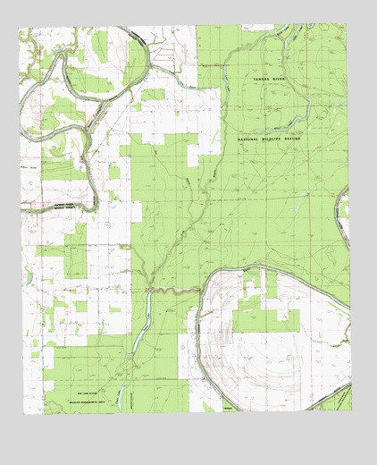
Indian Lake, LA USGS Topographic Map
Click on map above to begin viewing in our Map Viewer.

This topographic map contains these locations and features:
Feature Name Type Latitude Longitude GNIS ID View Map
Africa LakeLakeN32.3402°W91.4052°553265View Map
Bakers Cut-offChannelN32.3463°W91.4701°541300View Map
Buck LakeLakeN32.3738°W91.3988°553822View Map
Butler LandingLakeN32.3673°W91.4853°533591View Map
Chain LakeLakeN32.2552°W91.4632°553944View Map
Dry BayouGutN32.3318°W91.4476°534590View Map
Indian LakeLakeN32.2773°W91.4536°554826View Map
Jackson LandingPopulated PlaceN32.3485°W91.4998°543337View Map
Lick BayouGutN32.3246°W91.4273°536433View Map
Little Fork BayouLakeN32.3560°W91.4383°536548View Map
Lost LakeLakeN32.3572°W91.4213°555172View Map
Low Water BridgeBridgeN32.2807°W91.4332°536760View Map

Note: Coordinates in the location and feature list above are referenced to NAD83 datum.


Copyright (C) 2008-2025 Ryan Niemi / Sunset Dynamics ... All Rights Reserved