TopoQuest Logo
Do you find TopoQuest useful?
Help keep TopoQuest running and adding new maps/features by donating!
Bitcoin:  19c7KJd3qBynnjoSw5npx9KScwjBe4ifkT
Litecoin:  LXs6TkuXGGXo1vDsWCkWVdjQX94eUKd6ui
Home View Maps Find Maps Find Places Resources & Links


Dunn Mountain, Washington Topographic Map

USGS Map Title: Dunn Mountain, WA
USGS Map MRC: 48117C8
DRG (GeoTIFF) Download: o48117c8.tif


Neighboring USGS Topographic Map Quads:


  Kentry Ridge, WA  
48118D1
 

  Arden, WA  
48117D8
 

  Addy Mountain, WA  
48117D7
 

  Wellington Peak, WA  
48118C1
 

  Dunn Mountain, WA  
48117C8
 

  Addy, WA  
48117C7
 

  Blackhorse Canyon, WA  
48118B1
 

  Stensgar Mountain, WA  
48117B8
 

  Waitts Lake, WA  
48117B7


Map MRC Location:

N49°
W118°
N49°
W117°
H8 H7 H6 H5 H4 H3 H2 H1
G8 G7 G6 G5 G4 G3 G2 G1
F8 F7 F6 F5 F4 F3 F2 F1
E8 E7 E6 E5 E4 E3 E2 E1
D8 D7 D6 D5 D4 D3 D2 D1
C8 C7 C6 C5 C4 C3 C2 C1
B8 B7 B6 B5 B4 B3 B2 B1
A8 A7 A6 A5 A4 A3 A2 A1
N48°
W118°
N48°
W117°

Dunn Mountain, WA USGS 1:24K Topographic Map Preview:
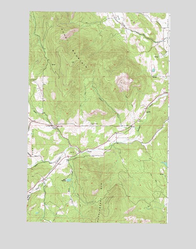
Dunn Mountain, WA USGS Topographic Map
Click on map above to begin viewing in our Map Viewer.

This topographic map contains these locations and features:
Feature Name Type Latitude Longitude GNIS ID View Map
Cassner CreekStreamN48.3063°W117.9022°1517462View Map
DunnLocaleN48.3077°W117.9783°1530518View Map
Dunn CreekStreamN48.2946°W117.9614°1519014View Map
Dunn MountainSummitN48.3449°W117.9611°1519016View Map
Klein CreekStreamN48.2918°W117.9525°1521720View Map
Miller ReservoirReservoirN48.2752°W117.9634°1523191View Map
Miller Reservoir DamDamN48.2749°W117.9611°1531995View Map
Schmidt (historical)Populated PlaceN48.2735°W117.9858°1530576View Map
Smith CreekStreamN48.2866°W117.9739°1525973View Map
Summit Valley CemeteryCemeteryN48.3089°W117.9431°1526730View Map
Summit Valley Community ChurchChurchN48.3073°W117.9786°2609217View Map
Summit Valley SchoolSchoolN48.3069°W117.9764°1531145View Map
Sunnyside SchoolSchoolN48.3160°W117.8955°1526753View Map
Swiss ValleyValleyN48.3580°W117.8839°1526872View Map
Tango Ranch Airport (historical)AirportN48.3443°W117.8872°1533655View Map
West Side SchoolSchoolN48.3555°W117.8800°1528001View Map
Westside SchoolSchoolN48.3555°W117.8800°1530383View Map
Westside SchoolSchoolN48.3555°W117.8800°1534069View Map

Note: Coordinates in the location and feature list above are referenced to NAD83 datum.


Copyright (C) 2008-2024 Ryan Niemi / Sunset Dynamics ... All Rights Reserved