TopoQuest Logo
Do you find TopoQuest useful?
Help keep TopoQuest running and adding new maps/features by donating!
Bitcoin:  19c7KJd3qBynnjoSw5npx9KScwjBe4ifkT
Litecoin:  LXs6TkuXGGXo1vDsWCkWVdjQX94eUKd6ui
Home View Maps Find Maps Find Places Resources & Links


Kentry Ridge, Washington Topographic Map

USGS Map Title: Kentry Ridge, WA
USGS Map MRC: 48118D1
DRG (GeoTIFF) Download: o48118d1.tif


Neighboring USGS Topographic Map Quads:


  Bangs Mountain, WA  
48118E2
 

  Kettle Falls, WA  
48118E1
 

  Colville, WA  
48117E8
 

  Rice, WA  
48118D2
 

  Kentry Ridge, WA  
48118D1
 

  Arden, WA  
48117D8
 

  Inchelium, WA  
48118C2
 

  Wellington Peak, WA  
48118C1
 

  Dunn Mountain, WA  
48117C8


Map MRC Location:

N49°
W119°
N49°
W118°
H8 H7 H6 H5 H4 H3 H2 H1
G8 G7 G6 G5 G4 G3 G2 G1
F8 F7 F6 F5 F4 F3 F2 F1
E8 E7 E6 E5 E4 E3 E2 E1
D8 D7 D6 D5 D4 D3 D2 D1
C8 C7 C6 C5 C4 C3 C2 C1
B8 B7 B6 B5 B4 B3 B2 B1
A8 A7 A6 A5 A4 A3 A2 A1
N48°
W119°
N48°
W118°

Kentry Ridge, WA USGS 1:24K Topographic Map Preview:
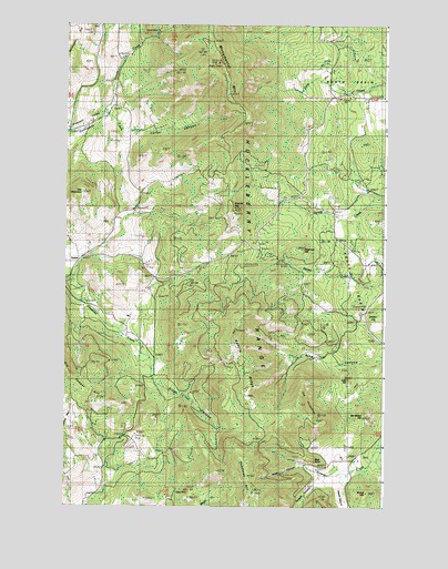
Kentry Ridge, WA USGS Topographic Map
Click on map above to begin viewing in our Map Viewer.

This topographic map contains these locations and features:
Feature Name Type Latitude Longitude GNIS ID View Map
Aquila MineMineN48.4985°W118.0864°1515936View Map
ArzinaPopulated PlaceN48.4399°W118.1186°1531405View Map
Blue PointCliffN48.3882°W118.0294°1516711View Map
Brazel HillSummitN48.3785°W118.0072°1516926View Map
Carter CanyonValleyN48.4724°W118.0989°1517429View Map
Daisy MineMineN48.3793°W118.0797°1518456View Map
Day MountainSummitN48.4566°W118.1167°1518520View Map
Deadman HillSummitN48.3793°W118.0514°1518548View Map
Erickson Ranch Airport (historical)AirportN48.3924°W118.0986°1533719View Map
Eslick CanyonValleyN48.3866°W118.0325°1519379View Map
Freeman HillSummitN48.4418°W118.0333°1519780View Map
Granite MountainSummitN48.4518°W118.0589°1520229View Map
Hawks CanyonValleyN48.3782°W118.0161°1520614View Map
Heidegger HillSummitN48.4985°W118.1164°1520674View Map
Holden HillSummitN48.4277°W118.0097°1520855View Map
Huckleberry RangeRangeN48.4743°W118.0542°1521035View Map
Kentry RidgeRidgeN48.4052°W118.0533°1521624View Map
King CanyonValleyN48.4130°W118.0050°1521677View Map
Kings CanyonValleyN48.4063°W118.0858°1521692View Map
Lake HillSummitN48.4085°W118.0141°1521851View Map
McMillan HillSummitN48.3980°W118.0119°1522932View Map
Monumental MountainSummitN48.4905°W118.0650°1523339View Map
Old Copper HillSummitN48.4021°W118.1097°1523996View Map
Pleasant Valley SchoolSchoolN48.4735°W118.1139°1524511View Map
Sawyer CreekStreamN48.4766°W118.1097°1525466View Map
South BasinBasinN48.4310°W118.0097°1526132View Map
The HorseshoeSummitN48.4007°W118.0342°1527038View Map
Twilight CanyonValleyN48.3813°W118.0264°1527516View Map

Note: Coordinates in the location and feature list above are referenced to NAD83 datum.


Copyright (C) 2008-2025 Ryan Niemi / Sunset Dynamics ... All Rights Reserved