TopoQuest Logo
Do you find TopoQuest useful?
Help keep TopoQuest running and adding new maps/features by donating!
Bitcoin:  19c7KJd3qBynnjoSw5npx9KScwjBe4ifkT
Litecoin:  LXs6TkuXGGXo1vDsWCkWVdjQX94eUKd6ui
Home View Maps Find Maps Find Places Resources & Links


Ararat, Alabama Topographic Map

USGS Map Title: Ararat, AL
USGS Map MRC: 31088H2
DRG (GeoTIFF) Download: o31088h2.tif


Neighboring USGS Topographic Map Quads:


  Land, AL  
32088A3
 

  Butler, AL  
32088A2
 

  Putnam, AL  
32088A1
 

  Toxey, AL  
31088H3
 

  Ararat, AL  
31088H2
 

  Woods Bluff, AL  
31088H1
 

  Silas, AL  
31088G3
 

  Coffeeville Lock And Dam, AL  
31088G2
 

  Coffeeville, AL  
31088G1


Map MRC Location:

N32°
W89°
N32°
W88°
H8 H7 H6 H5 H4 H3 H2 H1
G8 G7 G6 G5 G4 G3 G2 G1
F8 F7 F6 F5 F4 F3 F2 F1
E8 E7 E6 E5 E4 E3 E2 E1
D8 D7 D6 D5 D4 D3 D2 D1
C8 C7 C6 C5 C4 C3 C2 C1
B8 B7 B6 B5 B4 B3 B2 B1
A8 A7 A6 A5 A4 A3 A2 A1
N31°
W89°
N31°
W88°

Ararat, AL USGS 1:24K Topographic Map Preview:
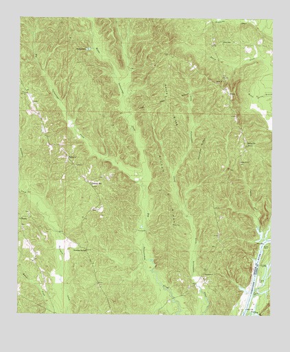
Ararat, AL USGS Topographic Map
Click on map above to begin viewing in our Map Viewer.

This topographic map contains these locations and features:
Feature Name Type Latitude Longitude GNIS ID View Map
AraratPopulated PlaceN31.9682°W88.1467°113195View Map
Bucey BluffCliffN31.8957°W88.1350°139958View Map
Campground BranchStreamN31.9540°W88.2445°139971View Map
Chappell Hill Oil FieldOilfieldN31.8974°W88.2489°151155View Map
Chatman RidgeRidgeN31.9432°W88.1600°115981View Map
CopassawLocaleN31.9293°W88.1292°139988View Map
Copper Salt CreekStreamN31.9071°W88.1281°116612View Map
Corinth Baptist ChurchChurchN31.9732°W88.1528°116633View Map
Ferrell Landing (historical)LocaleN31.9077°W88.1317°140000View Map
Gibson Mill (historical)LocaleN31.9676°W88.2339°140004View Map
Horne RidgeRidgeN31.9632°W88.1758°120399View Map
I Martin Landing (historical)LocaleN31.8946°W88.1339°140026View Map
J Martin Landing (historical)LocaleN31.9007°W88.1320°140028View Map
Liberty Church (historical)ChurchN31.9038°W88.2164°140037View Map
Little CemeteryCemeteryN31.8757°W88.1775°154712View Map
LouPopulated PlaceN31.9190°W88.2111°156630View Map
Middle Tallawampa CreekStreamN31.9318°W88.1897°152311View Map
Morgan BluffCliffN31.9043°W88.1328°140061View Map
Mosleys LakeLakeN31.9869°W88.2163°123111View Map
Pleasant HillPopulated PlaceN31.9302°W88.2145°152987View Map
Pleasant Hill Baptist ChurchChurchN31.9318°W88.2172°140091View Map
Pleasant Hill CemeteryCemeteryN31.9313°W88.2164°1805533View Map
Pleasant Hill United Methodist ChurchChurchN31.9307°W88.2161°140092View Map
Pleasant Hill Volunteer Fire DepartmentBuildingN31.9503°W88.2367°2691283View Map
Rock Hill BranchStreamN31.8982°W88.1325°140107View Map
Scruggs LandingLocaleN31.8965°W88.1306°157033View Map
Sisters ChapelChurchN31.9902°W88.1497°140126View Map
Slater Christian Methodist Episcopal ChurchChurchN31.9896°W88.1500°153466View Map
Spring HillPopulated PlaceN31.9471°W88.1372°127236View Map
Spring Hill ChurchChurchN31.9399°W88.1406°127253View Map
Stafford Congregational Methodist ChurchChurchN31.9407°W88.2256°153551View Map
Strafford School (historical)SchoolN31.9318°W88.2175°165617View Map
Tailawampa ChurchChurchN31.8924°W88.1583°127632View Map
Tallawampa Baptist ChurchChurchN31.8924°W88.1581°140137View Map
Tallawampa School (historical)SchoolN31.8915°W88.1583°140138View Map
Thornton SpringsPopulated PlaceN31.9021°W88.2161°157153View Map
Turkey CreekStreamN31.8754°W88.1372°128153View Map
Turkey PointCapeN31.9038°W88.1289°128176View Map
Wilson CemeteryCemeteryN31.9129°W88.1742°129070View Map
Wilson RidgeRidgeN31.9263°W88.1783°129097View Map
Wimberly Methodist Protestant ChurchChurchN31.9157°W88.2445°140159View Map
Wimberly Oil FieldOilfieldN31.8949°W88.2283°166984View Map
WimblyPopulated PlaceN31.9152°W88.2484°157268View Map

Note: Coordinates in the location and feature list above are referenced to NAD83 datum.


Copyright (C) 2008-2025 Ryan Niemi / Sunset Dynamics ... All Rights Reserved