TopoQuest Logo
Do you find TopoQuest useful?
Help keep TopoQuest running and adding new maps/features by donating!
Bitcoin:  19c7KJd3qBynnjoSw5npx9KScwjBe4ifkT
Litecoin:  LXs6TkuXGGXo1vDsWCkWVdjQX94eUKd6ui
Home View Maps Find Maps Find Places Resources & Links


Eagle Peak, New Mexico Topographic Map

USGS Map Title: Eagle Peak, NM
USGS Map MRC: 33108F5
DRG (GeoTIFF) Download: o33108f5.tif


Neighboring USGS Topographic Map Quads:


  Cruzville, NM  
33108G6
 

  Squirrel Springs Canyon, NM  
33108G5
 

  John Kerr Peak, NM  
33108G4
 

  Milligan Mountain, NM  
33108F6
 

  Eagle Peak, NM  
33108F5
 

  Collins Park, NM  
33108F4
 

  Sign Camp Mountain, NM  
33108E6
 

  Telephone Canyon, NM  
33108E5
 

  Pitchfork Canyon, NM  
33108E4


Map MRC Location:

N34°
W109°
N34°
W108°
H8 H7 H6 H5 H4 H3 H2 H1
G8 G7 G6 G5 G4 G3 G2 G1
F8 F7 F6 F5 F4 F3 F2 F1
E8 E7 E6 E5 E4 E3 E2 E1
D8 D7 D6 D5 D4 D3 D2 D1
C8 C7 C6 C5 C4 C3 C2 C1
B8 B7 B6 B5 B4 B3 B2 B1
A8 A7 A6 A5 A4 A3 A2 A1
N33°
W109°
N33°
W108°

Eagle Peak, NM USGS 1:24K Topographic Map Preview:
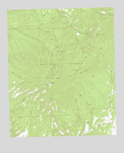
Eagle Peak, NM USGS Topographic Map
Click on map above to begin viewing in our Map Viewer.

This topographic map contains these locations and features:
Feature Name Type Latitude Longitude GNIS ID View Map
Barrel CanyonValleyN33.6353°W108.5226°903583View Map
Bear CanyonValleyN33.7317°W108.5495°903637View Map
Bear Canyon TankReservoirN33.7237°W108.5193°903646View Map
Black Burro CanyonValleyN33.6298°W108.5312°903851View Map
Black Burro TankReservoirN33.6379°W108.5351°903852View Map
Black Horse CanyonValleyN33.6259°W108.5428°903866View Map
Buzzard PeakSummitN33.6820°W108.5698°904259View Map
Buzzard Peak TankReservoirN33.6888°W108.5439°904260View Map
Cox CanyonValleyN33.6384°W108.5151°905462View Map
Deadman SpringSpringN33.6368°W108.5101°905646View Map
Deep TankReservoirN33.7055°W108.5532°905671View Map
Eagle PeakSummitN33.6767°W108.5764°905937View Map
Eagle Peak SpringSpringN33.6757°W108.5791°905939View Map
Eagle Peak TankReservoirN33.6850°W108.5764°905940View Map
End of Road TankReservoirN33.7142°W108.5569°913193View Map
FD TankReservoirN33.7387°W108.5856°906217View Map
Five Springs TankReservoirN33.7427°W108.5058°913192View Map
Fork TankReservoirN33.7206°W108.5727°906333View Map
Hidden SpringSpringN33.6575°W108.5059°906956View Map
Long Canyon TankReservoirN33.7123°W108.5694°908166View Map
McCarty TankReservoirN33.7101°W108.5181°908492View Map
Miner TankReservoirN33.6870°W108.5034°908782View Map
Negrito TankReservoirN33.6264°W108.5392°913189View Map
Perry Canyon TankReservoirN33.6391°W108.5915°913190View Map
Perry MesaBenchN33.6364°W108.6048°909577View Map
Perry Mesa TankReservoirN33.6443°W108.6114°909578View Map
Reserve Ranger DistrictForestN33.6489°W108.5659°2038644View Map
Road TankReservoirN33.7000°W108.5627°910338View Map
Rock TankReservoirN33.6546°W108.5325°910391View Map
Sheep Seep TankReservoirN33.6936°W108.5057°913188View Map
Trial TankReservoirN33.7019°W108.5367°911812View Map
Trujillo TankReservoirN33.6828°W108.5278°911839View Map
Wilson Canyon TankReservoirN33.7283°W108.6126°912426View Map

Note: Coordinates in the location and feature list above are referenced to NAD83 datum.


Copyright (C) 2008-2025 Ryan Niemi / Sunset Dynamics ... All Rights Reserved