TopoQuest Logo
Do you find TopoQuest useful?
Help keep TopoQuest running and adding new maps/features by donating!
Bitcoin:  19c7KJd3qBynnjoSw5npx9KScwjBe4ifkT
Litecoin:  LXs6TkuXGGXo1vDsWCkWVdjQX94eUKd6ui
Home View Maps Find Maps Find Places Resources & Links


John Kerr Peak, New Mexico Topographic Map

USGS Map Title: John Kerr Peak, NM
USGS Map MRC: 33108G4
DRG (GeoTIFF) Download: o33108g4.tif


Neighboring USGS Topographic Map Quads:


  Aragon, NM  
33108H5
 

  Tularosa Canyon, NM  
33108H4
 

  Bell Peak, NM  
33108H3
 

  Squirrel Springs Canyon, NM  
33108G5
 

  John Kerr Peak, NM  
33108G4
 

  Rael Spring, NM  
33108G3
 

  Eagle Peak, NM  
33108F5
 

  Collins Park, NM  
33108F4
 

  Salvation Peak, NM  
33108F3


Map MRC Location:

N34°
W109°
N34°
W108°
H8 H7 H6 H5 H4 H3 H2 H1
G8 G7 G6 G5 G4 G3 G2 G1
F8 F7 F6 F5 F4 F3 F2 F1
E8 E7 E6 E5 E4 E3 E2 E1
D8 D7 D6 D5 D4 D3 D2 D1
C8 C7 C6 C5 C4 C3 C2 C1
B8 B7 B6 B5 B4 B3 B2 B1
A8 A7 A6 A5 A4 A3 A2 A1
N33°
W109°
N33°
W108°

John Kerr Peak, NM USGS 1:24K Topographic Map Preview:
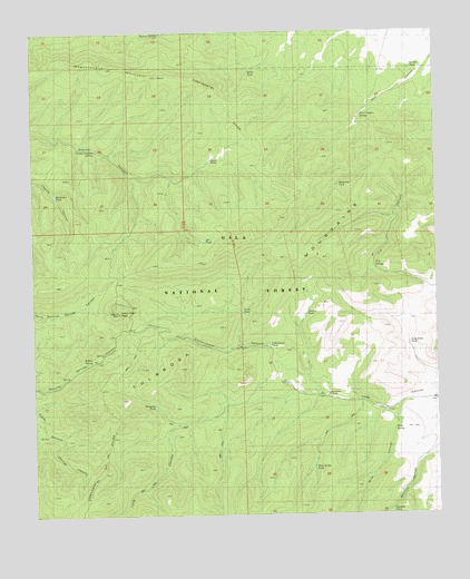
John Kerr Peak, NM USGS Topographic Map
Click on map above to begin viewing in our Map Viewer.

This topographic map contains these locations and features:
Feature Name Type Latitude Longitude GNIS ID View Map
Banker TankReservoirN33.8648°W108.4330°1848323View Map
Cottonwood CanyonValleyN33.7842°W108.4123°905403View Map
Cottonwood TankReservoirN33.7935°W108.4274°1848327View Map
Damian SpringSpringN33.8745°W108.4606°1848329View Map
Danley TankReservoirN33.8022°W108.4158°1848317View Map
Dark CanyonLocaleN33.8662°W108.3959°936726View Map
Dark Canyon SpringSpringN33.8531°W108.3988°902568View Map
GC Tank Number FiveReservoirN33.8517°W108.4414°898927View Map
GC Tank Number FourReservoirN33.8364°W108.4311°898928View Map
GC Tank Number ThreeReservoirN33.7945°W108.4604°898926View Map
GC Tank Number TwoReservoirN33.7993°W108.4661°898925View Map
Govina Canyon SpringSpringN33.8445°W108.4808°898923View Map
Horseshoe TankReservoirN33.8331°W108.4935°1848331View Map
John Kerr PeakSummitN33.8026°W108.4734°907389View Map
Long Canyon WindmillLocaleN33.7806°W108.4098°1848321View Map
Long Fork TankReservoirN33.7943°W108.3843°1848318View Map
Lopez TankReservoirN33.8420°W108.4453°1848324View Map
Mayberry TankReservoirN33.8356°W108.4055°1848316View Map
Pit TankReservoirN33.8210°W108.4473°1848325View Map
Sawmill TankReservoirN33.7512°W108.3908°1848320View Map
South TankReservoirN33.8026°W108.4359°1848326View Map
Spring TankReservoirN33.8653°W108.3830°1848314View Map
Spurgeon TankReservoirN33.7787°W108.4633°1848328View Map
T H SpringSpringN33.8146°W108.3947°1848315View Map
T H Tank Number TwoReservoirN33.8353°W108.3915°2038709View Map
Three Forks TankReservoirN33.7623°W108.4309°1848322View Map
Todd Cienega TankReservoirN33.8189°W108.4755°898924View Map
Wagontongue MountainSummitN33.8631°W108.4578°923715View Map
Willow SpringSpringN33.7899°W108.4825°1848330View Map
Wine CanyonValleyN33.7789°W108.3878°1848282View Map
Wine SpringSpringN33.7719°W108.3891°1848319View Map

Note: Coordinates in the location and feature list above are referenced to NAD83 datum.


Copyright (C) 2008-2025 Ryan Niemi / Sunset Dynamics ... All Rights Reserved