TopoQuest Logo
Do you find TopoQuest useful?
Help keep TopoQuest running and adding new maps/features by donating!
Bitcoin:  19c7KJd3qBynnjoSw5npx9KScwjBe4ifkT
Litecoin:  LXs6TkuXGGXo1vDsWCkWVdjQX94eUKd6ui
Home View Maps Find Maps Find Places Resources & Links


Milligan Mountain, New Mexico Topographic Map

USGS Map Title: Milligan Mountain, NM
USGS Map MRC: 33108F6
DRG (GeoTIFF) Download: o33108f6.tif


Neighboring USGS Topographic Map Quads:


  Dillon Mountain, NM  
33108G7
 

  Cruzville, NM  
33108G6
 

  Squirrel Springs Canyon, NM  
33108G5
 

  Reserve, NM  
33108F7
 

  Milligan Mountain, NM  
33108F6
 

  Eagle Peak, NM  
33108F5
 

  O Block Canyon, NM  
33108E7
 

  Sign Camp Mountain, NM  
33108E6
 

  Telephone Canyon, NM  
33108E5


Map MRC Location:

N34°
W109°
N34°
W108°
H8 H7 H6 H5 H4 H3 H2 H1
G8 G7 G6 G5 G4 G3 G2 G1
F8 F7 F6 F5 F4 F3 F2 F1
E8 E7 E6 E5 E4 E3 E2 E1
D8 D7 D6 D5 D4 D3 D2 D1
C8 C7 C6 C5 C4 C3 C2 C1
B8 B7 B6 B5 B4 B3 B2 B1
A8 A7 A6 A5 A4 A3 A2 A1
N33°
W109°
N33°
W108°

Milligan Mountain, NM USGS 1:24K Topographic Map Preview:
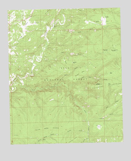
Milligan Mountain, NM USGS Topographic Map
Click on map above to begin viewing in our Map Viewer.

This topographic map contains these locations and features:
Feature Name Type Latitude Longitude GNIS ID View Map
Cerco CanyonValleyN33.6792°W108.6973°904900View Map
Chimney CanyonValleyN33.6339°W108.6645°905103View Map
Dry MesaSummitN33.7037°W108.6878°905888View Map
Dry Mesa TankReservoirN33.7000°W108.6797°905889View Map
Flat Top MesaSummitN33.6387°W108.6573°906299View Map
Frisco Plaza Number 5 TankReservoirN33.6648°W108.7056°2038475View Map
Gabe CanyonValleyN33.6473°W108.6515°906432View Map
Keko CanyonValleyN33.7028°W108.7159°907512View Map
Keko Canyon Tank Number 1ReservoirN33.7103°W108.6312°907513View Map
Keko Canyon Tank Number 2ReservoirN33.7109°W108.6404°907514View Map
Kiehnes CanyonValleyN33.6453°W108.6662°907552View Map
Kiehnes Canyon TankReservoirN33.6539°W108.6291°913191View Map
Kimball SpringSpringN33.7347°W108.6995°907553View Map
Largo Tank Number 2ReservoirN33.7378°W108.7211°907853View Map
Long CanyonValleyN33.7495°W108.6851°908159View Map
Milligan MesaBenchN33.6903°W108.6712°908759View Map
Milligan MountainSummitN33.6792°W108.6498°908760View Map
Negrito CreekStreamN33.7112°W108.7451°909037View Map
Piney ParkFlatN33.6795°W108.6412°909699View Map
Piney Park CanyonValleyN33.6773°W108.6867°909701View Map
Polk MesaBenchN33.7381°W108.6442°909776View Map
Polk Mesa Tank Number 1ReservoirN33.7416°W108.6427°909777View Map
Polk Mesa Tank Number 2ReservoirN33.7374°W108.6536°909778View Map
Sheep Basin CanyonValleyN33.6287°W108.6642°910982View Map
Stump TankReservoirN33.6894°W108.6388°911455View Map
Willow SpringSpringN33.6293°W108.7147°912414View Map
Willow Spring MountainRidgeN33.6409°W108.7112°912418View Map
Willow Spring TankReservoirN33.6335°W108.6986°913199View Map
Wilson CanyonValleyN33.7342°W108.7003°912424View Map

Note: Coordinates in the location and feature list above are referenced to NAD83 datum.


Copyright (C) 2008-2025 Ryan Niemi / Sunset Dynamics ... All Rights Reserved