TopoQuest Logo
Do you find TopoQuest useful?
Help keep TopoQuest running and adding new maps/features by donating!
Bitcoin:  19c7KJd3qBynnjoSw5npx9KScwjBe4ifkT
Litecoin:  LXs6TkuXGGXo1vDsWCkWVdjQX94eUKd6ui
Home View Maps Find Maps Find Places Resources & Links


Edina, Missouri Topographic Map

USGS Map Title: Edina, MO
USGS Map MRC: 40092B2
DRG (GeoTIFF) Download: o40092b2.tif


Neighboring USGS Topographic Map Quads:


  Bible Grove, MO  
40092C3
 

  Greensburg, MO  
40092C2
 

  Rutledge, MO  
40092C1
 

  Hurdland, MO  
40092B3
 

  Edina, MO  
40092B2
 

  Knox City, MO  
40092B1
 

  Locust Hill, MO  
40092A3
 

  Novelty, MO  
40092A2
 

  Edina SE, MO  
40092A1


Map MRC Location:

N41°
W93°
N41°
W92°
H8 H7 H6 H5 H4 H3 H2 H1
G8 G7 G6 G5 G4 G3 G2 G1
F8 F7 F6 F5 F4 F3 F2 F1
E8 E7 E6 E5 E4 E3 E2 E1
D8 D7 D6 D5 D4 D3 D2 D1
C8 C7 C6 C5 C4 C3 C2 C1
B8 B7 B6 B5 B4 B3 B2 B1
A8 A7 A6 A5 A4 A3 A2 A1
N40°
W93°
N40°
W92°

Edina, MO USGS 1:24K Topographic Map Preview:
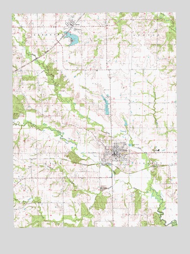
Edina, MO USGS Topographic Map
Click on map above to begin viewing in our Map Viewer.

This topographic map contains these locations and features:
Feature Name Type Latitude Longitude GNIS ID View Map
Baker CemeteryCemeteryN40.1917°W92.2452°713567View Map
BaringPopulated PlaceN40.2442°W92.2057°713640View Map
Baring Country Club DamDamN40.2334°W92.2002°760206View Map
Baring Country Club LakeReservoirN40.2352°W92.2038°760207View Map
Baring Fire DepartmentBuildingN40.2422°W92.2057°2621450View Map
Baring Post OfficePost OfficeN40.2430°W92.2039°2782913View Map
Beal School (historical)SchoolN40.1973°W92.1605°733087View Map
Bowen Brothers Mill (historical)LocaleN40.1609°W92.1835°733091View Map
Catholic CemeteryCemeteryN40.1718°W92.1731°2777504View Map
City of BaringCivilN40.2447°W92.2059°2394060View Map
City of EdinaCivilN40.1680°W92.1733°2394622View Map
Clancy School (historical)SchoolN40.1675°W92.1321°733088View Map
Democrat CreekStreamN40.1439°W92.1866°735576View Map
EdinaPopulated PlaceN40.1675°W92.1727°717404View Map
Edina Fire DepartmentBuildingN40.1670°W92.1743°2620345View Map
Edina Golf ClubLocaleN40.2014°W92.1763°755171View Map
Edina Police DepartmentBuildingN40.1684°W92.1734°2752218View Map
Edina Post OfficePost OfficeN40.1669°W92.1737°2783207View Map
Edina ReservoirReservoirN40.1957°W92.1789°758276View Map
Edina Reservoir Section 12 DamDamN40.1917°W92.1785°760255View Map
Edina Reservoir Section 7ReservoirN40.1855°W92.1643°760254View Map
Edina Reservoir Section 7 DamDamN40.1850°W92.1652°760253View Map
Free CemeteryCemeteryN40.1673°W92.1743°733089View Map
Knox CountyCivilN40.1283°W92.1481°758506View Map
Knox County High SchoolSchoolN40.1692°W92.1393°720680View Map
Knox County Sheriff's OfficeBuildingN40.1682°W92.1721°2752271View Map
Linville CemeteryCemeteryN40.1753°W92.1855°721135View Map
McCauley School (historical)SchoolN40.1903°W92.2141°733085View Map
MilltownPopulated PlaceN40.1623°W92.1813°733090View Map
North Fork South Fabius RiverStreamN40.1473°W92.1457°723468View Map
Old Edina CemeteryCemeteryN40.1650°W92.1687°2777503View Map
Pleasant Valley School (historical)SchoolN40.1470°W92.2121°733086View Map
Rock CreekStreamN40.1523°W92.1707°725448View Map
Saint Aloysius CemeteryCemeteryN40.2409°W92.2113°725718View Map
Saint Joseph ChurchChurchN40.1714°W92.1731°732593View Map
Saint Joseph New CemeteryCemeteryN40.1761°W92.1854°2777505View Map
Saint Joseph Old CemeteryCemeteryN40.1729°W92.1744°2702392View Map
Saint Josephs ConventChurchN40.1719°W92.1730°732596View Map
South Fork South Fabius RiverStreamN40.1473°W92.1455°726754View Map
The Lords BottomFlatN40.1681°W92.1919°732573View Map
Township of CenterCivilN40.1680°W92.1733°766847View Map

Note: Coordinates in the location and feature list above are referenced to NAD83 datum.


Copyright (C) 2008-2025 Ryan Niemi / Sunset Dynamics ... All Rights Reserved