TopoQuest Logo
Do you find TopoQuest useful?
Help keep TopoQuest running and adding new maps/features by donating!
Bitcoin:  19c7KJd3qBynnjoSw5npx9KScwjBe4ifkT
Litecoin:  LXs6TkuXGGXo1vDsWCkWVdjQX94eUKd6ui
Home View Maps Find Maps Find Places Resources & Links


Greensburg, Missouri Topographic Map

USGS Map Title: Greensburg, MO
USGS Map MRC: 40092C2
DRG (GeoTIFF) Download: o40092c2.tif


Neighboring USGS Topographic Map Quads:


  Downing, MO  
40092D3
 

  Memphis, MO  
40092D2
 

  Arbela, MO  
40092D1
 

  Bible Grove, MO  
40092C3
 

  Greensburg, MO  
40092C2
 

  Rutledge, MO  
40092C1
 

  Hurdland, MO  
40092B3
 

  Edina, MO  
40092B2
 

  Knox City, MO  
40092B1


Map MRC Location:

N41°
W93°
N41°
W92°
H8 H7 H6 H5 H4 H3 H2 H1
G8 G7 G6 G5 G4 G3 G2 G1
F8 F7 F6 F5 F4 F3 F2 F1
E8 E7 E6 E5 E4 E3 E2 E1
D8 D7 D6 D5 D4 D3 D2 D1
C8 C7 C6 C5 C4 C3 C2 C1
B8 B7 B6 B5 B4 B3 B2 B1
A8 A7 A6 A5 A4 A3 A2 A1
N40°
W93°
N40°
W92°

Greensburg, MO USGS 1:24K Topographic Map Preview:
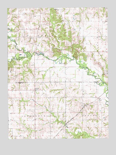
Greensburg, MO USGS Topographic Map
Click on map above to begin viewing in our Map Viewer.

This topographic map contains these locations and features:
Feature Name Type Latitude Longitude GNIS ID View Map
Bethel ChurchChurchN40.3467°W92.1366°714078View Map
Chaney School (historical)SchoolN40.3289°W92.1424°733064View Map
Cunningham CemeteryCemeteryN40.2889°W92.1396°716594View Map
Donaldson CemeteryCemeteryN40.3475°W92.2113°716973View Map
Dromey Airport (historical)AirportN40.2834°W92.2169°758706View Map
EdinburgPopulated PlaceN40.3736°W92.1846°733065View Map
Edinburg Baptist ChurchChurchN40.3736°W92.1938°735592View Map
Edinburg Baptist Church CemeteryCemeteryN40.3739°W92.1918°2777527View Map
FabiusPopulated PlaceN40.2886°W92.1380°740842View Map
Fabius School (historical)SchoolN40.2831°W92.1352°733075View Map
Forrester CemeteryCemeteryN40.3361°W92.1952°718105View Map
Fort Donaldson CemeteryCemeteryN40.3464°W92.2180°718108View Map
Fort Donaldson School (historical)SchoolN40.3464°W92.2146°733060View Map
Frogge CemeteryCemeteryN40.3206°W92.2227°718262View Map
Frogge School (historical)SchoolN40.3186°W92.2363°733061View Map
GreensburgPopulated PlaceN40.2964°W92.2169°735637View Map
Greensburg CemeteryCemeteryN40.2975°W92.2127°1891185View Map
Henrichs School (historical)SchoolN40.3659°W92.1452°733063View Map
Hicks CemeteryCemeteryN40.3464°W92.2041°719497View Map
Kiley School (historical)SchoolN40.2742°W92.1971°733074View Map
Myers School (historical)SchoolN40.3153°W92.1991°733062View Map
North Fork Middle Fabius RiverStreamN40.3328°W92.2260°723463View Map
Pettit CemeteryCemeteryN40.3411°W92.2235°724269View Map
Pleasant RetreatPopulated PlaceN40.3673°W92.2171°740396View Map
Pleasant Ridge Post OfficePost OfficeN40.3673°W92.2171°759854View Map
Ruskin (historical)LocaleN40.3448°W92.1532°740395View Map
Ruskin Post OfficePost OfficeN40.3448°W92.1532°759857View Map
Sand HillPopulated PlaceN40.3114°W92.1280°741239View Map
Sever Lake NorthReservoirN40.2573°W92.1484°760592View Map
Sever Lake North DamDamN40.2550°W92.1485°760591View Map
South Fork Middle Fabius RiverStreamN40.3325°W92.2263°726745View Map
Spillman MoundSummitN40.3220°W92.1793°726861View Map
Tobin CreekStreamN40.3278°W92.1785°727686View Map
Township of TobinCivilN40.3479°W92.2002°767382View Map

Note: Coordinates in the location and feature list above are referenced to NAD83 datum.


Copyright (C) 2008-2025 Ryan Niemi / Sunset Dynamics ... All Rights Reserved