TopoQuest Logo
Do you find TopoQuest useful?
Help keep TopoQuest running and adding new maps/features by donating!
Bitcoin:  19c7KJd3qBynnjoSw5npx9KScwjBe4ifkT
Litecoin:  LXs6TkuXGGXo1vDsWCkWVdjQX94eUKd6ui
Home View Maps Find Maps Find Places Resources & Links


Edinboro North, Pennsylvania Topographic Map

USGS Map Title: Edinboro North, PA
USGS Map MRC: 41080H2
DRG (GeoTIFF) Download: o41080h2.tif


Neighboring USGS Topographic Map Quads:


  Fairview, PA  
42080A3
 

  Swanville, PA  
42080A2
 

  Erie South, PA  
42080A1
 

  Albion, PA  
41080H3
 

  Edinboro North, PA  
41080H2
 

  Cambridge Springs NE, PA  
41080H1
 

  Conneautville, PA  
41080G3
 

  Edinboro South, PA  
41080G2
 

  Cambridge Springs, PA  
41080G1


Map MRC Location:

N42°
W81°
N42°
W80°
H8 H7 H6 H5 H4 H3 H2 H1
G8 G7 G6 G5 G4 G3 G2 G1
F8 F7 F6 F5 F4 F3 F2 F1
E8 E7 E6 E5 E4 E3 E2 E1
D8 D7 D6 D5 D4 D3 D2 D1
C8 C7 C6 C5 C4 C3 C2 C1
B8 B7 B6 B5 B4 B3 B2 B1
A8 A7 A6 A5 A4 A3 A2 A1
N41°
W81°
N41°
W80°

Edinboro North, PA USGS 1:24K Topographic Map Preview:
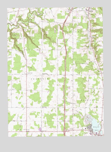
Edinboro North, PA USGS Topographic Map
Click on map above to begin viewing in our Map Viewer.

This topographic map contains these locations and features:
Feature Name Type Latitude Longitude GNIS ID View Map
Apple Tree FarmLocaleN41.8881°W80.2050°2711953View Map
Barking Rock FarmLocaleN41.9744°W80.2033°2711943View Map
Bethel Church (historical)ChurchN41.9845°W80.2045°1196867View Map
Black Kettle FarmsLocaleN41.8772°W80.2336°2711952View Map
Borough of McKeanCivilN41.9982°W80.1410°1215214View Map
BranchvillePopulated PlaceN41.9601°W80.1409°1170155View Map
Branchville SchoolSchoolN41.9595°W80.1364°1196818View Map
Branchville School (historical)SchoolN41.9595°W80.1364°1196870View Map
Camp Hawthorne RidgeLocaleN41.9728°W80.2373°1171017View Map
Central Erie County Paramedic Association - McKean StationBuildingN41.9982°W80.1415°2780638View Map
Clearview RanchLocaleN41.9953°W80.2264°2711915View Map
Crandall FarmsLocaleN41.9606°W80.2033°2711936View Map
Culberston Hills Golf CourseLocaleN41.8776°W80.1476°1205839View Map
Dillen Personal AirportAirportN41.9857°W80.1807°1194319View Map
Edinboro Elementary SchoolSchoolN41.8823°W80.1487°1211450View Map
Edinboro LakeLakeN41.8852°W80.1360°1174021View Map
Edinboro Lake DamDamN41.8767°W80.1364°1195826View Map
Elk SchoolSchoolN41.8798°W80.2262°1196862View Map
Elk Valley Golf CourseLocaleN41.9789°W80.2170°1205856View Map
Erie County Public Library Edinboro BranchBuildingN41.8789°W80.1417°2711894View Map
Eureka CornersLocaleN41.9031°W80.2056°1174336View Map
Eureka SchoolSchoolN41.9034°W80.2142°1196861View Map
Eureka SchoolSchoolN41.9034°W80.2139°1196815View Map
Falk RunStreamN41.9792°W80.2448°1174572View Map
Foy Corners SchoolSchoolN41.9028°W80.1853°1196863View Map
Franklin CenterPopulated PlaceN41.9356°W80.2248°1175146View Map
Franklin Township Volunteer Fire Department Station 72BuildingN41.9195°W80.2237°2645890View Map
Golden CemeteryCemeteryN41.9776°W80.1430°1175781View Map
Goodban RunStreamN41.9856°W80.2362°1175808View Map
Goodban SchoolSchoolN41.9589°W80.2045°1196868View Map
Harrison SchoolSchoolN41.9803°W80.1637°1196819View Map
Holiday Acres Golf CourseLocaleN41.8820°W80.1678°1205838View Map
Howard Fall School (historical)SchoolN41.9562°W80.2334°1196821View Map
Howard FallsFallsN41.9555°W80.2298°1177518View Map
Lamson RunStreamN41.9981°W80.1503°1178840View Map
LaveryPopulated PlaceN41.8801°W80.2256°1179042View Map
McKean Elementary SchoolSchoolN41.9973°W80.1451°1213879View Map
McKean Hose Company Station 40BuildingN41.9981°W80.1415°2645580View Map
McKean P O and StationLocaleN41.9987°W80.1431°1196872View Map
McKean Post OfficePost OfficeN41.9972°W80.1435°1214710View Map
McLanePopulated PlaceN41.9362°W80.1264°1180769View Map
MiddleboroPopulated PlaceN41.9969°W80.1431°1181060View Map
Mill Race FarmLocaleN41.9353°W80.1406°2711954View Map
Mishler CornersPopulated PlaceN41.9351°W80.2048°1181360View Map
Pleasure Golf CourseLocaleN41.9212°W80.1503°1205837View Map
Porter RunStreamN41.9856°W80.2359°1184299View Map
Powers CornersLocaleN41.8798°W80.2062°1184373View Map
Schaffer School (historical)SchoolN41.9592°W80.1703°1196869View Map
Shaffer SchoolSchoolN41.9592°W80.1703°1196820View Map
Shenango CreekStreamN41.8953°W80.1476°1187462View Map
Silverthorn SchoolSchoolN41.9345°W80.1842°1196822View Map
Stanley FarmsLocaleN41.9014°W80.2367°2711949View Map
Townline SchoolSchoolN41.9223°W80.1648°1196817View Map
Township of FranklinCivilN41.9299°W80.2150°1216412View Map
Township of McKeanCivilN41.9924°W80.1293°1216419View Map
Trinity ChurchChurchN41.9992°W80.1417°1189809View Map
Vanco FarmsLocaleN41.8856°W80.1867°2711948View Map
Wellman SchoolSchoolN41.8812°W80.1639°1196816View Map
WFSE-FM (Edinboro)TowerN41.8781°W80.1776°1200325View Map

Note: Coordinates in the location and feature list above are referenced to NAD83 datum.


Copyright (C) 2008-2025 Ryan Niemi / Sunset Dynamics ... All Rights Reserved