TopoQuest Logo
Do you find TopoQuest useful?
Help keep TopoQuest running and adding new maps/features by donating!
Bitcoin:  19c7KJd3qBynnjoSw5npx9KScwjBe4ifkT
Litecoin:  LXs6TkuXGGXo1vDsWCkWVdjQX94eUKd6ui
Home View Maps Find Maps Find Places Resources & Links


Cambridge Springs NE, Pennsylvania Topographic Map

USGS Map Title: Cambridge Springs NE, PA
USGS Map MRC: 41080H1
DRG (GeoTIFF) Download: o41080h1.tif


Neighboring USGS Topographic Map Quads:


  Swanville, PA  
42080A2
 

  Erie South, PA  
42080A1
 

  Hammett, PA  
42079A8
 

  Edinboro North, PA  
41080H2
 

  Cambridge Springs NE, PA  
41080H1
 

  Waterford, PA  
41079H8
 

  Edinboro South, PA  
41080G2
 

  Cambridge Springs, PA  
41080G1
 

  Millers Station, PA  
41079G8


Map MRC Location:

N42°
W81°
N42°
W80°
H8 H7 H6 H5 H4 H3 H2 H1
G8 G7 G6 G5 G4 G3 G2 G1
F8 F7 F6 F5 F4 F3 F2 F1
E8 E7 E6 E5 E4 E3 E2 E1
D8 D7 D6 D5 D4 D3 D2 D1
C8 C7 C6 C5 C4 C3 C2 C1
B8 B7 B6 B5 B4 B3 B2 B1
A8 A7 A6 A5 A4 A3 A2 A1
N41°
W81°
N41°
W80°

Cambridge Springs NE, PA USGS 1:24K Topographic Map Preview:
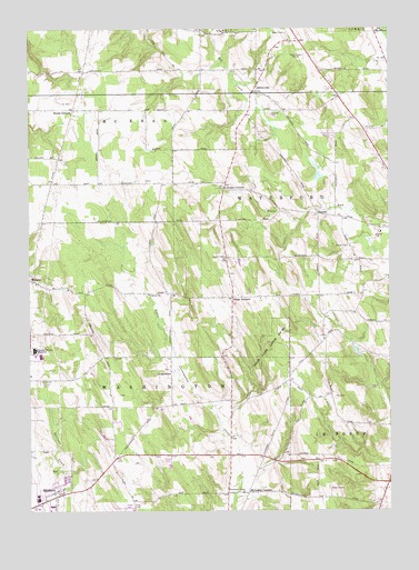
Cambridge Springs NE, PA USGS Topographic Map
Click on map above to begin viewing in our Map Viewer.

This topographic map contains these locations and features:
Feature Name Type Latitude Longitude GNIS ID View Map
Albrecht FarmsLocaleN41.9542°W80.0192°2711791View Map
Ash SchoolSchoolN41.9359°W80.0801°1196804View Map
Aubury SchoolSchoolN41.9895°W80.0651°1196806View Map
BagdadPopulated PlaceN41.9520°W80.0242°1203009View Map
Black SchoolSchoolN41.9259°W80.0378°1196809View Map
Borough of EdinboroCivilN41.8762°W80.1246°1215207View Map
Carlson Airport (historical)AirportN41.9035°W80.1024°1194309View Map
Crescent Hill FarmsLocaleN41.9289°W80.0172°2711828View Map
DraketownPopulated PlaceN41.9112°W80.0756°1173457View Map
Edinboro Post OfficePost OfficeN41.8774°W80.1194°2711908View Map
Elegeer FarmsLocaleN41.9283°W80.0578°2711797View Map
Gardner SchoolSchoolN41.9037°W80.0542°1196813View Map
General McLane High SchoolSchoolN41.9170°W80.1231°1175513View Map
Gleeten SchoolSchoolN41.8892°W80.0953°1196812View Map
James W Parker Middle SchoolSchoolN41.9151°W80.1206°1211443View Map
Kula FarmsLocaleN41.9544°W80.0358°2711792View Map
Macon SchoolSchoolN41.9153°W80.0989°1196811View Map
McLallen CornersPopulated PlaceN41.8798°W80.0492°1180768View Map
McLallen Post OfficePost OfficeN41.8803°W80.0493°1802653View Map
Phelps CornersLocaleN41.9303°W80.0539°1183653View Map
Reeds CornersPopulated PlaceN41.9795°W80.1092°1184828View Map
Saints Church (historical)ChurchN41.8895°W80.0559°1196814View Map
Sedgewick SchoolSchoolN41.9401°W80.0170°1196810View Map
Sharps CornersLocaleN41.9587°W80.0564°1187380View Map
Showman FarmsLocaleN41.9003°W80.0672°2711955View Map
SibleyvillePopulated PlaceN41.9837°W80.0467°1187641View Map
South Woods Golf CourseLocaleN41.9878°W80.1237°1206502View Map
Stancliff SchoolSchoolN41.9595°W80.1006°1196805View Map
State Game Lands Number 192ParkN41.9164°W80.0395°1188478View Map
Strong SchoolSchoolN41.9826°W80.0176°1196808View Map
Strongs CornersLocaleN41.9967°W80.0306°1205260View Map
Township of WashingtonCivilN41.8938°W80.1144°1216426View Map
Union SchoolSchoolN41.9789°W80.0476°1196807View Map
Washington Valley ChurchChurchN41.8798°W80.0509°1190654View Map
WRIE-AM (Erie)TowerN41.9923°W80.0287°1200518View Map

Note: Coordinates in the location and feature list above are referenced to NAD83 datum.


Copyright (C) 2008-2024 Ryan Niemi / Sunset Dynamics ... All Rights Reserved