TopoQuest Logo
Do you find TopoQuest useful?
Help keep TopoQuest running and adding new maps/features by donating!
Bitcoin:  19c7KJd3qBynnjoSw5npx9KScwjBe4ifkT
Litecoin:  LXs6TkuXGGXo1vDsWCkWVdjQX94eUKd6ui
Home View Maps Find Maps Find Places Resources & Links


Edinboro South, Pennsylvania Topographic Map

USGS Map Title: Edinboro South, PA
USGS Map MRC: 41080G2
DRG (GeoTIFF) Download: o41080g2.tif


Neighboring USGS Topographic Map Quads:


  Albion, PA  
41080H3
 

  Edinboro North, PA  
41080H2
 

  Cambridge Springs NE, PA  
41080H1
 

  Conneautville, PA  
41080G3
 

  Edinboro South, PA  
41080G2
 

  Cambridge Springs, PA  
41080G1
 

  Harmonsburg, PA  
41080F3
 

  Meadville, PA  
41080F2
 

  Blooming Valley, PA  
41080F1


Map MRC Location:

N42°
W81°
N42°
W80°
H8 H7 H6 H5 H4 H3 H2 H1
G8 G7 G6 G5 G4 G3 G2 G1
F8 F7 F6 F5 F4 F3 F2 F1
E8 E7 E6 E5 E4 E3 E2 E1
D8 D7 D6 D5 D4 D3 D2 D1
C8 C7 C6 C5 C4 C3 C2 C1
B8 B7 B6 B5 B4 B3 B2 B1
A8 A7 A6 A5 A4 A3 A2 A1
N41°
W81°
N41°
W80°

Edinboro South, PA USGS 1:24K Topographic Map Preview:
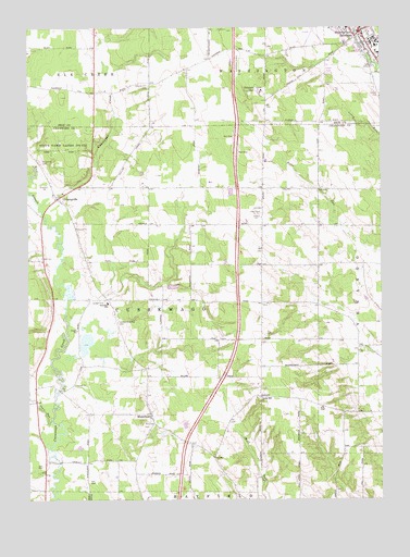
Edinboro South, PA USGS Topographic Map
Click on map above to begin viewing in our Map Viewer.

This topographic map contains these locations and features:
Feature Name Type Latitude Longitude GNIS ID View Map
Carmel - Freeman CemeteryCemeteryN41.7971°W80.2182°1171222View Map
Carr RunStreamN41.7709°W80.2420°1171256View Map
Central Erie County Paramedic Association - Edinboro StationBuildingN41.8736°W80.1309°2719521View Map
Clausen SchoolSchoolN41.8034°W80.2031°1205454View Map
CrossingvillePopulated PlaceN41.8298°W80.2389°1172754View Map
Culbertson Hills Airport (historical)AirportN41.8734°W80.1487°1194302View Map
Cussewago Township SchoolSchoolN41.8026°W80.2214°1205458View Map
Daniels School (historical)SchoolN41.8226°W80.1953°1205452View Map
Dundon SchoolSchoolN41.8317°W80.1470°1205451View Map
EdinboroPopulated PlaceN41.8742°W80.1317°1174020View Map
Edinboro Police DepartmentBuildingN41.8732°W80.1318°2777071View Map
Edinboro University of PennsylvaniaSchoolN41.8714°W80.1284°1208398View Map
Edinboro Volunteer Fire Department 38BuildingN41.8736°W80.1310°2644730View Map
Freeman School (historical)SchoolN41.8017°W80.1664°1205457View Map
Gibson HillSummitN41.8589°W80.1673°1175591View Map
Gibson SchoolSchoolN41.8584°W80.1614°1205448View Map
Gospel Hill ChurchChurchN41.7773°W80.1670°1175850View Map
Himebaugh SchoolSchoolN41.7731°W80.1359°1205460View Map
Homan SchoolSchoolN41.7903°W80.1303°1205456View Map
Hotchkiss SchoolSchoolN41.7776°W80.1667°1205459View Map
Kearney School (historical)SchoolN41.8334°W80.2164°1205449View Map
Lewis CemeteryCemeteryN41.8258°W80.1691°1179234View Map
Lewis Church (historical)ChurchN41.8234°W80.1673°1205453View Map
MosiertownPopulated PlaceN41.7726°W80.2062°1181614View Map
Saint James CemeteryCemeteryN41.8399°W80.2453°1186009View Map
Sandbank SchoolSchoolN41.7801°W80.2464°1205455View Map
Sherred Hill SchoolSchoolN41.8601°W80.2056°1205447View Map
Sherrod Hill CemeteryCemeteryN41.8596°W80.2068°1187496View Map
State Game Lands Number 152ParkN41.8431°W80.2362°1188454View Map
State Game Lands Number 269ParkN41.8001°W80.2164°1208085View Map
Tobin FarmsLocaleN41.8542°W80.2081°2711950View Map
Township of CussewagoCivilN41.8016°W80.2084°1216301View Map
Waldo SchoolSchoolN41.8326°W80.1670°1205450View Map
West Branch Cussewago CreekStreamN41.8278°W80.2462°1193627View Map
Whites SchoolSchoolN41.8692°W80.1706°1205446View Map

Note: Coordinates in the location and feature list above are referenced to NAD83 datum.


Copyright (C) 2008-2025 Ryan Niemi / Sunset Dynamics ... All Rights Reserved