TopoQuest Logo
Do you find TopoQuest useful?
Help keep TopoQuest running and adding new maps/features by donating!
Bitcoin:  19c7KJd3qBynnjoSw5npx9KScwjBe4ifkT
Litecoin:  LXs6TkuXGGXo1vDsWCkWVdjQX94eUKd6ui
Home View Maps Find Maps Find Places Resources & Links


Edinburg, Mississippi Topographic Map

USGS Map Title: Edinburg, MS
USGS Map MRC: 32089G3
DRG (GeoTIFF) Download: o32089g3.tif


Neighboring USGS Topographic Map Quads:


  Zama, MS  
32089H4
 

  Four Corners, MS  
32089H3
 

  Plattsburg, MS  
32089H2
 

  Renfroe, MS  
32089G4
 

  Edinburg, MS  
32089G3
 

  Pearl River, MS  
32089G2
 

  McAfee, MS  
32089F4
 

  Madden, MS  
32089F3
 

  McDonald, MS  
32089F2


Map MRC Location:

N33°
W90°
N33°
W89°
H8 H7 H6 H5 H4 H3 H2 H1
G8 G7 G6 G5 G4 G3 G2 G1
F8 F7 F6 F5 F4 F3 F2 F1
E8 E7 E6 E5 E4 E3 E2 E1
D8 D7 D6 D5 D4 D3 D2 D1
C8 C7 C6 C5 C4 C3 C2 C1
B8 B7 B6 B5 B4 B3 B2 B1
A8 A7 A6 A5 A4 A3 A2 A1
N32°
W90°
N32°
W89°

Edinburg, MS USGS 1:24K Topographic Map Preview:
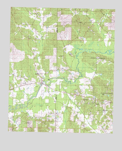
Edinburg, MS USGS Topographic Map
Click on map above to begin viewing in our Map Viewer.

This topographic map contains these locations and features:
Feature Name Type Latitude Longitude GNIS ID View Map
Arlington Volunteer Fire Department Station 2BuildingN32.8608°W89.2706°2665840View Map
Barrett (historical)LocaleN32.8271°W89.2695°707186View Map
Barrett Cemetery (historical)CemeteryN32.8304°W89.2728°691127View Map
Barrett LakeLakeN32.8322°W89.2549°666540View Map
Beasha CreekStreamN32.8021°W89.3076°666671View Map
Bethany CemeteryCemeteryN32.7726°W89.2662°666859View Map
Bose Nukse CreekStreamN32.7718°W89.3684°667452View Map
Brandon BranchStreamN32.8554°W89.2695°667522View Map
Coughlin MoundSummitN32.8287°W89.3017°668856View Map
EbenezerPopulated PlaceN32.7585°W89.3501°707083View Map
Ebenezer CemeteryCemeteryN32.7579°W89.3503°707084View Map
Ebenezer ChurchChurchN32.7587°W89.3537°669647View Map
EdinburgPopulated PlaceN32.7993°W89.3362°690913View Map
Edinburg Attendance CenterSchoolN32.7918°W89.3412°707086View Map
Fosters (historical)LocaleN32.7868°W89.2876°685027View Map
Franks BranchStreamN32.8010°W89.2959°670167View Map
Harmony CemeteryCemeteryN32.7829°W89.2837°707199View Map
Hill BranchStreamN32.7951°W89.3387°671205View Map
Hooper Mill CreekStreamN32.8001°W89.3320°671393View Map
Hurricane CreekStreamN32.7743°W89.3578°671624View Map
Indian Reservation Lake DamDamN32.7968°W89.2651°681659View Map
Jones CreekStreamN32.8082°W89.2884°671995View Map
Leake CreekStreamN32.8443°W89.3378°672342View Map
Lukfapa CreekStreamN32.8324°W89.2698°672951View Map
Luneluah CreekStreamN32.7835°W89.3020°672959View Map
Mars Hill CemeteryCemeteryN32.8429°W89.3531°707122View Map
Mars Hill ChurchChurchN32.8440°W89.3531°673150View Map
New Canaan ChurchChurchN32.7807°W89.2753°674598View Map
New County Line ChurchChurchN32.7687°W89.3178°691138View Map
New Harmony ChurchChurchN32.7837°W89.2834°674638View Map
New Testament Holiness ChurchChurchN32.7793°W89.2712°690996View Map
Norman Johnson Lake DamDamN32.8001°W89.2501°681663View Map
Old Canaan ChurchChurchN32.8268°W89.3134°675166View Map
Olney (historical)LocaleN32.8626°W89.2967°707221View Map
Palmetto FlatsFlatN32.7793°W89.3359°675417View Map
Pine Grove ChurchChurchN32.7976°W89.3548°675844View Map
RemusPopulated PlaceN32.8687°W89.3437°692169View Map
Remus CemeteryCemeteryN32.8690°W89.3451°707143View Map
Remus Missionary Baptist ChurchChurchN32.8690°W89.3448°707144View Map
Remus School (historical)SchoolN32.8693°W89.3448°707145View Map
Rice CreekStreamN32.7812°W89.3509°676624View Map
Sullivan BranchStreamN32.8312°W89.2901°690995View Map
Thompson Lake DamDamN32.8585°W89.2817°681704View Map
Underdown LakeLakeN32.8340°W89.2897°679025View Map
White Oak CemeteryCemeteryN32.8607°W89.2934°707234View Map
White Oak ChurchChurchN32.8615°W89.2917°679602View Map
Wye LakeLakeN32.8075°W89.3148°679902View Map
Yellow BluffCliffN32.8021°W89.3262°679934View Map

Note: Coordinates in the location and feature list above are referenced to NAD83 datum.


Copyright (C) 2008-2025 Ryan Niemi / Sunset Dynamics ... All Rights Reserved