TopoQuest Logo
Do you find TopoQuest useful?
Help keep TopoQuest running and adding new maps/features by donating!
Bitcoin:  19c7KJd3qBynnjoSw5npx9KScwjBe4ifkT
Litecoin:  LXs6TkuXGGXo1vDsWCkWVdjQX94eUKd6ui
Home View Maps Find Maps Find Places Resources & Links


Edmondson, North Carolina Topographic Map

USGS Map Title: Edmondson, NC
USGS Map MRC: 35078E5
DRG (GeoTIFF) Download: o35078e5.tif


Neighboring USGS Topographic Map Quads:


  Lake Wheeler, NC  
35078F6
 

  Garner, NC  
35078F5
 

  Clayton, NC  
35078F4
 

  Angier, NC  
35078E6
 

  Edmondson, NC  
35078E5
 

  Powhatan, NC  
35078E4
 

  Coats, NC  
35078D6
 

  Benson, NC  
35078D5
 

  Four Oaks, NC  
35078D4


Map MRC Location:

N36°
W79°
N36°
W78°
H8 H7 H6 H5 H4 H3 H2 H1
G8 G7 G6 G5 G4 G3 G2 G1
F8 F7 F6 F5 F4 F3 F2 F1
E8 E7 E6 E5 E4 E3 E2 E1
D8 D7 D6 D5 D4 D3 D2 D1
C8 C7 C6 C5 C4 C3 C2 C1
B8 B7 B6 B5 B4 B3 B2 B1
A8 A7 A6 A5 A4 A3 A2 A1
N35°
W79°
N35°
W78°

Edmondson, NC USGS 1:24K Topographic Map Preview:
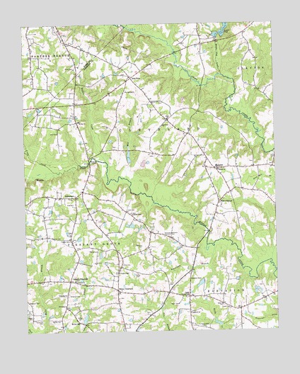
Edmondson, NC USGS Topographic Map
Click on map above to begin viewing in our Map Viewer.

This topographic map contains these locations and features:
Feature Name Type Latitude Longitude GNIS ID View Map
Austin PondReservoirN35.6190°W78.5275°980376View Map
Austins Pond DamDamN35.6190°W78.5275°999163View Map
Beaverdam BranchStreamN35.5346°W78.5306°980821View Map
Benson CemeteryCemeteryN35.5051°W78.6083°981008View Map
Berea ChurchChurchN35.5110°W78.5270°981031View Map
Buffalo CreekStreamN35.5693°W78.5839°982167View Map
Cleveland ChurchChurchN35.5838°W78.5553°983276View Map
Cleveland Elementary SchoolSchoolN35.5791°W78.5426°983280View Map
Cleveland Volunteer Fire DepartmentBuildingN35.5666°W78.5311°2639104View Map
Coats CemeteryCemeteryN35.5180°W78.5532°983310View Map
Coats CemeteryCemeteryN35.5493°W78.5739°983311View Map
Coats CrossroadsPopulated PlaceN35.5143°W78.5436°983312View Map
Drug StoreLocaleN35.6032°W78.5708°984338View Map
Ebenezer ChurchChurchN35.5935°W78.5570°984597View Map
EdmondsonPopulated PlaceN35.5552°W78.5995°984643View Map
Ennis CemeteryCemeteryN35.5274°W78.5766°984801View Map
Fellowship ChurchChurchN35.5104°W78.6050°985034View Map
Fellowship ChurchChurchN35.5152°W78.6047°985035View Map
Fifty - Two Ten Rescue SquadBuildingN35.5121°W78.5794°2720377View Map
Flowers CemeteryCemeteryN35.5095°W78.5234°985240View Map
Friendly ChapelChurchN35.5240°W78.5783°985414View Map
Honeycutt CemeteryCemeteryN35.5157°W78.6020°987016View Map
Interchange 312CrossingN35.6068°W78.5642°2455155View Map
Interchange 319CrossingN35.5161°W78.5576°2455156View Map
Johnson CrossroadsPopulated PlaceN35.5210°W78.6025°987676View Map
Johnsons ChapelChurchN35.5215°W78.5428°987698View Map
King CemeteryCemeteryN35.5521°W78.6007°987976View Map
Langdon PondReservoirN35.5685°W78.5714°999093View Map
Langdons Pond Number One DamDamN35.5685°W78.5714°999092View Map
Langdons Pond Number Two DamDamN35.5685°W78.5714°999094View Map
Leech CemeteryCemeteryN35.5810°W78.6079°988306View Map
Little CreekStreamN35.5657°W78.6103°988607View Map
McGee CemeteryCemeteryN35.5046°W78.5986°989576View Map
McGee CemeteryCemeteryN35.5235°W78.5690°989577View Map
McGee CrossroadsPopulated PlaceN35.5171°W78.5792°989578View Map
McGee MillPopulated PlaceN35.5038°W78.5975°1021391View Map
McGee PondReservoirN35.5035°W78.5964°999050View Map
McGees Mill Pond DamDamN35.5035°W78.5964°999049View Map
McLamb Airport (historical)AirportN35.5182°W78.5858°997933View Map
Mount Zion ChurchChurchN35.5854°W78.5972°990652View Map
Nimrod Stephenson Memorial CemeteryCemeteryN35.5396°W78.5556°991154View Map
Oakland ChurchChurchN35.5657°W78.5278°991476View Map
Parrish CemeteryCemeteryN35.5329°W78.5886°991892View Map
Penny CemeteryCemeteryN35.6077°W78.5995°992035View Map
Pleasant Grove ChurchChurchN35.5377°W78.6011°992479View Map
Providence ChurchChurchN35.5207°W78.6003°992870View Map
Rehobeth ChurchChurchN35.5074°W78.5428°993231View Map
Saint Amandas ChurchChurchN35.5977°W78.5736°993856View Map
Saint Marys Grove CemeteryCemeteryN35.5021°W78.5376°994039View Map
Shiloh ChurchChurchN35.5865°W78.5528°994695View Map
Smith CemeteryCemeteryN35.5382°W78.6111°994947View Map
Spence ChapelChurchN35.5479°W78.5711°995289View Map
Stevenson CemeteryCemeteryN35.5044°W78.6174°995485View Map
Stevenson CemeteryCemeteryN35.5124°W78.6236°995486View Map
Stevenson CemeteryCemeteryN35.5349°W78.5667°995487View Map
Township of ClevelandCivilN35.5781°W78.5397°1026848View Map
Township of Pleasant GroveCivilN35.5172°W78.6172°1026855View Map
Walton CemeteryCemeteryN35.5514°W78.6121°996760View Map
Whiteoak CreekStreamN35.6040°W78.5250°997238View Map
Wiggin CemeteryCemeteryN35.5063°W78.6220°997289View Map
Willow SpringsPopulated PlaceN35.5524°W78.5281°997422View Map

Note: Coordinates in the location and feature list above are referenced to NAD83 datum.


Copyright (C) 2008-2024 Ryan Niemi / Sunset Dynamics ... All Rights Reserved