TopoQuest Logo
Do you find TopoQuest useful?
Help keep TopoQuest running and adding new maps/features by donating!
Bitcoin:  19c7KJd3qBynnjoSw5npx9KScwjBe4ifkT
Litecoin:  LXs6TkuXGGXo1vDsWCkWVdjQX94eUKd6ui
Home View Maps Find Maps Find Places Resources & Links


El Mirage, California Topographic Map

USGS Map Title: El Mirage, CA
USGS Map MRC: 34117E6
DRG (GeoTIFF) Download: o34117e6.tif


Neighboring USGS Topographic Map Quads:


  Hi Vista, CA  
34117F7
 

  Adobe Mountain, CA  
34117F6
 

  Shadow Mountains, CA  
34117F5
 

  Lovejoy Buttes, CA  
34117E7
 

  El Mirage, CA  
34117E6
 

  Shadow Mountains SE, CA  
34117E5
 

  Valyermo, CA  
34117D7
 

  Mescal Creek, CA  
34117D6
 

  Phelan, CA  
34117D5


Map MRC Location:

N35°
W118°
N35°
W117°
H8 H7 H6 H5 H4 H3 H2 H1
G8 G7 G6 G5 G4 G3 G2 G1
F8 F7 F6 F5 F4 F3 F2 F1
E8 E7 E6 E5 E4 E3 E2 E1
D8 D7 D6 D5 D4 D3 D2 D1
C8 C7 C6 C5 C4 C3 C2 C1
B8 B7 B6 B5 B4 B3 B2 B1
A8 A7 A6 A5 A4 A3 A2 A1
N34°
W118°
N34°
W117°

El Mirage, CA USGS 1:24K Topographic Map Preview:
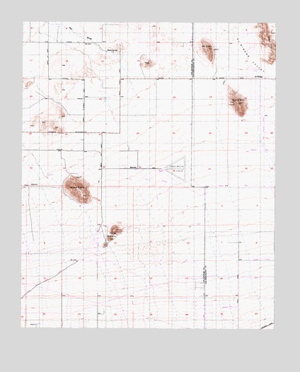
El Mirage, CA USGS Topographic Map
Click on map above to begin viewing in our Map Viewer.

This topographic map contains these locations and features:
Feature Name Type Latitude Longitude GNIS ID View Map
Black ButteSummitN34.5567°W117.7228°239386View Map
Black MountainSummitN34.5919°W117.6439°239423View Map
Brase Ranch (historical)LocaleN34.5605°W117.7120°1666841View Map
El MiragePopulated PlaceN34.6022°W117.6312°252884View Map
Engelbrecht Place (historical)LocaleN34.5736°W117.6492°1675850View Map
ER-B Ranch (historical)LocaleN34.6247°W117.6289°1675851View Map
Gray Butte FieldAirportN34.5645°W117.6815°1666851View Map
Gray MountainRidgeN34.6169°W117.6284°242967View Map
Hibbard Ranch (historical)LocaleN34.5978°W117.7151°1666852View Map
Le Montaine CreekStreamN34.5708°W117.6689°272005View Map
Mescal CreekStreamN34.5450°W117.7173°272422View Map
Moody SpringsSpringN34.6128°W117.7092°246163View Map
Mount ElmoSummitN34.6147°W117.6587°241985View Map
Three SistersRangeN34.5367°W117.7070°250476View Map
Vanderburg RanchLocaleN34.5767°W117.7220°1666871View Map

Note: Coordinates in the location and feature list above are referenced to NAD83 datum.


Copyright (C) 2008-2025 Ryan Niemi / Sunset Dynamics ... All Rights Reserved