TopoQuest Logo
Do you find TopoQuest useful?
Help keep TopoQuest running and adding new maps/features by donating!
Bitcoin:  19c7KJd3qBynnjoSw5npx9KScwjBe4ifkT
Litecoin:  LXs6TkuXGGXo1vDsWCkWVdjQX94eUKd6ui
Home View Maps Find Maps Find Places Resources & Links


Lovejoy Buttes, California Topographic Map

USGS Map Title: Lovejoy Buttes, CA
USGS Map MRC: 34117E7
DRG (GeoTIFF) Download: o34117e7.tif


Neighboring USGS Topographic Map Quads:


  Alpine Butte, CA  
34117F8
 

  Hi Vista, CA  
34117F7
 

  Adobe Mountain, CA  
34117F6
 

  Littlerock, CA  
34117E8
 

  Lovejoy Buttes, CA  
34117E7
 

  El Mirage, CA  
34117E6
 

  Juniper Hills, CA  
34117D8
 

  Valyermo, CA  
34117D7
 

  Mescal Creek, CA  
34117D6


Map MRC Location:

N35°
W118°
N35°
W117°
H8 H7 H6 H5 H4 H3 H2 H1
G8 G7 G6 G5 G4 G3 G2 G1
F8 F7 F6 F5 F4 F3 F2 F1
E8 E7 E6 E5 E4 E3 E2 E1
D8 D7 D6 D5 D4 D3 D2 D1
C8 C7 C6 C5 C4 C3 C2 C1
B8 B7 B6 B5 B4 B3 B2 B1
A8 A7 A6 A5 A4 A3 A2 A1
N34°
W118°
N34°
W117°

Lovejoy Buttes, CA USGS 1:24K Topographic Map Preview:
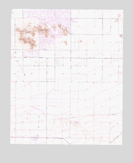
Lovejoy Buttes, CA USGS Topographic Map
Click on map above to begin viewing in our Map Viewer.

This topographic map contains these locations and features:
Feature Name Type Latitude Longitude GNIS ID View Map
Brian Ranch AirportAirportN34.5146°W117.7631°1653797View Map
Desert Relief (historical)Populated PlaceN34.5061°W117.8356°1666846View Map
Lake Los AngelesPopulated PlaceN34.6125°W117.8281°1666854View Map
Lake Los Angeles Branch County of Los Angeles Public LibraryBuildingN34.6169°W117.8273°1763266View Map
Lake Los Angeles Branch Palmdale Post OfficePost OfficeN34.6158°W117.8312°1733683View Map
Lake Los Angeles Census Designated PlaceCensusN34.6097°W117.8339°2408541View Map
Lake Los Angeles Elementary SchoolSchoolN34.5866°W117.8384°1666855View Map
LlanoPopulated PlaceN34.5058°W117.8178°1989112View Map
Llano Post OfficePost OfficeN34.5057°W117.8203°1733685View Map
Los Angeles County Fire Department Station 114BuildingN34.6069°W117.8255°2664702View Map
Lovejoy ButtesSummitN34.6017°W117.8512°1660959View Map
Lovejoy Lake (historical)ReservoirN34.6069°W117.8315°1682640View Map
Lovejoy SpringsSpringN34.6055°W117.8303°245233View Map
Morrison Ranch (historical)LocaleN34.5878°W117.7767°1666861View Map
Nichols Farms AirportAirportN34.5937°W117.8235°1653796View Map
Pomona Superior Court HeliportAirportN34.5022°W117.7501°1653836View Map
Vista San Gabriel Elementary SchoolSchoolN34.6159°W117.8085°1666872View Map
Wilsona (historical)Populated PlaceN34.6147°W117.7690°1666874View Map
Wilsona RanchLocaleN34.6142°W117.7690°251704View Map

Note: Coordinates in the location and feature list above are referenced to NAD83 datum.


Copyright (C) 2008-2024 Ryan Niemi / Sunset Dynamics ... All Rights Reserved