TopoQuest Logo
Do you find TopoQuest useful?
Help keep TopoQuest running and adding new maps/features by donating!
Bitcoin:  19c7KJd3qBynnjoSw5npx9KScwjBe4ifkT
Litecoin:  LXs6TkuXGGXo1vDsWCkWVdjQX94eUKd6ui
Home View Maps Find Maps Find Places Resources & Links


El Portal, California Topographic Map

USGS Map Title: El Portal, CA
USGS Map MRC: 37119F7
DRG (GeoTIFF) Download: o37119f7.tif


Neighboring USGS Topographic Map Quads:


  Ascension Mountain, CA  
37119G8
 

  Ackerson Mountain, CA  
37119G7
 

  Tamarack Flat, CA  
37119G6
 

  Kinsley, CA  
37119F8
 

  El Portal, CA  
37119F7
 

  El Capitan, CA  
37119F6
 

  Feliciana Mountain, CA  
37119E8
 

  Buckingham Mountain, CA  
37119E7
 

  Wawona, CA  
37119E6


Map MRC Location:

N38°
W120°
N38°
W119°
H8 H7 H6 H5 H4 H3 H2 H1
G8 G7 G6 G5 G4 G3 G2 G1
F8 F7 F6 F5 F4 F3 F2 F1
E8 E7 E6 E5 E4 E3 E2 E1
D8 D7 D6 D5 D4 D3 D2 D1
C8 C7 C6 C5 C4 C3 C2 C1
B8 B7 B6 B5 B4 B3 B2 B1
A8 A7 A6 A5 A4 A3 A2 A1
N37°
W120°
N37°
W119°

El Portal, CA USGS 1:24K Topographic Map Preview:
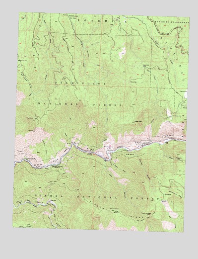
El Portal, CA USGS Topographic Map
Click on map above to begin viewing in our Map Viewer.

This topographic map contains these locations and features:
Feature Name Type Latitude Longitude GNIS ID View Map
Barrel SpringSpringN37.6466°W119.7663°256549View Map
Big Grizzly CreekStreamN37.7030°W119.8649°256937View Map
Big MeadowFlatN37.7058°W119.7527°266447View Map
Brown PeakSummitN37.6364°W119.8041°257494View Map
Buena VistaPopulated PlaceN37.7110°W119.7938°1655853View Map
Canty MeadowFlatN37.6360°W119.7988°257939View Map
Cathewood SaddleGapN37.6427°W119.7691°258084View Map
Chinquapin FallsFallsN37.6669°W119.7568°258327View Map
Clearing HousePopulated PlaceN37.6649°W119.8674°1655902View Map
Cold CanyonValleyN37.6658°W119.8098°258523View Map
Cranberry GulchValleyN37.6618°W119.8514°258871View Map
Crane CreekStreamN37.6763°W119.7754°258873View Map
Dry GulchValleyN37.6734°W119.8348°266659View Map
Eagle PeakSummitN37.6879°W119.7888°259668View Map
El PortalPopulated PlaceN37.6747°W119.7841°259813View Map
El Portal Census Designated PlaceCensusN37.6736°W119.7990°2583008View Map
El Portal Community HallBuildingN37.6744°W119.7846°1809282View Map
El Portal Elementary SchoolSchoolN37.6752°W119.7868°1809283View Map
El Portal ParkParkN37.6752°W119.7866°1809284View Map
El Portal Post OfficePost OfficeN37.6744°W119.7853°1809285View Map
ForestaPopulated PlaceN37.6983°W119.7552°260258View Map
Foresta FallsFallsN37.6927°W119.7599°260259View Map
Henness BranchStreamN37.6719°W119.7888°252108View Map
Hetch Hetchy Railroad MuseumBuildingN37.6735°W119.7860°1809287View Map
Hite CovePopulated PlaceN37.6408°W119.8491°1656072View Map
InclinePopulated PlaceN37.6605°W119.8527°1656087View Map
Indian CreekStreamN37.6758°W119.7702°261727View Map
Indian Flat CampgroundLocaleN37.6608°W119.8493°275674View Map
Indian Flat Guard StationLocaleN37.6613°W119.8491°261744View Map
Little Crane CreekStreamN37.6919°W119.7713°262574View Map
Little Nellie FallsFallsN37.7202°W119.7843°262678View Map
Merced GroveWoodsN37.7494°W119.8371°263457View Map
Moss CanyonValleyN37.6697°W119.8190°1988426View Map
Moss CreekStreamN37.6699°W119.8188°267035View Map
Nutmeg GulchValleyN37.6268°W119.8460°267084View Map
Pigeon GulchValleyN37.6654°W119.8061°264718View Map
Pinoche PeakSummitN37.6347°W119.7755°264795View Map
Pinoche Peak TrailTrailN37.6324°W119.7788°264796View Map
Pinoche RidgeRidgeN37.6346°W119.7755°264797View Map
Rancheria FlatFlatN37.6724°W119.8085°231221View Map
Redbud Picnic AreaLocaleN37.6688°W119.8216°275675View Map
Trumbull LookoutLocaleN37.6810°W119.8635°275673View Map
Trumbull PeakSummitN37.6879°W119.8615°268443View Map
Twin BridgesLocaleN37.7333°W119.8277°275677View Map

Note: Coordinates in the location and feature list above are referenced to NAD83 datum.


Copyright (C) 2008-2024 Ryan Niemi / Sunset Dynamics ... All Rights Reserved