TopoQuest Logo
Do you find TopoQuest useful?
Help keep TopoQuest running and adding new maps/features by donating!
Bitcoin:  19c7KJd3qBynnjoSw5npx9KScwjBe4ifkT
Litecoin:  LXs6TkuXGGXo1vDsWCkWVdjQX94eUKd6ui
Home View Maps Find Maps Find Places Resources & Links


Ascension Mountain, California Topographic Map

USGS Map Title: Ascension Mountain, CA
USGS Map MRC: 37119G8
DRG (GeoTIFF) Download: o37119g8.tif


Neighboring USGS Topographic Map Quads:


  Duckwall Mountain, CA  
37120H1
 

  Cherry Lake South, CA  
37119H8
 

  Lake Eleanor, CA  
37119H7
 

  Jawbone Ridge, CA  
37120G1
 

  Ascension Mountain, CA  
37119G8
 

  Ackerson Mountain, CA  
37119G7
 

  Buckhorn Peak, CA  
37120F1
 

  Kinsley, CA  
37119F8
 

  El Portal, CA  
37119F7


Map MRC Location:

N38°
W120°
N38°
W119°
H8 H7 H6 H5 H4 H3 H2 H1
G8 G7 G6 G5 G4 G3 G2 G1
F8 F7 F6 F5 F4 F3 F2 F1
E8 E7 E6 E5 E4 E3 E2 E1
D8 D7 D6 D5 D4 D3 D2 D1
C8 C7 C6 C5 C4 C3 C2 C1
B8 B7 B6 B5 B4 B3 B2 B1
A8 A7 A6 A5 A4 A3 A2 A1
N37°
W120°
N37°
W119°

Ascension Mountain, CA USGS 1:24K Topographic Map Preview:
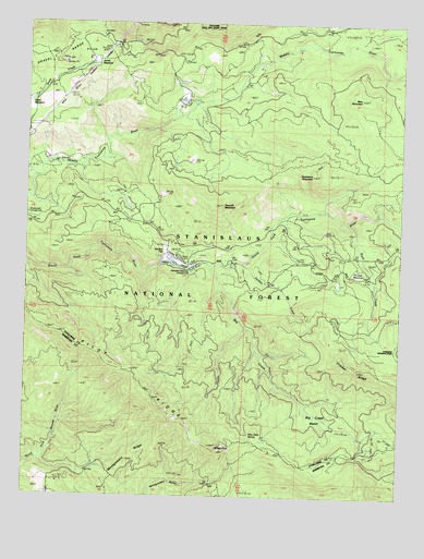
Ascension Mountain, CA USGS Topographic Map
Click on map above to begin viewing in our Map Viewer.

This topographic map contains these locations and features:
Feature Name Type Latitude Longitude GNIS ID View Map
Ackerson CreekStreamN37.8210°W119.8757°256105View Map
Ascension MountainSummitN37.8349°W119.9058°1657952View Map
Bear MountainSummitN37.8553°W119.8900°256685View Map
Berkeley-Tuolumne CampgroundLocaleN37.8113°W119.9324°253018View Map
Big CreekStreamN37.8108°W119.9399°256909View Map
Big Creek BasinBasinN37.7738°W119.9057°256915View Map
Camp TowengaLocaleN37.8538°W119.9493°274820View Map
Columbia Camp (historical)LocaleN37.8546°W119.9480°258609View Map
Crocker MeadowFlatN37.8091°W119.8901°252265View Map
Five Star Mine (historical)MineN37.8291°W119.8860°260182View Map
Goat CampLocaleN37.7594°W119.9743°274823View Map
Gravel RangeRangeN37.8606°W119.9990°260815View Map
Harden FlatPopulated PlaceN37.8110°W119.9474°261084View Map
Harden RanchLocaleN37.8124°W119.9527°252111View Map
Jones MeadowFlatN37.8652°W119.9802°252477View Map
Montgomery RidgeRidgeN37.7677°W119.9540°263776View Map
Pilot PeakSummitN37.7627°W119.9359°230663View Map
Pilot Peak SpringSpringN37.7664°W119.9258°252461View Map
Pilot RidgeRidgeN37.7626°W119.9360°267123View Map
Rush CreekStreamN37.8219°W119.8941°265677View Map
Rush Creek (historical)LocaleN37.8102°W119.8916°265676View Map
Sawmill MountainSummitN37.8267°W119.9364°265878View Map
SequoiaPopulated PlaceN37.8066°W119.8955°252087View Map
Soldier CreekStreamN37.8113°W119.9288°267377View Map
Spinning Wheel Forest Service FacilityLocaleN37.8433°W119.9763°274821View Map
Sunset Camp (historical)LocaleN37.8071°W119.8960°267969View Map
Tuolumne Camp (historical)LocaleN37.8116°W119.9332°268483View Map
Yosemite Lakes Park CampgroundLocaleN37.8124°W119.9549°274822View Map

Note: Coordinates in the location and feature list above are referenced to NAD83 datum.


Copyright (C) 2008-2024 Ryan Niemi / Sunset Dynamics ... All Rights Reserved