TopoQuest Logo
Do you find TopoQuest useful?
Help keep TopoQuest running and adding new maps/features by donating!
Bitcoin:  19c7KJd3qBynnjoSw5npx9KScwjBe4ifkT
Litecoin:  LXs6TkuXGGXo1vDsWCkWVdjQX94eUKd6ui
Home View Maps Find Maps Find Places Resources & Links


Elamville, Alabama Topographic Map

USGS Map Title: Elamville, AL
USGS Map MRC: 31085F6
DRG (GeoTIFF) Download: o31085f6.tif


Neighboring USGS Topographic Map Quads:


  Banks, AL  
31085G7
 

  Josie, AL  
31085G6
 

  Louisville, AL  
31085G5
 

  Brundidge, AL  
31085F7
 

  Elamville, AL  
31085F6
 

  Clio, AL  
31085F5
 

  Brundidge SE, AL  
31085E7
 

  Ariton, AL  
31085E6
 

  Skipperville, AL  
31085E5


Map MRC Location:

N32°
W86°
N32°
W85°
H8 H7 H6 H5 H4 H3 H2 H1
G8 G7 G6 G5 G4 G3 G2 G1
F8 F7 F6 F5 F4 F3 F2 F1
E8 E7 E6 E5 E4 E3 E2 E1
D8 D7 D6 D5 D4 D3 D2 D1
C8 C7 C6 C5 C4 C3 C2 C1
B8 B7 B6 B5 B4 B3 B2 B1
A8 A7 A6 A5 A4 A3 A2 A1
N31°
W86°
N31°
W85°

Elamville, AL USGS 1:24K Topographic Map Preview:
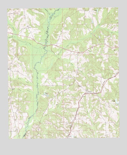
Elamville, AL USGS Topographic Map
Click on map above to begin viewing in our Map Viewer.

This topographic map contains these locations and features:
Feature Name Type Latitude Longitude GNIS ID View Map
Adam CemeteryCemeteryN31.6768°W85.6885°164018View Map
Barefoot SpringSpringN31.6731°W85.7455°113469View Map
BethelPopulated PlaceN31.6282°W85.6819°114008View Map
Big CreekStreamN31.7088°W85.7058°151683View Map
Big Creek ChurchChurchN31.7229°W85.6922°134758View Map
Birch School (historical)SchoolN31.6629°W85.6949°134759View Map
Buckhorn CreekStreamN31.7410°W85.7019°157901View Map
Burke PondsReservoirN31.6679°W85.7087°115230View Map
Carr CemeteryCemeteryN31.6690°W85.6944°115643View Map
Coal Springs (historical)Populated PlaceN31.6613°W85.6638°134772View Map
Danner CemeteryCemeteryN31.6574°W85.6963°117059View Map
Danner CreekStreamN31.6460°W85.7241°117061View Map
Dansby CemeteryCemeteryN31.6835°W85.6824°117063View Map
Days Mill (historical)LocaleN31.6296°W85.7305°1805318View Map
DosterPopulated PlaceN31.6477°W85.6738°117394View Map
Easterling Mill Pond DamDamN31.6585°W85.6283°129918View Map
Easterling's Fish HatcheryLocaleN31.6597°W85.6256°2674740View Map
Easterlings PondReservoirN31.6603°W85.6280°117797View Map
Elam ChurchChurchN31.6749°W85.6688°117899View Map
ElamvillePopulated PlaceN31.6677°W85.6563°117907View Map
Elamville ChurchChurchN31.6679°W85.6524°163345View Map
Elamville Fire DepartmentBuildingN31.6681°W85.6562°2691221View Map
Emmanuel ChurchChurchN31.6685°W85.6524°163346View Map
Faulk ChurchChurchN31.7118°W85.6552°118215View Map
Foulk CreekStreamN31.7310°W85.6494°1805322View Map
Hickory Hill Church (historical)ChurchN31.6954°W85.6591°134791View Map
Holmes Freewill Baptist ChurchChurchN31.6374°W85.6786°155875View Map
Jacksons PondReservoirN31.7475°W85.6483°120789View Map
Joiners BridgeBridgeN31.7141°W85.7069°139876View Map
Kaiser BranchStreamN31.6752°W85.7174°121082View Map
Lewis Store (historical)LocaleN31.7327°W85.6611°134800View Map
Little CreekStreamN31.7043°W85.6955°121750View Map
McSwains Bridge (historical)BridgeN31.6752°W85.7172°139886View Map
Pea River CemeteryCemeteryN31.6924°W85.7483°124531View Map
RichlandPopulated PlaceN31.7329°W85.7277°125616View Map
Richland Baptist ChurchChurchN31.7329°W85.7269°139914View Map
Richland CemeteryCemeteryN31.7335°W85.7263°1730140View Map
Richland CreekStreamN31.7041°W85.7122°125618View Map
Saint Louis ChurchChurchN31.6710°W85.6619°126133View Map
Sandy Run CreekStreamN31.7218°W85.7405°126386View Map
Spring BranchStreamN31.6685°W85.7161°127218View Map
Sutton CemeteryCemeteryN31.6890°W85.6763°127571View Map
Sutton LakeReservoirN31.6418°W85.6966°129914View Map
Sutton Lake DamDamN31.6418°W85.6966°129913View Map
Sweet Oak ChurchChurchN31.6652°W85.6663°153625View Map
Thompson CreekStreamN31.7188°W85.6691°127904View Map
Triumph ChurchChurchN31.6474°W85.6744°163358View Map

Note: Coordinates in the location and feature list above are referenced to NAD83 datum.


Copyright (C) 2008-2025 Ryan Niemi / Sunset Dynamics ... All Rights Reserved