TopoQuest Logo
Do you find TopoQuest useful?
Help keep TopoQuest running and adding new maps/features by donating!
Bitcoin:  19c7KJd3qBynnjoSw5npx9KScwjBe4ifkT
Litecoin:  LXs6TkuXGGXo1vDsWCkWVdjQX94eUKd6ui
Home View Maps Find Maps Find Places Resources & Links


Brundidge, Alabama Topographic Map

USGS Map Title: Brundidge, AL
USGS Map MRC: 31085F7
DRG (GeoTIFF) Download: o31085f7.tif


Neighboring USGS Topographic Map Quads:


  Troy, AL  
31085G8
 

  Banks, AL  
31085G7
 

  Josie, AL  
31085G6
 

  Brundidge NW, AL  
31085F8
 

  Brundidge, AL  
31085F7
 

  Elamville, AL  
31085F6
 

  Victoria, AL  
31085E8
 

  Brundidge SE, AL  
31085E7
 

  Ariton, AL  
31085E6


Map MRC Location:

N32°
W86°
N32°
W85°
H8 H7 H6 H5 H4 H3 H2 H1
G8 G7 G6 G5 G4 G3 G2 G1
F8 F7 F6 F5 F4 F3 F2 F1
E8 E7 E6 E5 E4 E3 E2 E1
D8 D7 D6 D5 D4 D3 D2 D1
C8 C7 C6 C5 C4 C3 C2 C1
B8 B7 B6 B5 B4 B3 B2 B1
A8 A7 A6 A5 A4 A3 A2 A1
N31°
W86°
N31°
W85°

Brundidge, AL USGS 1:24K Topographic Map Preview:
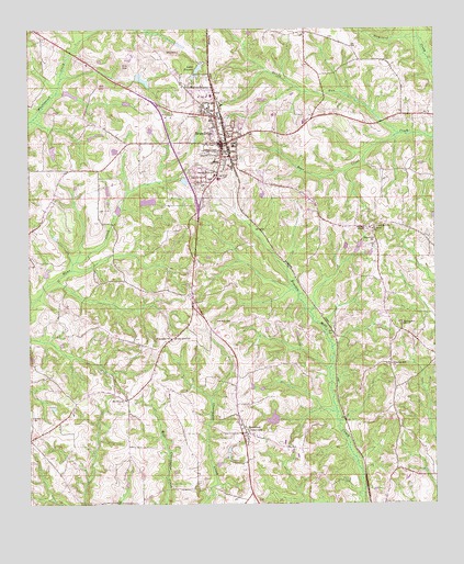
Brundidge, AL USGS Topographic Map
Click on map above to begin viewing in our Map Viewer.

This topographic map contains these locations and features:
Feature Name Type Latitude Longitude GNIS ID View Map
Abundant Life Center ChurchChurchN31.7149°W85.8286°1730371View Map
Armory ParkParkN31.7229°W85.8127°163503View Map
Bear CreekStreamN31.7224°W85.7608°113651View Map
Beaver Pond BranchStreamN31.7474°W85.8586°113746View Map
Broad ViewPopulated PlaceN31.7252°W85.8091°1730372View Map
BrundidgePopulated PlaceN31.7202°W85.8161°115032View Map
Brundidge Church of ChristChurchN31.7096°W85.8244°1730373View Map
Brundidge Church of GodChurchN31.7079°W85.8249°1730374View Map
Brundidge City CemeteryCemeteryN31.7152°W85.8152°163507View Map
Brundidge City HallBuildingN31.7204°W85.8152°163508View Map
Brundidge Country ClubLocaleN31.7218°W85.8399°1730375View Map
Brundidge DivisionCivilN31.6879°W85.8045°165929View Map
Brundidge High School (historical)SchoolN31.7227°W85.8133°139829View Map
Brundidge Medical CenterHospitalN31.7288°W85.8286°1730376View Map
Brundidge Municipal Airport (historical)AirportN31.7335°W85.8047°129410View Map
Brundidge Post OfficePost OfficeN31.7210°W85.8160°167907View Map
Brundidge Pre-SchoolSchoolN31.7116°W85.8202°163509View Map
Brundidge Public LibraryBuildingN31.7182°W85.8158°163511View Map
Brundidge Recreational ParkParkN31.7113°W85.8124°1730377View Map
Brundidge United Methodist ChurchChurchN31.7213°W85.8152°1730378View Map
Brundidge Volunteer Fire DepartmentBuildingN31.7205°W85.8148°2691128View Map
Caldwell SubdivisionPopulated PlaceN31.7113°W85.8216°1730379View Map
Carroll CemeteryCemeteryN31.7135°W85.8702°163513View Map
City of BrundidgeCivilN31.7182°W85.8178°2403943View Map
Community Church of God in ChristChurchN31.7310°W85.8208°1730380View Map
County Line Baptist ChurchChurchN31.7282°W85.8191°1730381View Map
County Line CemeteryCemeteryN31.7277°W85.8194°1730382View Map
Fleming CemeteryCemeteryN31.7163°W85.8111°1730383View Map
Flowers CemeteryCemeteryN31.6696°W85.7888°163523View Map
Friendship ChurchChurchN31.6688°W85.8316°118669View Map
Galloway ParkParkN31.7293°W85.8197°163529View Map
Green RidgePopulated PlaceN31.7121°W85.8041°1730384View Map
Hamilton Cross Fire RescueBuildingN31.6441°W85.8104°2691456View Map
Hamilton Cross Roads Church of ChristChurchN31.6427°W85.8074°139866View Map
Hamilton CrossroadsPopulated PlaceN31.6438°W85.8083°119639View Map
Hamilton Crossroads CemeteryCemeteryN31.6424°W85.8069°163531View Map
Hamilton Crossroads School (historical)SchoolN31.6396°W85.8088°157665View Map
Harris LakeReservoirN31.6474°W85.7999°129916View Map
Harris Lake DamDamN31.6468°W85.7983°129915View Map
HillcrestPopulated PlaceN31.7252°W85.8116°1730385View Map
Hopewell CemeteryCemeteryN31.6952°W85.7686°163538View Map
Hopewell ChurchChurchN31.6952°W85.7686°120367View Map
Lake ForeenReservoirN31.7399°W85.8223°118484View Map
Lake Foreen DamDamN31.7418°W85.8216°129945View Map
Lakeview CemeteryCemeteryN31.7374°W85.8194°139879View Map
Lily Hill Baptist ChurchChurchN31.6982°W85.7677°149973View Map
Mount Olive ChurchChurchN31.6524°W85.8455°123290View Map
New Hope Missionary Baptist ChurchChurchN31.7288°W85.8169°1730386View Map
New Jerusalem Holiness ChurchChurchN31.7385°W85.8299°1730387View Map
New Zion ChurchChurchN31.6732°W85.8136°123917View Map
New Zion School (historical)SchoolN31.6732°W85.8133°157666View Map
Pea River SchoolSchoolN31.6979°W85.7686°124532View Map
Philadelphia Presbyterian Church (historical)ChurchN31.7374°W85.8194°139905View Map
Pierson SubdivisionPopulated PlaceN31.7390°W85.8294°1730388View Map
Pike County Elementary SchoolSchoolN31.7327°W85.8194°163555View Map
Pike County High SchoolSchoolN31.7116°W85.8177°139907View Map
Pleasant Hill ChurchChurchN31.6618°W85.7633°124985View Map
Ramage SubdivisionPopulated PlaceN31.7171°W85.8202°1730389View Map
Reeves Crossroads School (historical)SchoolN31.6682°W85.7547°157667View Map
Saint Paul CemeteryCemeteryN31.7302°W85.8219°1730390View Map
Saint Paul United Methodist ChurchChurchN31.7299°W85.8213°1730391View Map
Salem Baptist ChurchChurchN31.7174°W85.8149°1730392View Map
Shady Grove ChurchChurchN31.6688°W85.8305°126597View Map
Shiloh ChurchChurchN31.6479°W85.8741°126729View Map
Springfield ChurchChurchN31.6727°W85.7602°127281View Map
Walter Bass DamDamN31.7418°W85.8299°129946View Map
Walter Bass PondReservoirN31.7418°W85.8299°129947View Map
Williams CemeteryCemeteryN31.7002°W85.7883°163577View Map
Williams Chapel Methodist ChurchChurchN31.6977°W85.7708°153991View Map
Windmill HillsPopulated PlaceN31.7293°W85.8249°1730393View Map

Note: Coordinates in the location and feature list above are referenced to NAD83 datum.


Copyright (C) 2008-2025 Ryan Niemi / Sunset Dynamics ... All Rights Reserved