TopoQuest Logo
Do you find TopoQuest useful?
Help keep TopoQuest running and adding new maps/features by donating!
Bitcoin:  19c7KJd3qBynnjoSw5npx9KScwjBe4ifkT
Litecoin:  LXs6TkuXGGXo1vDsWCkWVdjQX94eUKd6ui
Home View Maps Find Maps Find Places Resources & Links


Skipperville, Alabama Topographic Map

USGS Map Title: Skipperville, AL
USGS Map MRC: 31085E5
DRG (GeoTIFF) Download: o31085e5.tif


Neighboring USGS Topographic Map Quads:


  Elamville, AL  
31085F6
 

  Clio, AL  
31085F5
 

  Texasville, AL  
31085F4
 

  Ariton, AL  
31085E6
 

  Skipperville, AL  
31085E5
 

  Clopton, AL  
31085E4
 

  Ozark, AL  
31085D6
 

  Ewell, AL  
31085D5
 

  Echo, AL  
31085D4


Map MRC Location:

N32°
W86°
N32°
W85°
H8 H7 H6 H5 H4 H3 H2 H1
G8 G7 G6 G5 G4 G3 G2 G1
F8 F7 F6 F5 F4 F3 F2 F1
E8 E7 E6 E5 E4 E3 E2 E1
D8 D7 D6 D5 D4 D3 D2 D1
C8 C7 C6 C5 C4 C3 C2 C1
B8 B7 B6 B5 B4 B3 B2 B1
A8 A7 A6 A5 A4 A3 A2 A1
N31°
W86°
N31°
W85°

Skipperville, AL USGS 1:24K Topographic Map Preview:
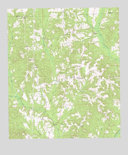
Skipperville, AL USGS Topographic Map
Click on map above to begin viewing in our Map Viewer.

This topographic map contains these locations and features:
Feature Name Type Latitude Longitude GNIS ID View Map
Abbeville CemeteryCemeteryN31.5741°W85.5013°163270View Map
Allen ChapelChurchN31.5666°W85.5447°113004View Map
Antioch CemeteryCemeteryN31.5385°W85.5619°113104View Map
ArgutaPopulated PlaceN31.5693°W85.5952°156001View Map
Arguta Hunting ClubLocaleN31.5582°W85.5919°133451View Map
AsburyPopulated PlaceN31.5118°W85.5452°113239View Map
Asbury CemeteryCemeteryN31.5121°W85.5447°1729924View Map
Asbury Lookout TowerTowerN31.5004°W85.5524°164275View Map
Asbury United Methodist ChurchChurchN31.5127°W85.5438°155937View Map
Bakey BranchStreamN31.5760°W85.5083°133452View Map
BeamonPopulated PlaceN31.5191°W85.5860°113625View Map
Beersheba CemeteryCemeteryN31.5582°W85.5049°113831View Map
Bordshaw BranchStreamN31.5866°W85.5144°112799View Map
Bottoms Mill BridgeBridgeN31.5135°W85.5738°114759View Map
Bremon School (historical)SchoolN31.5204°W85.5991°133461View Map
Burnt Mill BranchStreamN31.5588°W85.5724°115269View Map
Caney BranchStreamN31.5779°W85.5097°115562View Map
Concord ChurchChurchN31.6218°W85.5627°116485View Map
Cotton CreekStreamN31.5104°W85.5710°116685View Map
Davis BridgeBridgeN31.5960°W85.5838°117107View Map
Dikes School (historical)SchoolN31.5991°W85.5613°133482View Map
Dixon BridgeBridgeN31.5599°W85.6222°133483View Map
Dry BranchStreamN31.5821°W85.5802°117496View Map
Dykes CrossroadPopulated PlaceN31.6002°W85.5611°156291View Map
Glenn BridgeBridgeN31.5388°W85.6124°119038View Map
Herring School (historical)SchoolN31.6249°W85.5272°1805328View Map
Little Judy CreekStreamN31.5188°W85.5758°121807View Map
Long SchoolSchoolN31.5591°W85.5505°152150View Map
McCalls Mill (historical)LocaleN31.6113°W85.6241°133510View Map
Metcalf Mill BridgeBridgeN31.5557°W85.5716°152306View Map
Morgan Baptist ChurchChurchN31.5557°W85.5130°155941View Map
Morgan School (historical)SchoolN31.5568°W85.5119°133515View Map
Mount Pleasant ChurchChurchN31.5041°W85.5483°133521View Map
Phillips CrossroadsPopulated PlaceN31.6168°W85.6069°156878View Map
Pleasant Ridge Baptist ChurchChurchN31.5766°W85.5977°155906View Map
Roberts BranchStreamN31.5974°W85.5197°125694View Map
Roberts CrossroadsPopulated PlaceN31.6010°W85.5288°156973View Map
Saint Rose ChurchChurchN31.5718°W85.5433°126209View Map
Salem Baptist ChurchChurchN31.6146°W85.5619°126237View Map
Sandy CreekStreamN31.5404°W85.6141°126375View Map
Sikes CreekStreamN31.6027°W85.5233°155242View Map
SkippervillePopulated PlaceN31.5577°W85.5455°126940View Map
Skipperville CemeteryCemeteryN31.5588°W85.5472°1730230View Map
Skipperville Post OfficePost OfficeN31.5579°W85.5486°167327View Map
Skipperville SchoolSchoolN31.5663°W85.5447°126941View Map
Skipperville United Methodist ChurchChurchN31.5582°W85.5463°155810View Map
Skipperville Volunteer Fire DepartmentBuildingN31.5583°W85.5458°2691522View Map
Summer Hill Church (historical)ChurchN31.5016°W85.5472°133558View Map
Union CemeteryCemeteryN31.5674°W85.5980°1805652View Map
Union Presbyterian ChurchChurchN31.5685°W85.5977°153760View Map

Note: Coordinates in the location and feature list above are referenced to NAD83 datum.


Copyright (C) 2008-2025 Ryan Niemi / Sunset Dynamics ... All Rights Reserved