TopoQuest Logo
Do you find TopoQuest useful?
Help keep TopoQuest running and adding new maps/features by donating!
Bitcoin:  19c7KJd3qBynnjoSw5npx9KScwjBe4ifkT
Litecoin:  LXs6TkuXGGXo1vDsWCkWVdjQX94eUKd6ui
Home View Maps Find Maps Find Places Resources & Links


Electric Mountain, Colorado Topographic Map

USGS Map Title: Electric Mountain, CO
USGS Map MRC: 39107A5
DRG (GeoTIFF) Download: o39107a5.tif


Neighboring USGS Topographic Map Quads:


  Porter Mountain, CO  
39107B6
 

  Spruce Mountain, CO  
39107B5
 

  Elk Knob, CO  
39107B4
 

  Chalk Mountain, CO  
39107A6
 

  Electric Mountain, CO  
39107A5
 

  Bull Mountain, CO  
39107A4
 

  Gray Reservoir, CO  
38107H6
 

  Bowie, CO  
38107H5
 

  Somerset, CO  
38107H4


Map MRC Location:

N40°
W108°
N40°
W107°
H8 H7 H6 H5 H4 H3 H2 H1
G8 G7 G6 G5 G4 G3 G2 G1
F8 F7 F6 F5 F4 F3 F2 F1
E8 E7 E6 E5 E4 E3 E2 E1
D8 D7 D6 D5 D4 D3 D2 D1
C8 C7 C6 C5 C4 C3 C2 C1
B8 B7 B6 B5 B4 B3 B2 B1
A8 A7 A6 A5 A4 A3 A2 A1
N39°
W108°
N39°
W107°

Electric Mountain, CO USGS 1:24K Topographic Map Preview:
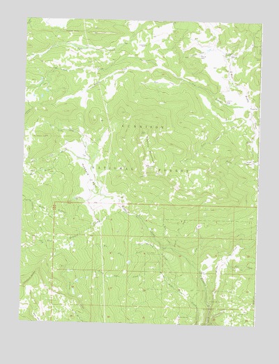
Electric Mountain, CO USGS Topographic Map
Click on map above to begin viewing in our Map Viewer.

This topographic map contains these locations and features:
Feature Name Type Latitude Longitude GNIS ID View Map
Beaver CreekStreamN39.1061°W107.5539°175471View Map
Big Alder CreekStreamN39.0225°W107.5514°175451View Map
Branch of Bee CreekStreamN39.0303°W107.5437°175460View Map
Bulk Park DitchCanalN39.1125°W107.5756°197456View Map
Chimney RocksPillarN39.1197°W107.6003°175473View Map
Columbine Ditch Nuber OneCanalN39.1011°W107.5598°197452View Map
Columbine Ditch Nuber TwoCanalN39.1017°W107.5528°197450View Map
Columbine Ditch Number FiveCanalN39.0983°W107.5531°197453View Map
Columbine Ditch Number ThreeCanalN39.0986°W107.5362°197449View Map
Columbine RanchLocaleN39.0919°W107.5181°175467View Map
Cottonwood CreekStreamN39.0005°W107.5253°175455View Map
Cow CreekStreamN39.0905°W107.5053°175439View Map
Dyke Ditch Number TwoCanalN39.1147°W107.5739°197455View Map
Electric MountainSummitN39.0789°W107.5609°175466View Map
Elk CreekStreamN39.0689°W107.6064°175425View Map
Fawn CreekStreamN39.1008°W107.5409°175470View Map
Flying M RanchLocaleN39.1111°W107.5320°175469View Map
Grouse SpringSpringN39.0034°W107.5411°175458View Map
Hubbard ParkFlatN39.0589°W107.5867°175449View Map
Little Alder CreekStreamN39.0225°W107.5514°175450View Map
Little Dyke CreekStreamN39.0667°W107.5901°175447View Map
Lombard SlidesCliffN39.0180°W107.6195°202303View Map
Lone Pine CreekStreamN39.0008°W107.5231°186344View Map
Main Hubbard CreekStreamN39.0530°W107.5837°175426View Map
Middle Hubbard CreekStreamN39.0530°W107.5837°175424View Map
Molly Group MineMineN39.1100°W107.6112°1684141View Map
Morman CreekStreamN39.0133°W107.5406°175456View Map
Norells Bell RanchLocaleN39.1147°W107.5617°175472View Map
Pilot CreekStreamN39.0250°W107.5201°175454View Map
Poison ParkFlatN39.0672°W107.5126°175465View Map
Slide CreekStreamN39.0247°W107.5337°175459View Map
Terror TrailTrailN39.0689°W107.5367°175462View Map
Trail CreekStreamN39.0853°W107.5048°175464View Map
Twin Spruce DitchCanalN39.1047°W107.5473°197454View Map
West Hubbard CreekStreamN39.0458°W107.5714°175423View Map
West Muddy Ranger StationLocaleN39.1111°W107.5164°175468View Map
Willow CreekStreamN39.0080°W107.5234°175453View Map
Wolf CreekStreamN39.0314°W107.5456°175461View Map

Note: Coordinates in the location and feature list above are referenced to NAD83 datum.


Copyright (C) 2008-2025 Ryan Niemi / Sunset Dynamics ... All Rights Reserved