TopoQuest Logo
Do you find TopoQuest useful?
Help keep TopoQuest running and adding new maps/features by donating!
Bitcoin:  19c7KJd3qBynnjoSw5npx9KScwjBe4ifkT
Litecoin:  LXs6TkuXGGXo1vDsWCkWVdjQX94eUKd6ui
Home View Maps Find Maps Find Places Resources & Links


Argos, Indiana Topographic Map

USGS Map Title: Argos, IN
USGS Map MRC: 41086B2
DRG (GeoTIFF) Download: o41086b2.tif


Neighboring USGS Topographic Map Quads:


  Plymouth, IN  
41086C3
 

  Inwood, IN  
41086C2
 

  Bourbon, IN  
41086C1
 

  Rutland, IN  
41086B3
 

  Argos, IN  
41086B2
 

  Mentone, IN  
41086B1
 

  Pershing, IN  
41086A3
 

  Rochester, IN  
41086A2
 

  Akron, IN  
41086A1


Map MRC Location:

N42°
W87°
N42°
W86°
H8 H7 H6 H5 H4 H3 H2 H1
G8 G7 G6 G5 G4 G3 G2 G1
F8 F7 F6 F5 F4 F3 F2 F1
E8 E7 E6 E5 E4 E3 E2 E1
D8 D7 D6 D5 D4 D3 D2 D1
C8 C7 C6 C5 C4 C3 C2 C1
B8 B7 B6 B5 B4 B3 B2 B1
A8 A7 A6 A5 A4 A3 A2 A1
N41°
W87°
N41°
W86°

Argos, IN USGS 1:24K Topographic Map Preview:
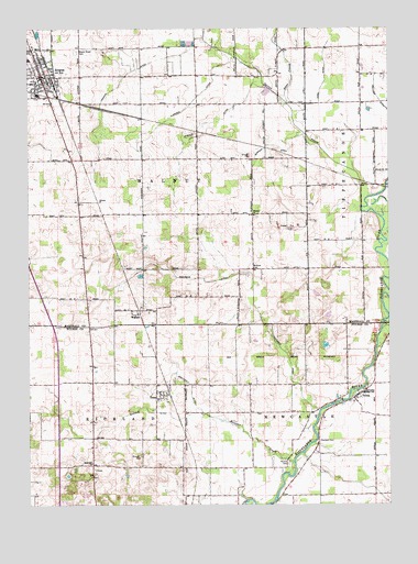
Argos, IN USGS Topographic Map
Click on map above to begin viewing in our Map Viewer.

This topographic map contains these locations and features:
Feature Name Type Latitude Longitude GNIS ID View Map
Albright DitchCanalN41.2320°W86.1914°430049View Map
ArgosPopulated PlaceN41.2378°W86.2146°430243View Map
Argos Community Ambulance ServiceBuildingN41.2369°W86.2462°2719340View Map
Argos Fire DepartmentBuildingN41.2367°W86.2462°2701434View Map
Argos Police DepartmentBuildingN41.2370°W86.2462°2758214View Map
Argos Post OfficePost OfficeN41.2375°W86.2464°2710749View Map
Argos Public LibraryBuildingN41.2378°W86.2456°2708879View Map
Argos Volunteer Fire DepartmentBuildingN41.2370°W86.2463°2626026View Map
Berger DitchCanalN41.2195°W86.1669°430843View Map
Big Yellow CreekStreamN41.1712°W86.1272°431074View Map
County Line LandfillLocaleN41.1664°W86.2339°2708761View Map
Crum FarmsLocaleN41.1881°W86.2158°2710744View Map
Deep CreekStreamN41.2475°W86.1892°433411View Map
Deer CreekStreamN41.2303°W86.1594°433429View Map
Eaton Busenburg DitchCanalN41.1267°W86.1269°433964View Map
Hamlett CemeteryCemeteryN41.1417°W86.1486°435653View Map
Hillside Dairy FarmLocaleN41.1806°W86.1875°2710745View Map
Hooker DitchCanalN41.2384°W86.2150°436409View Map
Horn DitchCanalN41.2353°W86.1472°436480View Map
Maple Grove CemeteryCemeteryN41.2442°W86.2328°438554View Map
McGrew CemeteryCemeteryN41.1870°W86.1719°438878View Map
Outlet CreekStreamN41.2031°W86.1344°440777View Map
Pfiefer DitchCanalN41.2253°W86.1867°441072View Map
Rannels DitchCanalN41.1495°W86.2133°441772View Map
Ranstead FarmLocaleN41.1561°W86.2442°2710748View Map
Redinger DitchCanalN41.1806°W86.1714°441833View Map
Reister CemeteryCemeteryN41.1356°W86.1597°441887View Map
Reister CreekStreamN41.1359°W86.1578°441888View Map
Rosewood FarmsLocaleN41.1864°W86.2322°2710747View Map
Sand Hill ChurchChurchN41.1359°W86.2278°442982View Map
Shetterly DitchCanalN41.1553°W86.1933°443372View Map
TalmaPopulated PlaceN41.1539°W86.1350°444555View Map
TiosaPopulated PlaceN41.1528°W86.2056°444774View Map
Township of NewcastleCivilN41.1304°W86.1299°453662View Map
Township of WalnutCivilN41.2248°W86.2053°453970View Map
WalnutPopulated PlaceN41.1762°W86.2119°445403View Map
Walnut ChurchChurchN41.2012°W86.1714°445406View Map
Yellow CreekStreamN41.1723°W86.1278°449600View Map

Note: Coordinates in the location and feature list above are referenced to NAD83 datum.


Copyright (C) 2008-2025 Ryan Niemi / Sunset Dynamics ... All Rights Reserved